2020s Maps of Nassau County, New York
Explore 15 historic maps of Nassau County from the 2020s. These maps offer a rare glimpse into what life looked like during the 2020s — showing old roads, neighborhoods, homes, and landmarks that have changed or disappeared over time.
Whether you're researching your family's past, planning a metal detecting trip, or studying how Nassau County's landscape evolved across the 2020s, these high-resolution maps are a powerful tool for exploring the history of this region.
- Focus on a specific era: All maps on this page are from the 2020s, giving you a focused view of this time period.
- See what’s changed: Compare century-old streets, trails, and buildings to today's modern landscape using overlays and satellite layers.
- Research with precision: Use these maps for genealogy, historical research, land use analysis, or educational projects.
- View, download, or print: Maps are fully viewable online in high resolution, and can be downloaded or printed for your own records.
Start exploring Nassau County's history through authentic maps from the 2020s. This is your window into the past.
Nassau County, NY maps
(15)- 2023 Map of West Gilgo Beach, 2023 Print
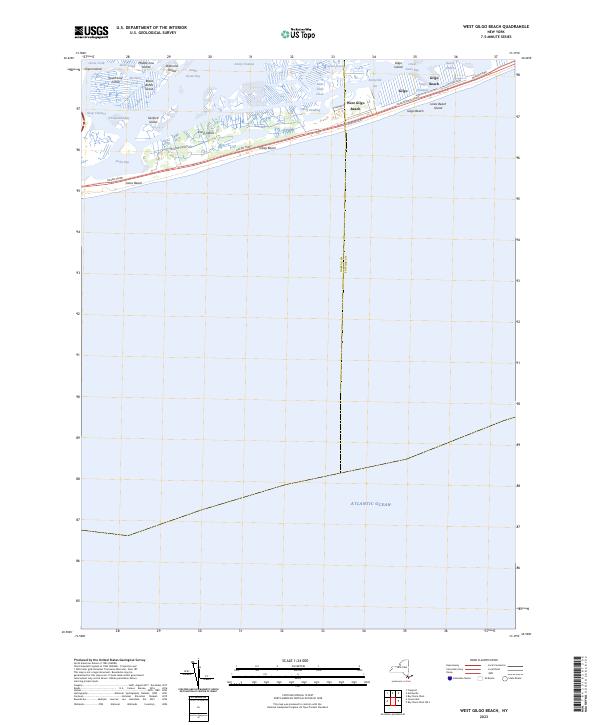 2023 West Gilgo Beach2023 Print · USGSThe barrier islands of Nassau and Suffolk counties are captured in this 2023 survey of the South Shore. Trace the residential layouts of West Gilgo Beach and Gilgo Beach alongside the marshy reaches of South Oyster Bay and Diamond Shoals.
 - 2023 Map of Lawrence, 2023 Print
 2023 Lawrence2023 Print · USGSThe Nassau County coastline is captured here in the contemporary era, showing the interconnected shore towns from CEDARHURST to Lido Beach. Genealogy researchers can locate the Long Island Cem and Saint Marys, or trace the waterfronts of Island Park and Barnum Island.
 - 2023 Map of Jones Inlet, 2023 Print
 2023 Jones Inlet2023 Print · USGSThe South Shore of Long Island is captured here in the early twenty-first century, showing the transition from mainland towns to the barrier islands. Trace the coastal geography from Baldwin down to Point Lookout and the iconic shore at Jones Beach.
 - 2023 Map of Flushing, 2023 Print
 2023 Flushing2023 Print · USGSQueens and the Bronx shoreline are captured in this contemporary look at their dense neighborhoods and complex waterways. Trace local history through landmarks like Hart Island, Old Ferry Point, and the Potters Field Burial Ground.
 - 2023 Map of Sea Cliff, 2023 Print
 2023 Sea Cliff2023 Print · USGSThe Gold Coast of Nassau County is captured here in the early twenty-first century, showing the dense network of villages along Manhasset Bay. Researchers can locate historic burial sites like Nassau Knolls Cem and Roslyn Cem or trace the shoreline from Sands Point to Kings Point.
 - 2023 Map of Jamaica, 2023 Print
 2023 Jamaica2023 Print · USGSQueens is shown in its contemporary complexity, from the sprawling runways of John F Kennedy International Airport to the tight-knit streets of Richmond Hill. Researchers can identify historic neighborhood boundaries and landmarks like Maple Grove Cem and CUNY York College.
 - 2023 Map of Lloyd Harbor, 2023 Print
 2023 Lloyd Harbor2023 Print · USGSThe North Shore of Long Island is captured here in the contemporary era, showing a landscape of exclusive harbor towns and historic estates. Trace the grounds of Sagamore Hill, locate Lefferts Mill, and explore the protected coastlines of Eatons Neck and Lloyd Harbor.
 - 2023 Map of Huntington, 2023 Print
 2023 Huntington2023 Print · USGSThe Nassau and Suffolk border near the north shore is shown here in the 2020s, tracing the area's evolution from maritime villages to major suburban centers. Researchers can locate family sites across several notable grounds including Pinelawn Cem, Mount Golda Cem, and the historic Old Burial Hill Cem.
 - 2023 Map of Freeport, 2023 Print
 2023 Freeport2023 Print · USGSNassau County’s densely settled suburban landscape and intricate coastal marshlands are captured in this recent survey. Local researchers can trace the routes of the Long Island RR and locate community landmarks like Greenfield Cem and Saint Georges Church.
 - 2023 Map of Mamaroneck, 2023 Print
 2023 Mamaroneck2023 Print · USGSThe Westchester coast near the Long Island Sound shows a landscape of dense residential growth and historic burial sites. Genealogists can trace family names at Haviland Cem or Solomon Gedney Burial Ground and study the transit network near Port Chester.
 - 2023 Map of Bayville, 2023 Print
 2023 Bayville2023 Print · USGSThe northern shore of Long Island is captured here in detail, showcasing the unique geography of peninsulas and protected harbors. Researchers can find historical landmarks like Sagamore Hill and several local burial grounds including Locust Valley Cem.
 - 2023 Map of Hicksville, 2023 Print
 2023 Hicksville2023 Print · USGSNorth Shore villages and inland estates are captured in this modern survey of central Nassau County. Researchers can locate the Theodore Roosevelt Grave and trace lineage through sites like Brookville Cem and Zion Cem.
 - 2023 Map of Far Rockaway, 2023 Print
 2023 Far Rockaway2023 Print · USGSThe Rockaway Peninsula and Jamaica Bay appear in high resolution in this modern coastal survey. Researchers can trace the dense urban street grids of Far Rockaway and Arverne or explore the wetland geography of The Raunt and Big Egg Marsh.
 - 2023 Map of Lynbrook, 2023 Print
 2023 Lynbrook2023 Print · USGSNassau County and eastern Queens appear in high detail during this contemporary era of dense suburban development. Genealogists and historians can trace family plots and local landmarks at Montefiore Cem, Stuart Ave Methodist Church Cem, and the Nassau County Courthouse.
 - 2023 Map of Amityville, 2023 Print
 2023 Amityville2023 Print · USGSThe south shore of Long Island is shown here in detail during its modern era of dense suburban development and coastal navigation. Researchers can trace the extensive cemetery districts like Saint Charles Cem or explore the waterfront layouts of Biltmore Shores and Nassau Shores.
End of results
Showing maps 1-15 of 15
Top cities of Nassau County
- Hempstead historical maps
- Oyster Bay historical maps
- North Hempstead historical maps
- Long Beach historical maps
- Glen Cove historical maps
- New Hyde Park historical maps
See more
Frequently asked questions
- What are the different types of historical maps available for Nassau County?
- What is the oldest map of Nassau County?
- Where can I purchase historical maps of Nassau County for my home or office?
- Where can I download high-res historical maps of Nassau County?
- Are there historical topographic maps available for Nassau County?
- Is there historical aerial imagery available for Nassau County?
- Where are historical maps of Nassau County sourced from?