1900s (20th Century) Maps of Queens, New York
Explore 61 historic maps of Queens from the 1900s (20th Century). These maps offer a rare glimpse into what life looked like during the 1900s — showing old roads, neighborhoods, homes, and landmarks that have changed or disappeared over time.
Whether you're researching your family's past, planning a metal detecting trip, or studying how Queens's landscape evolved across the 1900s, these high-resolution maps are a powerful tool for exploring the history of this region.
- Focus on a specific era: All maps on this page are from the 1900s, giving you a focused view of this time period.
- See what’s changed: Compare century-old streets, trails, and buildings to today's modern landscape using overlays and satellite layers.
- Research with precision: Use these maps for genealogy, historical research, land use analysis, or educational projects.
- View, download, or print: Maps are fully viewable online in high resolution, and can be downloaded or printed for your own records.
Start exploring Queens's history through authentic maps from the 1900s. This is your window into the past.
Queens, New York maps
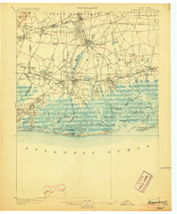
(61)- 1900 Map of Passaic
 1900 Passaic1900 Print · USGSCovers Queens, including New York, Newark, and other nearby areas
 - 1900 Map of Staten Island
 1900 Staten Island1900 Print · USGSCovers Queens, including New York, Newark, and other nearby areas10 unique versions available
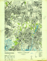
 - 1900 Map of Harlem
 1900 Harlem1900 Print · USGSCovers Queens, including New York, North Hempstead, and other nearby areas16 unique versions available
 - 1900 Map of Brooklyn
 1900 Brooklyn1900 Print · USGSCovers Queens, including New York, Hempstead, and other nearby areas11 unique versions available
 - 1900 Map of Oyster Bay
 1900 Oyster Bay1900 Print · USGSCovers Queens, including New York, Hempstead, and other nearby areas15 unique versions available
 - 1903 Map of Hempstead
 1903 Hempstead1903 Print · USGSCovers Queens, including New York, Hempstead, and other nearby areas9 unique versions available
 - 1905 Map of Passaic
 1905 Passaic1905 Print · USGSCovers Queens, including New York, Newark, and other nearby areas4 unique versions available
 - 1942 Map of Passaic
 1942 Passaic1942 Print · USGSCovers Queens, including New York, Newark, and other nearby areas
 - 1944 Map of Newark, 1971 Print
 1944 Newark1971 Print · USGSCovers Queens, including New York, Philadelphia, and other nearby areas5 unique versions available
 - 1947 Map of Brooklyn
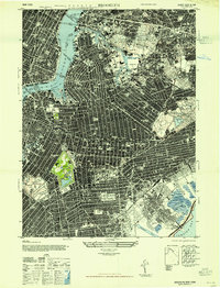 1947 Brooklyn1947 Print · USGSCovers Queens, including New York, Kings County, and other nearby areas
 - 1947 Map of Sea Cliff
 1947 Sea Cliff1947 Print · USGSCovers Queens, including New York, Oyster Bay, and other nearby areas
 - 1947 Map of Jamaica
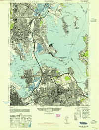
 1947 Jamaica1947 Print · USGSCovers Queens, including New York, Hempstead, and other nearby areas
 - 1947 Map of Lynbrook
 1947 Lynbrook1947 Print · USGSCovers Queens, including New York, Hempstead, and other nearby areas
 - 1947 Map of Flushing
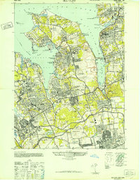
 1947 Flushing1947 Print · USGSCovers Queens, including New York, North Hempstead, and other nearby areas2 unique versions available
 - 1947 Map of The Narrows
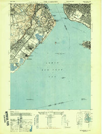 1947 The Narrows1947 Print · USGSCovers Queens, including New York, Todt Hill, and other nearby areas2 unique versions available
 - 1947 Map of Far Rockaway
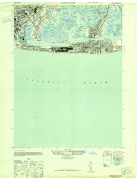
 1947 Far Rockaway1947 Print · USGSCovers Queens, including New York, Hempstead, and other nearby areas
 - 1947 Map of Lawrence
 1947 Lawrence1947 Print · USGSCovers Queens, including New York, Hempstead, and other nearby areas
 - 1947 Map of Central Park
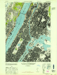 1947 Central Park1947 Print · USGSCovers Queens, including New York, North Bergen, and other nearby areas
 - 1947 Map of Coney Island
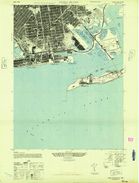 1947 Coney Island1947 Print · USGSCovers Queens, including New York, Kings County, and other nearby areas
 - 1949 Map of Newark
 1949 Newark1949 Print · USGSCovers Queens, including New York, Philadelphia, and other nearby areas2 unique versions available
 - 1949 Map of New York, 1951 Print
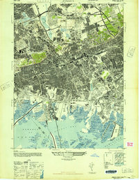
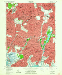
 1949 New York1951 Print · USGSCovers Queens, including New York, Hempstead, and other nearby areas
 - 1954 Map of New York
 1954 New York1954 Print · USGSCovers Queens, including New York, Hempstead, and other nearby areas2 unique versions available
 - 1954 Map of Lawrence, 1956 Print
 1954 Lawrence1956 Print · USGSCovers Queens, including New York, Hempstead, and other nearby areas
 - 1954 Map of Far Rockaway, 1956 Print
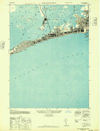
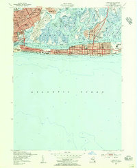
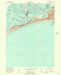 1954 Far Rockaway1956 Print · USGSCovers Queens, including New York, Hempstead, and other nearby areas
 - 1954 Map of Lynbrook, 1957 Print
 1954 Lynbrook1957 Print · USGSCovers Queens, including New York, Hempstead, and other nearby areas2 unique versions available
Showing maps 1-25 of 61
Frequently asked questions
- What are the different types of historical maps available for Queens?
- What is the oldest map of Queens?
- Where can I purchase historical maps of Queens for my home or office?
- Where can I download high-res historical maps of Queens?
- Are there historical topographic maps available for Queens?
- Is there historical aerial imagery available for Queens?
- Where are historical maps of Queens sourced from?