Old Maps of Whitestown, New York for Genealogy
Trace your family roots with 37 historic maps of Whitestown. These high-res maps reveal old neighborhoods, homesites, landmarks, and streets — helping you uncover where your ancestors lived and how the area evolved over time.
- Explore historic neighborhoods: Identify where your relatives may have lived in the 1800s or 1900s.
- Compare maps over time: Trace the changes in streets, buildings, and landmarks for multi-generational research.
- Perfect for genealogy & ancestry research: Used by family historians and researchers to map out lineage and migration.
These maps are an incredible resource for exploring your personal connection to Whitestown's past.
Whitestown, NY maps
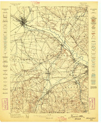
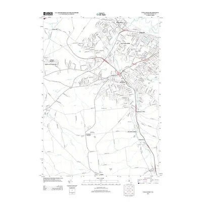
(37)- 1895 Map of Oriskany
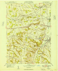
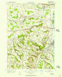
 1895 Oriskany1895 Print · USGSOneida County at the end of the nineteenth century reveals a landscape defined by the great Mohawk valley canals and emerging industrial hamlets. Researchers can trace the path of the Erie Canal, find the Franklin Iron Works, and locate early educational landmarks like College Hill.
 - 1898 Map of Oriskany
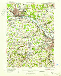
 1898 Oriskany1898 Print · USGSOneida County at the close of the nineteenth century reveals a landscape defined by the intersection of the Erie Canal and major rail lines. Genealogists can trace family homes in Spencer Settlement, locate industrial sites like Hecla Works, or find the historic Oriskany Battle Monument.10 unique versions available
 - 1947 Map of Rome, 1952 Print
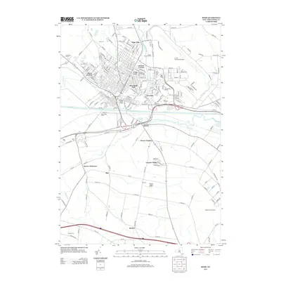
 1947 Rome1952 Print · USGSMid-century Oneida County is captured here during the height of its industrial and military significance. Researchers can trace the paths of the Old Erie Canal, locate family roots near St Johns Cem, or study the grounds of Hamilton College.3 unique versions available
 - 1949 Map of Utica West
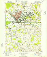
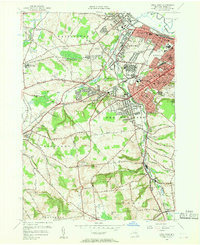
 1949 Utica West1949 Print · USGSOneida County's industrial and institutional heart comes into focus just after the war as the mill towns along Sauquoit Creek expand. Trace family roots and local history at the Utica State Hospital, Washington Mills, and the Crown Hill Memorial Park Cemetery.
 - 1949 Map of Oriskany
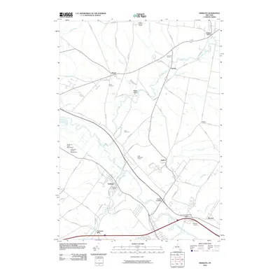
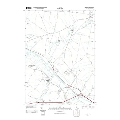
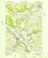 1949 Oriskany1949 Print · USGSOneida County in the late 1940s reveals a landscape shaped by the Mohawk River and the historic canal systems. Local historians can trace the paths of the Erie Canal, find family burial sites at Townsend Cem, and locate the Oriskany Battle Mon.
 - 1949 Map of Rome
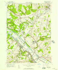
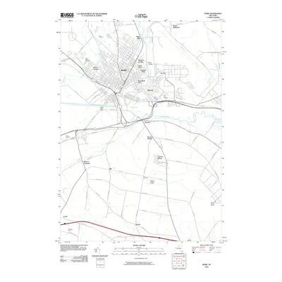
 1949 Rome1949 Print · USGSRome was a bustling transportation and military hub in the late 1940s, where the Mohawk River valley met the industrial age. Local historians can trace the massive Rome Air Depot, the path of the BARGE CANAL, and long-standing family locales like Wright Settlement.
 - 1949 Map of Clinton
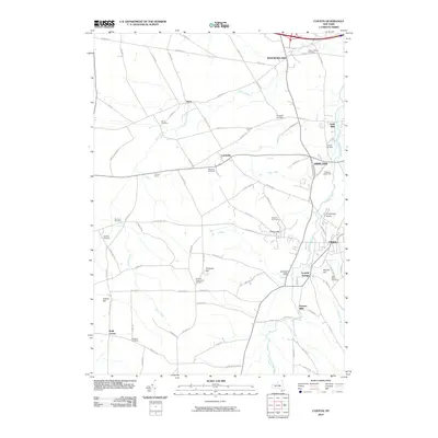
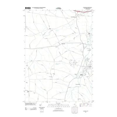
 1949 Clinton1949 Print · USGSOneida County at mid-century reveals a landscape defined by the Oriskany Creek valley and the prominent campus of Hamilton College. Researchers can trace old family lines through Evergreen Cem or locate former mill sites near Farmers Mills and Franklin Springs.
 - 1950 Map of Utica, 1951 Print
 1950 Utica1951 Print · USGSCentral New York in the post-war era showcases the industrial Mohawk Valley and the pristine Adirondack interior. Researchers can trace transportation networks like the New York Central Railroad and find early Cold War sites such as Griffiss Air Force Base.
 - 1955 Map of Utica West, 1957 Print
 1955 Utica West1957 Print · USGSThe industrial corridor of the Mohawk Valley is captured here during the mid-fifties, showing the growth of Utica and New York Mills along the rail lines. Researchers can trace family roots through numerous sites like Holy Trinity Cem, St John Ch, and the Utica State Hospital grounds.2 unique versions available
 - 1955 Map of Rome, 1957 Print
 1955 Rome1957 Print · USGSMid-century Rome and its surrounding Oneida County townships are shown here during a period of significant military and industrial expansion. Genealogists and historians can trace local landmarks like Ft Stanwix, the sprawling Griffiss Air Force Base, and rural communities such as Spencer Settlement.4 unique versions available
 - 1955 Map of Oriskany, 1957 Print
 1955 Oriskany1957 Print · USGSThe Mohawk Valley in the mid-1950s shows a dense intersection of industrial history and Cold War-era expansion. Local historians can trace the path of the Erie Canal past Oriskany or locate the U S Mil Res Floyd Test Site and the State Hospital.2 unique versions available
 - 1955 Map of Clinton, 1957 Print
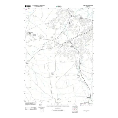
 1955 Clinton1957 Print · USGSOneida County's educational and transit hubs are captured in the mid-1950s, featuring the extensive campus of Hamilton College. Researchers can locate old family burial sites like Bronson Cem and trace historic routes such as the Seneca Turnpike.2 unique versions available
 - 1957 Map of Utica
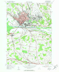
 1957 Utica1957 Print · USGSCentral New York and the Adirondack foothills are captured here in the mid-fifties, showing a landscape defined by the Mohawk River corridor and the growing highway system. Genealogists and researchers can trace the rail lines of the New York Central and locate communities from Lowville to Gloversville.
 - 1962 Map of Utica
 1962 Utica1962 Print · USGSCentral New York and the Adirondack wilderness are captured here during the mid-century era of highway and industrial expansion. Genealogists and historians can trace the development of the New York State Thruway and local rail lines connecting Utica, Rome, and Gloversville.3 unique versions available
 - 1964 Map of Utica
 1964 Utica1964 Print · USGSCentral New York and the high wilderness of the Adirondacks are captured here during the post-war era of infrastructure expansion. Researchers can trace the development of the New York State Thruway alongside historic corridors like the Oneida Lake (Barge Canal Route) and the N. Y. Central railroad.
 - 1967 Map of Utica
 1967 Utica1967 Print · USGSCentral New York's industrial Mohawk Valley meets the Adirondack wilderness in the 1960s, showing the region's transition from manufacturing hubs to state-managed parklands. Trace historic settlements and sites like Griffiss Air Force Base, Colgate University, and the Lyons Falls Paper Mill.
 - 1985 Map of Utica, 1986 Print
 1985 Utica1986 Print · USGSThe Mohawk Valley in the mid-eighties shows a landscape of industrial river cities and high-tech military hubs before the post-Cold War transition. Trace the development of Rome and Utica, the operations at Griffiss Air Force Base, and the lakeside activity at Oneida Lake.2 unique versions available
 - 2010 Map of Clinton, 2010 Print
 2010 Clinton2010 Print · USGSCovers Whitestown, including Kirkland, Westmoreland, and other nearby areas
 - 2010 Map of Utica West, 2010 Print
 2010 Utica West2010 Print · USGSCovers Whitestown, including Utica, New Hartford, and other nearby areas
 - 2010 Map of Oriskany, 2010 Print
 2010 Oriskany2010 Print · USGSCovers Whitestown, including Rome, Marcy, and other nearby areas
 - 2010 Map of Rome, 2010 Print
 2010 Rome2010 Print · USGSCovers Whitestown, including Rome, Westmoreland, and other nearby areas
 - 2013 Map of Clinton, 2013 Print
 2013 Clinton2013 Print · USGSCovers Whitestown, including Kirkland, Westmoreland, and other nearby areas
 - 2013 Map of Oriskany, 2013 Print
 2013 Oriskany2013 Print · USGSCovers Whitestown, including Rome, Marcy, and other nearby areas
 - 2013 Map of Rome, 2013 Print
 2013 Rome2013 Print · USGSCovers Whitestown, including Rome, Westmoreland, and other nearby areas
 - 2013 Map of Utica West, 2013 Print
 2013 Utica West2013 Print · USGSCovers Whitestown, including Utica, New Hartford, and other nearby areas
Showing maps 1-25 of 37
Top cities near Whitestown
- Utica historical maps
- Rome historical maps
- New Hartford historical maps
- Kirkland historical maps
- Marcy historical maps
- Frankfort historical maps
See more
Top neighborhoods of Whitestown
- Colemans Mills historical maps
- Walesville historical maps
- Whitesboro historical maps
- Yorkville historical maps
- Oriskany historical maps
Frequently asked questions
- What are the different types of historical maps available for Whitestown?
- What is the oldest map of Whitestown?
- Where can I purchase historical maps of Whitestown for my home or office?
- Where can I download high-res historical maps of Whitestown?
- Are there historical topographic maps available for Whitestown?
- Is there historical aerial imagery available for Whitestown?
- Where are historical maps of Whitestown sourced from?