2020s Maps of Phelps, New York
Explore 6 historic maps of Phelps from the 2020s. These maps offer a rare glimpse into what life looked like during the 2020s — showing old roads, neighborhoods, homes, and landmarks that have changed or disappeared over time.
Whether you're researching your family's past, planning a metal detecting trip, or studying how Phelps's landscape evolved across the 2020s, these high-resolution maps are a powerful tool for exploring the history of this region.
- Focus on a specific era: All maps on this page are from the 2020s, giving you a focused view of this time period.
- See what’s changed: Compare century-old streets, trails, and buildings to today's modern landscape using overlays and satellite layers.
- Research with precision: Use these maps for genealogy, historical research, land use analysis, or educational projects.
- View, download, or print: Maps are fully viewable online in high resolution, and can be downloaded or printed for your own records.
Start exploring Phelps's history through authentic maps from the 2020s. This is your window into the past.
Phelps, NY maps
(6)- 2023 Map of Newark, 2023 Print
 2023 Newark2023 Print · USGSWayne County’s canal-side heritage remains visible in this contemporary survey of the corridor between Newark and Lyons. Researchers can trace old township burial grounds like Silver Hill Marbletown Cem and locate historic hamlets such as Mud Mills and Hydesville.
 - 2023 Map of Lyons, 2023 Print
 2023 Lyons2023 Print · USGSWayne County's agricultural heartland and canal heritage are visible in this detailed survey, centered on the historic village of Lyons. Researchers can trace old transportation corridors along the Erie Canal or locate local landmarks like Lock Berlin, Alloway, and several cemeteries including Oak Hill Cem.
 - 2023 Map of Geneva North, 2023 Print
 2023 Geneva North2023 Print · USGSThe Finger Lakes borderlands of Seneca and Ontario Counties come to life in this contemporary study of local crossroads and waterways. Genealogists can trace family names across a dozen burial grounds like Quaker Cem or find old homesteads near Packwood Corners and West Junius.
 - 2023 Map of Palmyra, 2023 Print
 2023 Palmyra2023 Print · USGSThe Erie Canal corridor comes to life in this recent study of the Wayne County landscape. Genealogists can trace family plots at Palmyra Cem or Gibson Rural Cem, while canal buffs can follow the path of The Wide Waters.
 - 2023 Map of Phelps, 2023 Print
 2023 Phelps2023 Print · USGSOntario County is depicted here in the early twenty-first century, showing the enduring agricultural and village life around Phelps. Trace family history and local land use through features like Seneca Castle, Oaks Corners, and numerous plots like Melvin Hill Cem.
 - 2023 Map of Clifton Springs, 2023 Print
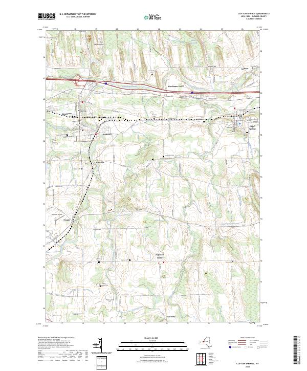 2023 Clifton Springs2023 Print · USGSOntario County is defined by its drumlin fields and milling history in this modern survey. Genealogists can trace family names through dozens of local burial grounds, from the Manchester Village Cem to the storied Hill Cumorah and the County Home Cem.
End of results
Showing maps 1-6 of 6
Top cities near Phelps
- Farmington historical maps
- Arcadia historical maps
- Geneva historical maps
- Canandaigua historical maps
- Canandaigua historical maps
- Manchester historical maps
See more
Top neighborhoods of Phelps
- Fort Hill historical maps
- Knickerbocker Corner historical maps
- Melvin Hill historical maps
- Oaks Corners historical maps
- Orleans historical maps
- Phelps Junction historical maps
See more
Frequently asked questions
- What are the different types of historical maps available for Phelps?
- What is the oldest map of Phelps?
- Where can I purchase historical maps of Phelps for my home or office?
- Where can I download high-res historical maps of Phelps?
- Are there historical topographic maps available for Phelps?
- Is there historical aerial imagery available for Phelps?
- Where are historical maps of Phelps sourced from?