2020s Maps of Chester, New York
Explore 4 historic maps of Chester from the 2020s. These maps offer a rare glimpse into what life looked like during the 2020s — showing old roads, neighborhoods, homes, and landmarks that have changed or disappeared over time.
Whether you're researching your family's past, planning a metal detecting trip, or studying how Chester's landscape evolved across the 2020s, these high-resolution maps are a powerful tool for exploring the history of this region.
- Focus on a specific era: All maps on this page are from the 2020s, giving you a focused view of this time period.
- See what’s changed: Compare century-old streets, trails, and buildings to today's modern landscape using overlays and satellite layers.
- Research with precision: Use these maps for genealogy, historical research, land use analysis, or educational projects.
- View, download, or print: Maps are fully viewable online in high resolution, and can be downloaded or printed for your own records.
Start exploring Chester's history through authentic maps from the 2020s. This is your window into the past.
Chester, NY maps
(4)- 2023 Map of Warwick, 2023 Print
 2023 Warwick2023 Print · USGSOrange County's mix of historic villages and ridge-line trails is clearly visible in this recent survey. Local researchers can locate family sites like Wisner Cem or trace the Appalachian National Scenic Trail as it crosses Bellvale Mountain.
 - 2023 Map of Monroe, 2023 Print
 2023 Monroe2023 Print · USGSOrange County's ridgelines and glacial lakes come into focus in this recent survey of the Monroe area. Researchers can trace land use from the Bull Mine area to local history sites like Seamanville Cem and the Uta Mesivta of Kiryas Joel.
 - 2023 Map of Goshen, 2023 Print
 2023 Goshen2023 Print · USGSThe Goshen area of Orange County comes alive in this contemporary record of its river-and-rail landscape. Researchers can trace family history at Saint Johns Cem, explore the Wallkill Valley, or locate the Orange County Courthouse.
 - 2023 Map of Maybrook, 2023 Print
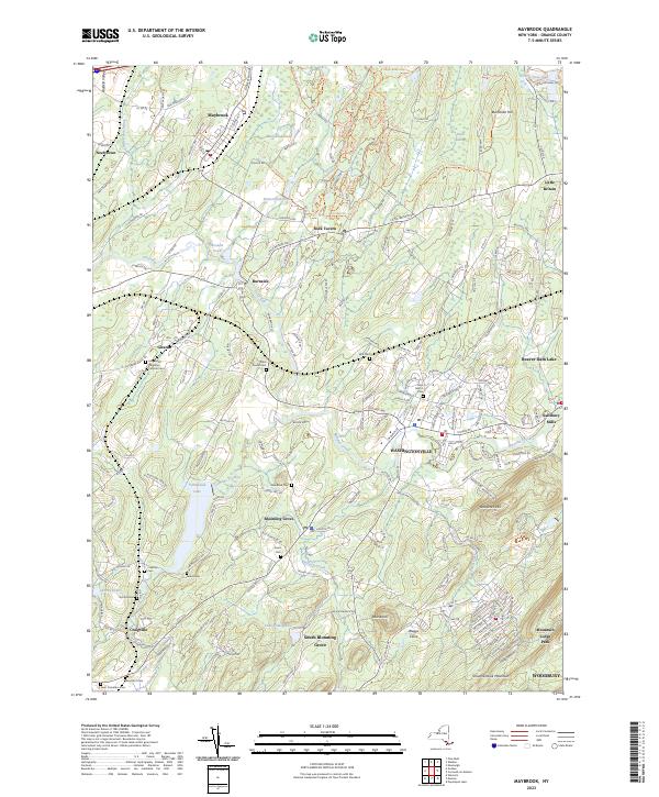 2023 Maybrook2023 Print · USGSOrange County's pastoral and residential landscape is captured in modern detail, centered on the historic corridors of Washingtonville and Blooming Grove. Researchers can locate numerous burial sites like Woodhull Cem and Saint Davids Cem alongside the waters of Moodna Creek.
End of results
Showing maps 1-4 of 4
Top cities near Chester
- Ramapo historical maps
- Haverstraw historical maps
- Spring Valley historical maps
- Palm Tree historical maps
- Kiryas Joel historical maps
- Warwick historical maps
See more
Top neighborhoods of Chester
- Sugar Loaf historical maps
- Chester historical maps
- Chester Park Estates historical maps
- Ashford Estates historical maps
- Sugar Loaf Commons historical maps
- Rock Ridge Estates historical maps
See more
Frequently asked questions
- What are the different types of historical maps available for Chester?
- What is the oldest map of Chester?
- Where can I purchase historical maps of Chester for my home or office?
- Where can I download high-res historical maps of Chester?
- Are there historical topographic maps available for Chester?
- Is there historical aerial imagery available for Chester?
- Where are historical maps of Chester sourced from?