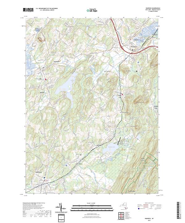
2023 Map of Warwick
USGS Topo · Published 2023About this map
The village of Warwick anchors this modern topographical landscape, where the urban street grid quickly gives way to the agricultural and mountainous terrain of Orange County. To the northeast, the settlements of Sugar Loaf and Chester are separated by the significant heights of Sugarloaf Mountain and Brimstone Mountain. Water is central to the area's layout, with Glenmere Lake and Wickham Lake serving as focal points for the surrounding lowlands.
Find a feature on this map
46 named features on this map. Tap any name to fly to it.
Don’t see what you’re looking for? This feature index may not catch every label — zoom into the map to look around manually.
Map Details
Editions of this 2023 Warwick Map
This is the sole edition of this map. No revisions or reprints were ever made.
Other maps of this area

1891 · Greenwood Lake
USGS Topo · 1:62,500

1891 · Ramapo
USGS Topo · 1:62,500

1893 · Greenwood Lake
USGS Topo · 1:62,500

1893 · Ramapo
USGS Topo · 1:62,500

1902 · Schunemunk
USGS Topo · 1:62,500

1903 · Greenwood Lake
USGS Topo · 1:62,500

1906 · Goshen
USGS Topo · 1:62,500

1908 · Goshen
USGS Topo · 1:62,500

1910 · Ramapo
USGS Topo · 1:62,500

1910 · Greenwood Lake
USGS Topo · 1:62,500