
1906 Map of Goshen
USGS Topo · Published 1959About this map
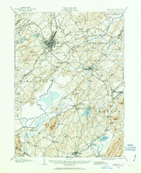
Middletown and Goshen serve as the primary hubs in this early 20th-century landscape, which is defined by an intricate network of competing rail lines. The Erie RR, New York Ontario and Western RR, and Lehigh and Hudson River RR crisscross the region, connecting smaller agricultural centers like Florida and Chester to broader markets. The geography is notably shaped by the sprawling marshlands and drainage projects in the southwest, where the Commissioners Ditch cuts through the flats near Pine Island. This area, once known for its fertile black dirt, is bounded by prominent elevations such as Mt Adam, Mt Eve, and the Pochuck Mtn range. Further east, the terrain becomes increasingly varied, featuring the Sugarloaf Mtn and the waters of Glenmere Lake, illustrating the varied agricultural and industrial character of the era.
Find a feature on this map
107 named features on this map. Tap any name to fly to it.
Don’t see what you’re looking for? This feature index may not catch every label — zoom into the map to look around manually.
Map Details
Editions of this 1906 Goshen Map
2 editions found
Other maps of this area

1888 · Franklin
USGS Topo · 1:62,500

1891 · Greenwood Lake
USGS Topo · 1:62,500

1891 · Ramapo
USGS Topo · 1:62,500

1893 · Greenwood Lake
USGS Topo · 1:62,500

1893 · Ramapo
USGS Topo · 1:62,500

1894 · Franklin
USGS Topo · 1:62,500

1897 · Franklin
USGS Topo · 1:62,500

1902 · Schunemunk
USGS Topo · 1:62,500

1903 · Newburg
USGS Topo · 1:62,500

1903 · Franklin Furnace
USGS Topo · 1:62,500