2020s Maps of Otsego County, New York
Explore 32 historic maps of Otsego County from the 2020s. These maps offer a rare glimpse into what life looked like during the 2020s — showing old roads, neighborhoods, homes, and landmarks that have changed or disappeared over time.
Whether you're researching your family's past, planning a metal detecting trip, or studying how Otsego County's landscape evolved across the 2020s, these high-resolution maps are a powerful tool for exploring the history of this region.
- Focus on a specific era: All maps on this page are from the 2020s, giving you a focused view of this time period.
- See what’s changed: Compare century-old streets, trails, and buildings to today's modern landscape using overlays and satellite layers.
- Research with precision: Use these maps for genealogy, historical research, land use analysis, or educational projects.
- View, download, or print: Maps are fully viewable online in high resolution, and can be downloaded or printed for your own records.
Start exploring Otsego County's history through authentic maps from the 2020s. This is your window into the past.
Otsego County, NY maps
(32)- 2023 Map of West Davenport, 2023 Print
 2023 West Davenport2023 Print · USGSTracing the border of Otsego and Delaware counties, this recent survey shows the deep valleys of Charlotte Creek and the Susquehanna River. Genealogists can locate several burial grounds like McMinn Cem and trace rural settlements from West Davenport to East Meredith.
 - 2023 Map of Otego, 2023 Print
 2023 Otego2023 Print · USGSThe Susquehanna River valley and its surrounding highlands are captured in this modern survey of Otsego County. Local historians can trace dozens of family burial grounds such as Burdick Cemetery and Northup Cemetery or explore the rural routes through Otsdawa and Wells Bridge.
 - 2023 Map of Hartwick, 2023 Print
 2023 Hartwick2023 Print · USGSOtsego County's rural character is preserved in this recent survey of the hills and valleys surrounding Hartwick. Researchers can trace genealogical roots through numerous sites like Snowden Hill Cem, Robinson Cem, and the historic hamlet of Patent.
 - 2023 Map of Van Hornesville, 2023 Print
 2023 Van Hornesville2023 Print · USGSHerkimer County's rural uplands are meticulously detailed in this recent survey of the settlements south of the Mohawk River. Genealogists can trace several small burial grounds like Pumpkin Hook Cem and Hawn Cem near Starkville and Van Hornesville.
 - 2023 Map of Oneonta, 2023 Print
 2023 Oneonta2023 Print · USGSThe Susquehanna River valley and its surrounding highlands are captured here in the early twenty-first century. Researchers can trace local lineage through Riverside Cem and Oneonta Plains Cem or explore the academic footprints of Hartwick College.
 - 2023 Map of Gilbertsville, 2023 Print
 2023 Gilbertsville2023 Print · USGSOtsego County's rural character is preserved in this modern survey of the Gilbertsville and Unadilla Center area. Genealogists can trace family locations through numerous sites like Old Churchyard Cem, Sand Hill, and the secluded Black Ash Bog.
 - 2023 Map of Brookfield, 2023 Print
 2023 Brookfield2023 Print · USGSThe Unadilla Valley comes to life in this contemporary survey of the Madison County borderlands. Genealogists can trace family legacies at the Brookfield Rural Cem, Welch Cem, and Mott Cem near the riverbanks of the Unadilla River.
 - 2023 Map of New Berlin South, 2023 Print
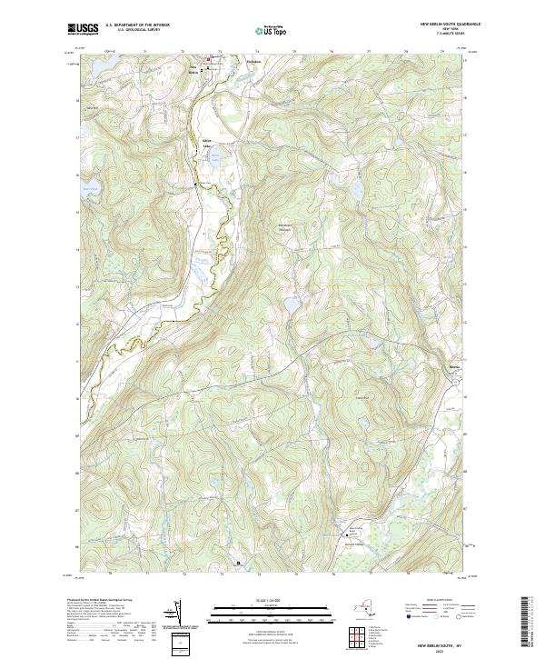 2023 New Berlin South2023 Print · USGSThe Unadilla River valley comes to life in this contemporary study of the Otsego County highlands. Researchers can pinpoint historic family sites like the Morris Family Burial Ground or trace the rural road networks surrounding New Berlin and Hoboken.
 - 2023 Map of Schuyler Lake, 2023 Print
 2023 Schuyler Lake2023 Print · USGSThe Otsego County highlands and the shores of Canadarago Lake are captured here in a contemporary record of this rural New York landscape. Researchers can trace historic cemeteries and small hamlets like Dogtown, Exeter Corner, and Lidell Corners along the winding creek valleys.
 - 2023 Map of Mount Vision, 2023 Print
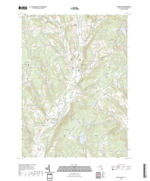 2023 Mount Vision2023 Print · USGSUpper Otsego County in the early twenty-first century remains a landscape of valley hamlets and high ridges. Researchers can trace historic burial sites like Lena Cem and Elm Row Cem or explore the geography of Wilber Lake and Arnold Lake.
 - 2023 Map of Holmesville, 2023 Print
 2023 Holmesville2023 Print · USGSChenango County is mapped here in the early twenty-first century, showing the rural hills and river valleys between the Unadilla River and Chenango Lake. Genealogists can locate several family burial grounds like Bloom Cem and Edmonds Cem near the historic King Settlement.
 - 2023 Map of Unadilla Forks, 2023 Print
 2023 Unadilla Forks2023 Print · USGSThe Unadilla River valley comes to life in this contemporary survey of the Otsego County borderlands. Genealogists can locate numerous family burial sites, including Unadilla Forks Cem, Huntly Cem, and the high-elevation Bass Cem.
 - 2023 Map of Franklin, 2023 Print
 2023 Franklin2023 Print · USGSDelaware County’s rural highlands and river valleys are documented here in the early twenty-first century. Researchers can trace family history through several local burying grounds like Valley Cemetery and East Sidney Cemetery or locate the site of Franklin Depot.
 - 2023 Map of Edmeston, 2023 Print
 2023 Edmeston2023 Print · USGSOtsego County's rural heartland is meticulously documented in this recent survey of the hamlets along Wharton Creek. Genealogists and local historians can trace family locations through Burlington Flats Cem, Union Cem, and the small settlement at Garrattsville.
 - 2023 Map of New Berlin North, 2023 Print
 2023 New Berlin North2023 Print · USGSUpper Chenango and Otsego counties appear here in the early twenty-first century, centered on the winding Unadilla River. Researchers can trace family history through numerous small burial grounds like Gazlay Cem and Greenwood Cem or explore the rural hamlets of Sweets and Five Corners.
 - 2023 Map of Unadilla, 2023 Print
 2023 Unadilla2023 Print · USGSThe Susquehanna River valley in the early 2020s remains the central artery for this corner of Delaware County. Researchers can trace family history through numerous hillside burial sites like Evergreen Hill Cem and explore hamlets like Sidney Center and Youngs.
 - 2023 Map of West Winfield, 2023 Print
 2023 West Winfield2023 Print · USGSThe rural borderlands of Oneida and Herkimer Counties are captured here as they appeared in the early 2020s. Researchers can trace local heritage through numerous burial grounds like Jerusalem Hill Cem and settlements such as Clayville and West Winfield.
 - 2023 Map of Morris, 2023 Print
 2023 Morris2023 Print · USGSOtsego County's rural character and long-established hamlets are beautifully preserved in this recent survey of the New York foothills. Genealogists and historians can trace family roots through numerous sites like the Quaker Burying Ground, Old Church Cem, and the quiet crossroads of Stetsonville.
 - 2023 Map of Millers Mills, 2023 Print
 2023 Millers Mills2023 Print · USGSThe rural uplands of Herkimer County are shown here in recent years, where the headwaters of the Unadilla River and Steele Creek meet. Genealogists can trace family names at the Brown-Young Cem, Millers Mills Cem, and Edick Cem.
 - 2023 Map of Sidney, 2023 Print
 2023 Sidney2023 Print · USGSChenango County's river valleys and upland forests are captured here in the early twenty-first century as the area's industrial and agricultural history endures. Researchers can trace family sites at Saint Peters Churchyard Cem, navigate the rural roads of Bennettsville, or locate the Sidney Municipal Airport.
 - 2023 Map of Jordanville, 2023 Print
 2023 Jordanville2023 Print · USGSThe quiet crossroads of Jordanville and Paines Hollow are shown here in recent years, surrounded by a dense network of country cemeteries and high points like Harter Hill. Genealogists can trace family burial sites at Piper Cem, Helmer Cem, and the Crain Memorial Cem.
 - 2023 Map of East Springfield, 2023 Print
 2023 East Springfield2023 Print · USGSThe northern tip of Otsego Lake comes into focus in this recent survey of the Springfield and Cherry Valley area. Researchers can trace historic burial sites like Middle Village Cem or explore the terrain around Summit Lake and Glimmerglass State Park.
 - 2023 Map of Westford, 2023 Print
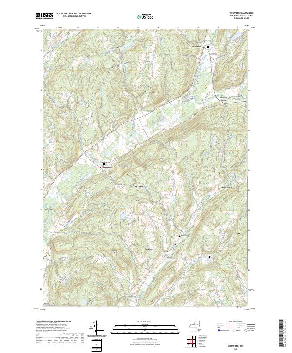 2023 Westford2023 Print · USGSOtsego County's rural uplands are shown here in recent detail, centered on the valley settlements and cemetery sites that define the region's heritage. Genealogists can locate family sites at Middlefield Cem and Draper Hill Cem or trace the winding course of Cherry Valley Creek.
 - 2023 Map of Davenport, 2023 Print
 2023 Davenport2023 Print · USGSDavenport and the surrounding Charlotte Valley are shown here in the early twenty-first century, a landscape of family farms and creek-side hamlets. Genealogists can trace lineage through numerous sites like Fergusonville Cem, Quaker Hill Cem, and Kortright Center.
 - 2023 Map of Richfield Springs, 2023 Print
 2023 Richfield Springs2023 Print · USGSRichfield Springs and the northern shores of Otsego Lake appear here in modern detail, where the headwaters of the Susquehanna River meet rugged upland hills. Researchers can locate several burial grounds, including Twelve Thousand Cem and Lakeview Cem, alongside the historic Presbyterian Church.
Showing maps 1-25 of 32
Top cities of Otsego County
- Oneonta historical maps
- Oneonta historical maps
- Unadilla historical maps
- Otsego historical maps
- Milford historical maps
- Otego historical maps
See more
Frequently asked questions
- What are the different types of historical maps available for Otsego County?
- What is the oldest map of Otsego County?
- Where can I purchase historical maps of Otsego County for my home or office?
- Where can I download high-res historical maps of Otsego County?
- Are there historical topographic maps available for Otsego County?
- Is there historical aerial imagery available for Otsego County?
- Where are historical maps of Otsego County sourced from?