Old Maps of Stephentown, New York for Metal Detecting
Plan your next treasure hunt with 74 historic maps of Stephentown. Find old homesites, ghost towns, trails, and gathering spots that may be lost to time — perfect for identifying promising metal detecting locations.
- Locate forgotten sites: Uncover places like long-lost settlements, abandoned rail lines, or gathering spots.
- Plan better hunts: Use map overlays combined with LiDAR or satellite views to narrow in on historically rich areas.
- Made for detectorists: Thousands of hobbyists use these maps to discover relics, coins, and hidden history.
Use these historic maps to boost your research and find new opportunities beneath the surface of Stephentown.
Stephentown, NY maps
(74)- 1888 Map of Berlin
 1888 Berlin1888 Print · USGSRensselaer County at the close of the nineteenth century was a region of high ridges and narrow rail-linked valleys. Researchers can trace the path of the Lebanon Springs Railroad and locate vanished farmsteads in Barber Hollow or Mc Master Hollow.2 unique versions available
 - 1888 Map of Pittsfield
 1888 Pittsfield1888 Print · USGSThe Berkshires and eastern New York meet in this late 19th-century record of a landscape defined by communal settlements and early industry. Genealogists and historians can trace the footprint of the Canaan Shakers, industrial sites at Richmond Furnace, and the early rail stops at Edwards Station.
 - 1890 Map of Pittsfield
 1890 Pittsfield1890 Print · USGSThe Berkshires and New York borderlands are captured here in the late nineteenth century, showing a landscape defined by communal Shaker life and iron works. Researchers can trace the Lebanon Springs Railroad through Lebanon Springs or locate early industrial hubs like Richmond Furnace and Lower Barkerville.
 - 1890 Map of Berlin
 1890 Berlin1890 Print · USGSThe New York and Massachusetts borderlands in the 1880s were a landscape of steep ridges and rail-connected valley towns. Genealogists and historians can trace the old corridors of the Lebanon Springs Railroad and locate vanished family landmarks near Berlin Center, Garfield, and East Poestenkill.
 - 1893 Map of Troy
 1893 Troy1893 Print · USGSThe Hudson River valley at the end of the nineteenth century was a bustling hub of commerce where the Erie Canal met the Troy waterfront. Researchers can trace the early rail networks of the Boston and Albany Railroad or locate vanished sites like Schodack Depot and the industrial hamlet of Glass House.
 - 1893 Map of Pittsfield
 1893 Pittsfield1893 Print · USGSThe Berkshires and the New York border are captured here in the late nineteenth century, showing a landscape of Shaker communities and early industrial sites. Genealogists can trace family roots in Barkerville, Curtisville, and near the historic Richmond Furnace.
 - 1894 Map of Berlin
 1894 Berlin1894 Print · USGSThe Rensselaer and Berkshire borderlands come alive in the late nineteenth century, showing a landscape of valley settlements and upland hollows. Trace the path of the Lebanon Springs Railroad as it connects Berlin Center, North Stephentown, and Garfield.
 - 1894 Map of Pittsfield
 1894 Pittsfield1894 Print · USGSThe Massachusetts and New York borderlands meet in the 1890s, where industrial villages and Shaker settlements thrive along the rail corridors. Genealogists and historians can trace family roots through communities like Canaan Shakers, Richmond Furnace, and Lower Barkerville.
 - 1895 Map of Troy
 1895 Troy1895 Print · USGSThe Hudson River valley at the close of the nineteenth century was a bustling nexus of river, rail, and canal traffic. Genealogists and historians can trace family-named hills and early hamlets from Troy to the lakes of Sand Lake, including Glass House and Sliter.
 - 1897 Map of Pittsfield
 1897 Pittsfield1897 Print · USGSThe Berkshires and Columbia County come to life in the late nineteenth century as a hub of rail travel and communal living. Trace the historic Canaan Shakers settlement, find long-gone stops like Edwards Station, or study the industrial layout of Richmond Furnace.11 unique versions available
 - 1898 Map of Berlin
 1898 Berlin1898 Print · USGSRensselaer County valley towns and the Taconic highlands are captured in the late nineteenth century as the Lebanon Springs Railroad linked the region. Genealogists can trace family locations in Berlin, Stephentown, and Hancock, or find landmarks like Buckwheat Hill and Barber Hollow.10 unique versions available
 - 1898 Map of Troy
 1898 Troy1898 Print · USGSThe Hudson River valley at the turn of the century shows a bustling corridor of industry and rail before modern expansion transformed the capital region. Researchers can trace historic riverfront districts like Greenbush and Bath or locate vanished rail stops such as Schodack Depot and the Erie Canal route.8 unique versions available
 - 1899 Map of Housatonic
 1899 Housatonic1899 Print · USGSThe Berkshire hills at the close of the nineteenth century reveal a landscape of industrial hamlets and Shaker settlements. Trace the rail-and-river economy through Lenox Furnace, locate the historic Shaker Village, and find landmarks like Laura Tower.
 - 1900 Map of Taconic
 1900 Taconic1900 Print · USGSThe tri-state border region of the Taconic Mountains thrived at the turn of the century as a hub of rail travel and valley industry. Genealogists and historians can trace the early footprints of Hoosick Falls, Bennington, and the winding path of the Rutland R.R.4 unique versions available
 - 1900 Map of Housatonic
 1900 Housatonic1900 Print · USGSThe Berkshires and the Housatonic Valley are captured here at a moment of industrial and social transition during the late Victorian era. Genealogists and historians can trace the early rail networks of the Boston and Albany R.R. through old settlements like Shaker Village and Lenox Furnace.5 unique versions available
 - 1903 Map of Kinderhook
 1903 Kinderhook1903 Print · USGSColumbia County at the turn of the century shows a landscape defined by the intersection of water power and rail. Trace the industrial heritage of Stuyvesant Falls and White Mills or locate ancestral homes in Old Chatham and Valatie.6 unique versions available
 - 1925 Map of Troy
 1925 Troy1925 Print · USGSRensselaer County at the mid-twenties shows a landscape of established mill towns and developing lakefront retreats. Genealogists can trace family roots through numerous sites like St Josephs Cemetery, Teller Mill, and early schoolhouses from Albia to Hoags Corners.
 - 1928 Map of Troy
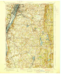 1928 Troy1928 Print · USGSThe Hudson River valley at the height of its industrial era features the dense centers of Troy and Watervliet. Researchers can trace old neighborhoods near Rensselaer Polytechnic Institute or locate family plots in St Agnes Cemetery and St Marys Cemetery.5 unique versions available
 - 1933 Map of Kinderhook
 1933 Kinderhook1933 Print · USGSColumbia County in the early thirties is a landscape of thriving mill towns and rail junctions. Genealogists and historians can locate family-named schoolhouses like Woltermire Sch or trace the grounds of the Martin Van Buren Homestead.3 unique versions available
 - 1943 Map of Housatonic
 1943 Housatonic1943 Print · USGSThe Berkshires and the Housatonic Valley are captured during the war years, showing a landscape of traditional Shaker settlements and growing industrial centers. Trace the routes of the NY NH & H RR and explore sites like Shaker Village, Richmond Furnace, and Rockdale Mills.
 - 1944 Map of Hancock, 1956 Print
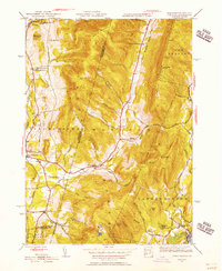 1944 Hancock1956 Print · USGSThe Taconic borderlands of Massachusetts and New York are captured here in the mid-1940s, showing a landscape of high ridges and rural valleys. Genealogists and hikers can trace old roads to sites like Balance Rock Sch, the Fire Tower on Brodie Mountain, and landmarks like Widow Whites Peak.2 unique versions available
 - 1945 Map of Stephentown Center, 1958 Print
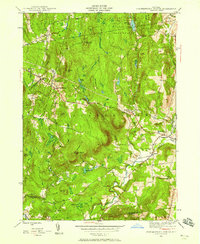 1945 Stephentown Center1958 Print · USGSRensselaer County's rugged eastern borderlands are captured here just after the war, showing the network of valley hamlets and highland ridges. Genealogists can locate ancestors at Hillside Cem or Sacred Heart Cem and trace the paths through Dunham Hollow and West Stephentown.4 unique versions available
 - 1946 Map of Canaan, 1958 Print
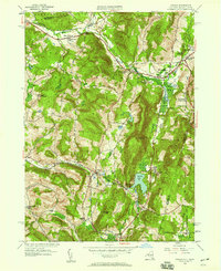 1946 Canaan1958 Print · USGSThe New York and Massachusetts borderlands appear here in the late 1940s, anchored by the settlements of New Lebanon and Canaan. Researchers can trace family history through sites like the Cemetery of the Evergreens, Darrow Sch, and the Berkshire Industrial Farm.
 - 1947 Map of Stephentown Center
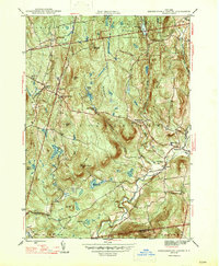 1947 Stephentown Center1947 Print · USGSRensselaer County at the end of the 1940s reveals a patchwork of highland forests and tight-knit valley hamlets connected by the Rutland railroad. Genealogists can locate family burial sites at Hillside Cem and Sacred Heart Cem or trace old property lines near Stephentown Center.2 unique versions available
 - 1947 Map of Canaan
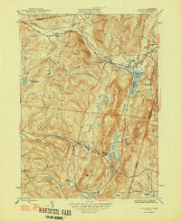 1947 Canaan1947 Print · USGSThe Taconic borderlands come alive in this post-war survey of the New York-Massachusetts state line. Genealogists and historians can trace family plots at the Cemetery of the Evergreens or locate the old Darrow Sch and Berkshire Industrial Farm.2 unique versions available
Showing maps 1-25 of 74
Top cities near Stephentown
- Pittsfield historical maps
- East Greenbush historical maps
- North Greenbush historical maps
- Schodack historical maps
- Brunswick historical maps
- Sand Lake historical maps
See more
Top neighborhoods of Stephentown
- North Stephentown historical maps
- Wyomanock historical maps
- West Stephentown historical maps
- Garfield historical maps
- Stephentown Center historical maps
Frequently asked questions
- What are the different types of historical maps available for Stephentown?
- What is the oldest map of Stephentown?
- Where can I purchase historical maps of Stephentown for my home or office?
- Where can I download high-res historical maps of Stephentown?
- Are there historical topographic maps available for Stephentown?
- Is there historical aerial imagery available for Stephentown?
- Where are historical maps of Stephentown sourced from?