Old Maps of Lisbon, New York for Metal Detecting
Plan your next treasure hunt with 62 historic maps of Lisbon. Find old homesites, ghost towns, trails, and gathering spots that may be lost to time — perfect for identifying promising metal detecting locations.
- Locate forgotten sites: Uncover places like long-lost settlements, abandoned rail lines, or gathering spots.
- Plan better hunts: Use map overlays combined with LiDAR or satellite views to narrow in on historically rich areas.
- Made for detectorists: Thousands of hobbyists use these maps to discover relics, coins, and hidden history.
Use these historic maps to boost your research and find new opportunities beneath the surface of Lisbon.
Lisbon, NY maps
(62)- 1904 Map of Lisbon
 1904 Lisbon1904 Print · USGSThe St. Lawrence River borderlands are captured in detail during the early 1900s, documenting the intricate islands and rapids before modern navigation projects. Trace the old riverfront at Red Mills or the rail lines of the Grand Trunk R. R. near Cardinal.
 - 1904 Map of Ogdensburg, 1957 Print
 1904 Ogdensburg1957 Print · USGSEarly 20th-century St. Lawrence County is defined here by the busy rail and river crossroads of Ogdensburg and its agricultural surroundings. Researchers can locate long-lost rural landmarks like Kings Corners Kokomo PO, the Bell Schoolhouse, and the sprawling St Lawrence State Hospital.
 - 1905 Map of Waddington
 1905 Waddington1905 Print · USGSThe international border along the St. Lawrence River is captured here in the early 1900s, before modern seaway developments altered the shoreline. Researchers can trace the original locations of Waddington, the locks of the Rapide Plat Canal, and the Grand Trunk RR rail line.5 unique versions available
 - 1905 Map of Ogdensburg
 1905 Ogdensburg1905 Print · USGSOgdensburg and the St. Lawrence River frontier are captured here in the era of steam rail and rural post offices. Local researchers can trace old family names at Northrup Cors, locate the Fish Creek Church, or follow the river to Heuvelton and the Lost Village.4 unique versions available
 - 1906 Map of Red Mills
 1906 Red Mills1906 Print · USGSThe St. Lawrence River corridor at the turn of the century shows a landscape of rapids and rail-side villages along the international border. Researchers can trace the path of the Grand Trunk R R or explore the many islands and landings near Red Mills and Iroquois.4 unique versions available
 - 1910 Map of Canton, 1956 Print
 1910 Canton1956 Print · USGSSt. Lawrence County is captured here in the early twentieth century as a busy corridor of rail travel and river-powered industry. Researchers can locate family homesteads near Crary Mills, Langdon Corners, or the historic Brick Chapel along the Grass River.
 - 1911 Map of Canton
 1911 Canton1911 Print · USGSNorthern St. Lawrence County is captured here in the early twentieth century as a busy corridor of river-powered industry and rail transport. Genealogists and historians can trace the foundations of Canton and Potsdam or locate smaller rural hubs like Brick Chapel and Pyrites.4 unique versions available
 - 1942 Map of Waddington, 1957 Print
 1942 Waddington1957 Print · USGSSt. Lawrence County is captured during the early 1940s, showing the riverside docks of Waddington and the international channel of the St Lawrence River. Researchers can locate numerous local landmarks including St Marys Cem, Chipman, and over ten numbered schoolhouses scattered across the rural township.
 - 1943 Map of Ogdensburg East
 1943 Ogdensburg East1943 Print · USGSThe St. Lawrence riverfront hums with activity during the early 1940s as Ogdensburg serves as a critical junction for rail and river transit. Genealogists can trace family homesteads near Northrup Corners or locate ancestors at Notre Dame Cem and dozens of rural school sites like School No 29.
 - 1943 Map of Rensselaer Falls
 1943 Rensselaer Falls1943 Print · USGSSt. Lawrence County in the early 1940s is shown here as a landscape of rural school districts and river-bound settlements. You can trace family homesteads near Kendrew Corners or follow the New York Central rail lines into DeKalb Junction.
 - 1943 Map of Waddington
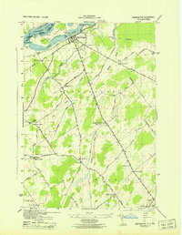 1943 Waddington1943 Print · USGSSt. Lawrence County in the mid-1940s was a landscape of tightly-knit rural townships and family-named crossroads. Genealogists can trace family footprints through numerous numbered district schools and local landmarks like Drews Corner, Halfway House Corners, and St Marys Cem.
 - 1943 Map of Lisbon
 1943 Lisbon1943 Print · USGSLisbon and the surrounding St. Lawrence County farm country are captured here during the early 1940s. Genealogists can trace family connections through a dozen local schools and landmarks like White Ch, Flackville Cem, and the Rutland rail line.
 - 1943 Map of Red Mills
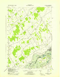 1943 Red Mills1943 Print · USGSThe international border along the St. Lawrence River is frozen in time here during the mid-forties, showing the landscape before modern seaway construction. Local historians can trace the riverside community of Red Mills, the industrial layout of Cardinal, and the island-filled waters of the Galop Rapids.
 - 1943 Map of Sparrowhawk Point
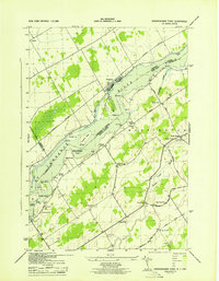 1943 Sparrowhawk Point1943 Print · USGSThe international border along the St. Lawrence River is captured here in the 1940s, showing the intersection of Canadian rail and American rural life. Researchers can find numerous local landmarks including School No 17, Union Cem, and Iroquois.
 - 1944 Map of Canton
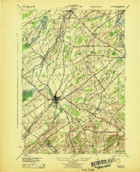 1944 Canton1944 Print · USGSSt. Lawrence County was a landscape of river-powered hamlets and busy rail corridors during the mid-forties. Researchers can trace the layout of Canton and Potsdam or find smaller family-named junctions like Casey Corners, Langdon Corners, and Slab City.
 - 1948 Map of Ogdensburg, 1973 Print
 1948 Ogdensburg1973 Print · USGSThe international border along the St Lawrence River comes to life in the late 1940s, showing the vital rail and water connections between New York and Ontario. Researchers can trace the grounds of St Lawrence University, the massive Camp Drum military reservation, and the historic Rideau River and Canal.2 unique versions available
 - 1951 Map of Ogdensburg
 1951 Ogdensburg1951 Print · USGSThe St. Lawrence frontier and the North Country are captured here during the post-war era, from the river ports to the high Adirondacks. Genealogists and historians can trace the rail-and-river economy through Ogdensburg, the Rutland rail lines, and Potsdam.
 - 1953 Map of Ogdensburg
 1953 Ogdensburg1953 Print · USGSThe North Country and St. Lawrence Valley are shown here in the early fifties, just as the region’s rail-and-river economy remained in full swing. Genealogists and historians can trace family-named corners and rural hubs along the Rutland railroad or locate heritage sites near Ogdensburg, Potsdam, and the St Regis Indian Reservation.
 - 1961 Map of Ogdensburg
 1961 Ogdensburg1961 Print · USGSThe St. Lawrence valley and the Adirondack high country meet in this early sixties survey during a peak era for rail and river commerce. Genealogists and historians can trace the paths of the New York Central railroad through remote settlements like Wanakena, Conifer, and Piercefield.
 - 1963 Map of Rensselaer Falls, 1965 Print
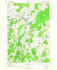 1963 Rensselaer Falls1965 Print · USGSSt. Lawrence County in the early sixties is anchored by the river-and-rail corridor connecting Rensselaer Falls and De Kalb Junction. Genealogists can locate family landmarks like Walruth Cem, Kendrew Cem, and the historic settlement at Coopers Falls.
 - 1963 Map of Sparrowhawk Point, 1965 Print
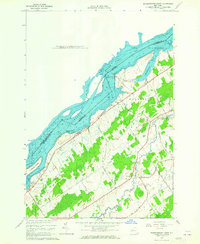 1963 Sparrowhawk Point1965 Print · USGSThe international border along the St. Lawrence River is captured here in the early sixties as modern seaway engineering met old riverfront townships. Genealogists can locate family burial sites at Union Cem and O'Neill Cem or trace the rural routes of Bull Run Road and Keystone Road.2 unique versions available
 - 1963 Map of Lisbon, 1965 Print
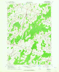 1963 Lisbon1965 Print · USGSLisbon and its surrounding St. Lawrence County hamlets are captured here in the early sixties, showing a landscape of rural crossroads and farming tracts. Genealogists can trace family names and local landmarks like the Covenanter Ch, Flackville Cem, and several Gravel Pits.2 unique versions available
 - 1963 Map of Ogdensburg East, 1965 Print
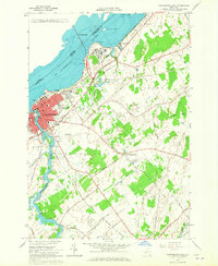 1963 Ogdensburg East1965 Print · USGSThe St. Lawrence River border at the height of the 1960s features the growing city of Ogdensburg and its international bridge. Genealogists can trace family lines through several local burial sites including St Marys Cem and the State Hospital Cem or locate rural homesteads near Heuvelton.2 unique versions available
 - 1963 Map of Red Mills, 1965 Print
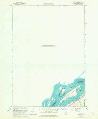 1963 Red Mills1965 Print · USGSThe international border along the St. Lawrence River is captured in the early sixties as it winds past the northern edge of New York. Genealogists and historians can locate the riverside settlement of Red Mills and trace landmarks like Galop Island and Benedict Island.
 - 1964 Map of Morley, 1965 Print
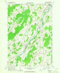 1964 Morley1965 Print · USGSSt. Lawrence County in the mid-1960s is defined here by the winding Grass River and the quiet hamlets of Morley and Madrid Springs. Researchers can trace old family roads and locate several remote burial sites, including Doran Cem and St James Cem.2 unique versions available
Showing maps 1-25 of 62
Top cities near Lisbon
- Potsdam historical maps
- Canton historical maps
- Ogdensburg historical maps
- Canton historical maps
- Oswegatchie historical maps
- Louisville historical maps
See more
Top neighborhoods of Lisbon
- Red Mills historical maps
- Flackville historical maps
- Pine Grove historical maps
- Hague Crossing historical maps
Frequently asked questions
- What are the different types of historical maps available for Lisbon?
- What is the oldest map of Lisbon?
- Where can I purchase historical maps of Lisbon for my home or office?
- Where can I download high-res historical maps of Lisbon?
- Are there historical topographic maps available for Lisbon?
- Is there historical aerial imagery available for Lisbon?
- Where are historical maps of Lisbon sourced from?