Old Maps of Edgewater Park, Morristown for Hiking & Exploration
Hike through history with 14 historic maps of Edgewater Park. Explore old trails, ghost towns, and forgotten backroads — perfect for outdoor adventurers and local explorers.
- Rediscover forgotten places: Map out old mining camps, roads, and footpaths that no longer exist on modern maps.
- Layer with modern tools: Combine with LiDAR or satellite views to plan hikes through historical terrain.
- Made for exploration: Popular among hikers, overlanders, and local history lovers.
Use these maps to find adventure and explore the hidden past of Edgewater Park.
Edgewater Park, Morristown maps
(14)- 1906 Map of Brier Hill
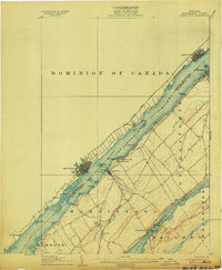 1906 Brier Hill1906 Print · USGSThe St. Lawrence River frontier was a bustling corridor of international ferries and competing railroads at the turn of the century. You can trace the historic Steamboat Route and locate vanished river-side landmarks like Cole Ferry, Edgewater Park, and Brier Hill Sta.7 unique versions available
 - 1942 Map of Morristown, 1958 Print
 1942 Morristown1958 Print · USGSThe international border along the St Lawrence River comes alive in the 1940s, showing the vital connection between Morristown and Brockville. Genealogists can trace early rural life through named roads like Yankee Street and local landmarks like Chippewa Street Church.
 - 1943 Map of Morristown
 1943 Morristown1943 Print · USGSThe international border along the St Lawrence River comes alive in the 1940s, showing the cross-river connection between Brockville and Morristown. Researchers can trace old family sites near Chippewa Street Church, numerous rural schools, and the path of the New York Central rail line.
 - 1948 Map of Ogdensburg, 1973 Print
 1948 Ogdensburg1973 Print · USGSThe international border along the St Lawrence River comes to life in the late 1940s, showing the vital rail and water connections between New York and Ontario. Researchers can trace the grounds of St Lawrence University, the massive Camp Drum military reservation, and the historic Rideau River and Canal.2 unique versions available
 - 1951 Map of Ogdensburg
 1951 Ogdensburg1951 Print · USGSThe St. Lawrence frontier and the North Country are captured here during the post-war era, from the river ports to the high Adirondacks. Genealogists and historians can trace the rail-and-river economy through Ogdensburg, the Rutland rail lines, and Potsdam.
 - 1953 Map of Ogdensburg
 1953 Ogdensburg1953 Print · USGSThe North Country and St. Lawrence Valley are shown here in the early fifties, just as the region’s rail-and-river economy remained in full swing. Genealogists and historians can trace family-named corners and rural hubs along the Rutland railroad or locate heritage sites near Ogdensburg, Potsdam, and the St Regis Indian Reservation.
 - 1961 Map of Ogdensburg
 1961 Ogdensburg1961 Print · USGSThe St. Lawrence valley and the Adirondack high country meet in this early sixties survey during a peak era for rail and river commerce. Genealogists and historians can trace the paths of the New York Central railroad through remote settlements like Wanakena, Conifer, and Piercefield.
 - 1963 Map of Morristown, 1964 Print
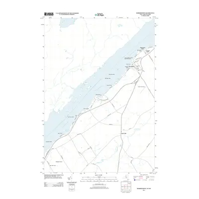
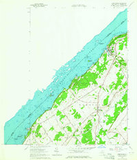 1963 Morristown1964 Print · USGSThe St. Lawrence River shoreline in the early sixties features established village life and growing summer colonies. Genealogists and local historians can trace family plots at Sunnyside Cem or explore the rail-era footprint of Brier Hill Station and Oak Point.3 unique versions available
 - 1985 Map of Ogdensburg, 1986 Print
 1985 Ogdensburg1986 Print · USGSThe St. Lawrence River valley and the northern New York borderlands are shown here in the mid-1980s, during a period of established institutional and collegiate growth. Researchers can trace the paths of CONRAIL through Potsdam or locate local landmarks like Mater Dei College and Rensselaer Falls.2 unique versions available
 - 2011 Map of Morristown, 2011 Print
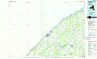
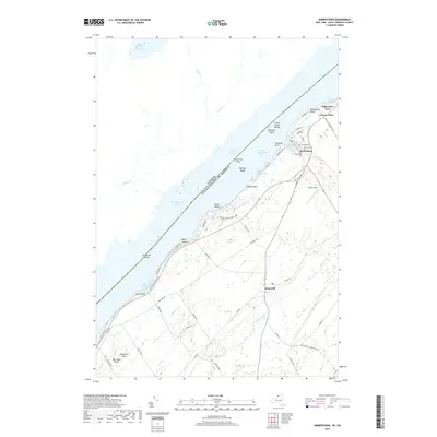
 2011 Morristown2011 Print · USGSCovers Edgewater Park, including Brockville, Elizabethtown-Kitley, and other nearby areas
 - 2013 Map of Morristown, 2013 Print
 2013 Morristown2013 Print · USGSCovers Edgewater Park, including Brockville, Elizabethtown-Kitley, and other nearby areas
 - 2016 Map of Morristown, 2016 Print
 2016 Morristown2016 Print · USGSCovers Edgewater Park, including Brockville, Elizabethtown-Kitley, and other nearby areas
 - 2019 Map of Morristown, 2019 Print
 2019 Morristown2019 Print · USGSCovers Edgewater Park, including Brockville, Elizabethtown-Kitley, and other nearby areas
 - 2023 Map of Morristown, 2023 Print
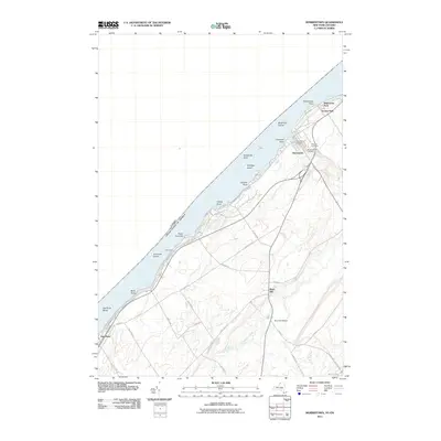
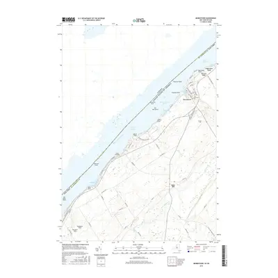
 2023 Morristown2023 Print · USGSSt. Lawrence County riverfront life is centered on the village of Morristown during the twenty-first century. Researchers can trace family sites at Sunnyside Cem and Greenwood Cem or explore the river banks near Jacques Cartier State Park.
End of results
Showing maps 1-14 of 14
Top cities near Edgewater Park
- Ogdensburg historical maps
- Gouverneur historical maps
- Lisbon historical maps
- Oswegatchie historical maps
- Alexandria historical maps
- De Kalb historical maps
See more
Frequently asked questions
- What are the different types of historical maps available for Edgewater Park?
- What is the oldest map of Edgewater Park?
- Where can I purchase historical maps of Edgewater Park for my home or office?
- Where can I download high-res historical maps of Edgewater Park?
- Are there historical topographic maps available for Edgewater Park?
- Is there historical aerial imagery available for Edgewater Park?
- Where are historical maps of Edgewater Park sourced from?