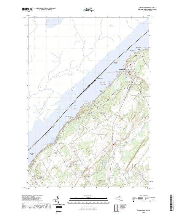
2023 Map of Morristown
USGS Topo · Published 2023About this map
The Saint Lawrence River forms a massive liquid border between New York and Canada, defining the entire northern reach of this landscape. Along its banks, the village of Morristown serves as a primary hub of river activity, situated where Morristown Bay provides a natural harbor sheltered by Morristown Point. The inland terrain is marked by a transition from the riverfront heights to the agricultural and wetland stretches surrounding Brier Hill. Numerous local burial sites, including Sunnyside Cem, Pine Hill Cem, and Greenwood Cem, are clustered near the village, reflecting the long-established settlement history of this corridor. The Saint Lawrence Seaway channel cuts through the river, while land-based recreation is anchored by the riverfront acreage of Jacques Cartier State Park. Further south, the course of Chippewa Creek meanders toward the interior, illustrating the drainage patterns that shaped the county’s early rural development.
Find a feature on this map
61 named features on this map. Tap any name to fly to it.
Don’t see what you’re looking for? This feature index may not catch every label — zoom into the map to look around manually.
Map Details
Editions of this 2023 Morristown Map
This is the sole edition of this map. No revisions or reprints were ever made.
Other maps of this area

1903 · Alexandria Bay
USGS Topo · 1:62,500

1906 · Brier Hill
USGS Topo · 1:62,500

1912 · Hammond
USGS Topo · 1:62,500

1942 · Morristown
USGS Topo · 1:24,000

1943 · Morristown
USGS Topo · 1:31,680

1943 · Edwardsville
USGS Topo · 1:31,680
1943 · Ogdensburg West
USGS Topo · 1:31,680

1944 · Hammond
USGS Topo · 1:62,500

1948 · Chippewa Bay
USGS Topo · 1:24,000

1948 · Alexandria Bay
USGS Topo · 1:62,500