Old Maps of Carlisle, New York for Academic Research
Study the evolution of Carlisle with 57 high-resolution historic maps. Whether you're teaching, researching, or modeling changes in land use, these maps provide essential visual documentation of urban, environmental, and geographic change.
- Analyze long-term change: Track patterns in development, transportation, and natural features.
- Ideal for environmental or urban studies: Support academic projects with primary historical map data.
- Use in the classroom or lab: Educators and researchers rely on these maps to bring historical context to life.
These maps are a powerful tool for teaching, research, and visualizing how Carlisle has changed over the decades.
Carlisle, NY maps
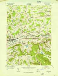
(57)- 1896 Map of Fonda
 1896 Fonda1896 Print · USGSThe Mohawk Valley was a technological corridor in the 1890s, defined by the convergence of major rail lines and the Erie Canal. Genealogists and historians can trace the old post offices and hamlet life at Yatesville Randall P.O., Auriesville, and Rural Grove.
 - 1898 Map of Fonda
 1898 Fonda1898 Print · USGSThe Mohawk Valley at the close of the 19th century was a powerhouse of transit and industry. Genealogists and historians can trace the bustling Erie Canal corridor through Fonda, the upland reaches of Charleston, and the path of the West Shore R. R.
 - 1898 Map of Canajoharie, 1954 Print
 1898 Canajoharie1954 Print · USGSThe Mohawk Valley was at its industrial peak in the late 1890s, when the river, canal, and railroads all shared the same narrow corridor. Genealogists and historians can trace old homesteads and local landmarks in Stone Arabia, Ft. Plain, and the historic resort at Sharon Springs.
 - 1898 Map of Schoharie, 1963 Print
 1898 Schoharie1963 Print · USGSSchoharie County in the late nineteenth century was a landscape of vital river valleys and developing rail lines. Local historians can trace the paths of the Delaware and Hudson RR or locate old hamlets like Breakabeen and Fultonham.
 - 1900 Map of Canajoharie
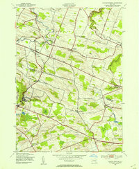
 1900 Canajoharie1900 Print · USGSThe Mohawk Valley at the turn of the century shows a dense network of canal, rail, and river transportation. Genealogists can trace family footprints in historic Canajoharie, the upland farms near Stone Arabia, and the resort area of Sharon Springs.
 - 1900 Map of Schoharie
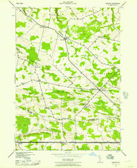
 1900 Schoharie1900 Print · USGSSchoharie County at the turn of the century shows a landscape defined by the winding Schoharie Creek and vital rail connections. Genealogists can trace family roots through specific locations like Howe Cave, Mineral Springs, and the various stops along the Middleburg and Schoharie RR.8 unique versions available
 - 1900 Map of Schoharie, 1944 Print
 1900 Schoharie1944 Print · USGSSchoharie County at the close of the nineteenth century centers on a thriving valley rail network and small industrial settlements. Genealogists and historians can trace the paths of the Middleburg and Schoharie railroad and locate rural landmarks like Howes Cave and Boucks Falls.
 - 1902 Map of Canajoharie
 1902 Canajoharie1902 Print · USGSThe Mohawk Valley was a bustling corridor of canal traffic and steam power just after the turn of the century. Genealogists can trace family names and farmsteads near Stone Arabia or explore the resort layout of Sharon Springs and the industrial hubs of Ft. Plain and Canajoharie.6 unique versions available
 - 1902 Map of Fonda
 1902 Fonda1902 Print · USGSThe Mohawk Valley at the close of the nineteenth century reveals a critical junction of the Erie Canal and major railroads. Genealogists and historians can trace old homesteads and local centers like Auriesville, Sammonsville, and the remote Charleston Four Corners.8 unique versions available
 - 1904 Map of Richmondville
 1904 Richmondville1904 Print · USGSSchoharie and Otsego counties appear here at the start of the century as the rail-and-river economy reached its peak. Genealogists can trace family footprints through historic hamlets like Lutheranville, Seward, and South Valley along the Delaware and Hudson RR.5 unique versions available
 - 1943 Map of Cobleskill, 1954 Print
 1943 Cobleskill1954 Print · USGSSchoharie County's rugged valley and rail corridor are captured here during the 1940s, anchored by the town of Cobleskill. Genealogists and historians can locate specific sites like the State Agricultural School, Howe Caverns, and the Lawyer Cem.4 unique versions available
 - 1943 Map of Sharon Springs, 1955 Print
 1943 Sharon Springs1955 Print · USGSSchoharie and Montgomery Counties are captured in detail during the early 1940s, showing a landscape of upland farms and rural crossroads. Genealogists can locate family landmarks like Flanders Cem, the Dutch Reformed Ch, and small settlements such as Mapletown (Blaine) and Argusville.3 unique versions available
 - 1943 Map of Carlisle, 1957 Print
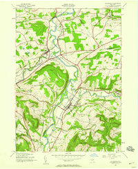
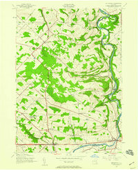
 1943 Carlisle1957 Print · USGSUpper Montgomery and Schoharie counties appear here during the mid-forties, characterized by a dense network of upland farms and crossroads hamlets. Researchers can locate numerous local landmarks like Charleston Four Corners, Gove Cem, and the Cherry Valley Turnpike.2 unique versions available
 - 1943 Map of Schoharie, 1959 Print
 1943 Schoharie1959 Print · USGSThe Schoharie Valley was a vital rail and river corridor during the mid-forties, defined by its small farming hamlets and prominent terrain. Researchers can trace ancestral roots through the Old Stone Fort, several rural schoolhouses, and cemeteries like St Pauls Cem and Central Bridge Cem.4 unique versions available
 - 1943 Map of Esperance, 1959 Print
 1943 Esperance1959 Print · USGSThe rural borderlands of Montgomery and Schoharie counties appear here during the mid-forties, showing a landscape of scattered crossroads and winding waterways. Family historians can locate family-named landmarks like Kimball Cem and Rockwell Corners or trace old school districts like Carytown Sch.2 unique versions available
 - 1944 Map of Richmondville, 1960 Print
 1944 Richmondville1960 Print · USGSSchoharie County was a landscape of rail-connected villages and hillside farmsteads in the mid-1940s. Genealogists can trace the location of local institutions and families through labels for St Johns Ch, Peoples Cem, and several district schools like School No 12.4 unique versions available
 - 1945 Map of Cobleskill
 1945 Cobleskill1945 Print · USGSSchoharie County in the mid-1940s is defined by its railroad valley and early tourist attractions. Researchers can trace family plots like Guernsey Cem, find the original State Agricultural School site, and locate Howe Caverns and Secret Caverns.
 - 1945 Map of Carlisle
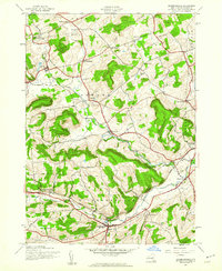
 1945 Carlisle1945 Print · USGSMid-century Montgomery and Schoharie Counties appear as a landscape of crossroads hamlets and country schools just after the war. You can trace early family sites like Lykers Cem or follow the historic path of the CHERRY VALLEY TURNPIKE through Carlisle.
 - 1945 Map of Richmondville
 1945 Richmondville1945 Print · USGSSchoharie County's agricultural valleys and upland hamlets are captured here at the end of the Second World War. Researchers can trace dozens of rural landmarks, from St Johns Church and Beekman Corners to specific 1940s schoolhouses like School No 8 and School No 3.
 - 1946 Map of Schoharie
 1946 Schoharie1946 Print · USGSThe Schoharie Valley in the mid-1940s remains a landscape of river-bottom farms and rural schoolhouses. Genealogists can trace family roots at St Pauls Cem or locate the site of Old Central Bridge and the Old Stone Fort.
 - 1946 Map of Esperance
 1946 Esperance1946 Print · USGSThe Montgomery and Schoharie County borderlands appear here in the mid-1940s, just as the rural school system and turnpike network remained central to local life. You can trace old property sites near Sloansville, Charleston, and family burials at the Kimball Cem.
 - 1948 Map of Binghamton, 1980 Print
 1948 Binghamton1980 Print · USGSCentral New York and the Southern Tier thrive in the late 1940s as a hub of rail traffic and mountain industry. Researchers can trace historic transit lines like the Erie Railroad through Binghamton or find old valley settlements near Oneonta and Delhi.
 - 1950 Map of Binghamton
 1950 Binghamton1950 Print · USGSBinghamton and the surrounding Southern Tier are shown in the mid-century era, highlighting the intricate rail and river networks that drove local industry. Researchers can trace the path of the Erie Railroad and locate landmarks from Otsego Lake to Sidney Mountain.2 unique versions available
 - 1958 Map of Binghamton
 1958 Binghamton1958 Print · USGSCentral New York in the late fifties was a network of manufacturing cities and river valleys connected by vital rail lines. Genealogists and historians can trace family roots in Oneonta, Norwich, and Cooperstown or locate long-standing farms along Schoharie Creek.
 - 1963 Map of Binghamton
 1963 Binghamton1963 Print · USGSThe Southern Tier and Catskill peaks are shown in the early sixties as new reservoirs reshaped the valleys. Trace historic rail corridors like the Erie Lackawanna RR and explore lakeside settlements such as Cooperstown and Oneonta.
Showing maps 1-25 of 57
Top cities near Carlisle
- Amsterdam historical maps
- Cobleskill historical maps
- Duanesburg historical maps
- Amsterdam historical maps
- Cobleskill historical maps
- Minden historical maps
See more
Top neighborhoods of Carlisle
- Carlisle Center historical maps
- Grovenor Corners historical maps
- Argusville historical maps
- Little York historical maps
Frequently asked questions
- What are the different types of historical maps available for Carlisle?
- What is the oldest map of Carlisle?
- Where can I purchase historical maps of Carlisle for my home or office?
- Where can I download high-res historical maps of Carlisle?
- Are there historical topographic maps available for Carlisle?
- Is there historical aerial imagery available for Carlisle?
- Where are historical maps of Carlisle sourced from?