Old Maps of Montauk Beach, Montauk for Academic Research
Study the evolution of Montauk Beach with 15 high-resolution historic maps. Whether you're teaching, researching, or modeling changes in land use, these maps provide essential visual documentation of urban, environmental, and geographic change.
- Analyze long-term change: Track patterns in development, transportation, and natural features.
- Ideal for environmental or urban studies: Support academic projects with primary historical map data.
- Use in the classroom or lab: Educators and researchers rely on these maps to bring historical context to life.
These maps are a powerful tool for teaching, research, and visualizing how Montauk Beach has changed over the decades.
Montauk Beach, Montauk maps
(15)- 1904 Map of Montauk
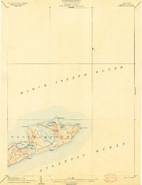 1904 Montauk1904 Print · USGSThe tip of Long Island at the turn of the century is a maritime frontier where the railway meets the Atlantic. Researchers can trace the early layout of Montauk, the vital Montauk Point L.H., and coastal life-saving stations like Ditch Plain L.S.S.6 unique versions available
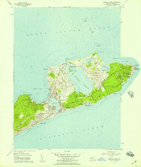
 - 1942 Map of Montauk Point
 1942 Montauk Point1942 Print · USGSThe tip of Long Island comes into focus during the early 1940s as a vital coastal and maritime hub. Researchers can trace the Long Island railroad line to its terminus and locate specific landmarks like the Lighthouse and Ditch Plain LSS.
 - 1942 Map of Block Island, 1943 Print
 1942 Block Island1943 Print · USGSThe coastal borderlands of Rhode Island and Connecticut are captured here during the wartime years, documenting a landscape defined by rail and sea. Researchers can trace the NY NH & H RR through historic mill villages or locate landmarks like the Silex Mine and Indian Burying Hill.2 unique versions available
 - 1947 Map of Providence, 1948 Print
 1947 Providence1948 Print · USGSSouthern New England is captured in the mid-1940s, showing a landscape defined by busy industrial ports and expanding military installations. Researchers can trace the rail lines of the N.Y. N.H. & H. RR or locate coastal defenses like Fort Adams and Quonset Point.5 unique versions available
 - 1948 Map of Providence, 1951 Print
 1948 Providence1951 Print · USGSSouthern New England’s coastal reaches are captured here in the late 1940s, from the industrial heart of Providence to the tip of Provincetown. Genealogists and historians can trace rail lines like the Central Vermont Railway and locate active military sites such as Otis Air Force Base and Fort Rodman.
 - 1956 Map of Montauk Point, 1957 Print
 1956 Montauk Point1957 Print · USGSThe tip of Long Island in the mid-fifties shows a unique blend of seasonal retreat and military defense. Researchers can trace the end of the Long Island Railroad at Montauk Sta and locate the Lighthouse at the edge of Montauk Point.2 unique versions available
 - 1957 Map of Providence
 1957 Providence1957 Print · USGSCoastal New England at the height of the mid-century era shows a landscape shaped by maritime industry and Cold War defense. Genealogists and historians can trace the reach of the New York, New Haven & Hartford RR and locate legacy sites like Fort Adams and Quonset Point Naval Air Station.
 - 1958 Map of Providence
 1958 Providence1958 Print · USGSThe Rhode Island and Massachusetts coastlines are shown in detail during the late 1950s, from the urban cores to the tips of the islands. Researchers can trace the mid-century footprint of Quonset Point Naval Air Station, the defense works at Fort Adams, and the rail network of the New York, New Haven and Hartford RR.
 - 1963 Map of Providence
 1963 Providence1963 Print · USGSSouthern New England's coastal and industrial heartland is captured here in the early sixties, from the Rhode Island mainland to the far reaches of the Cape. Researchers can trace mid-century growth in Providence or locate landmarks on Marthas Vineyard and Nantucket Island.
 - 1984 Map of Block Island
 1984 Block Island1984 Print · USGSThe coastal borderlands of Rhode Island, Connecticut, and New York are captured here in the mid-eighties, from the rail hubs of Westerly to the shores of Block Island. Genealogists and historians can trace the shoreline's evolution through landmarks like the Pequot Indian Res, New Shoreham, and Narragansett Pier.
 - 2010 Map of Montauk Point, 2010 Print
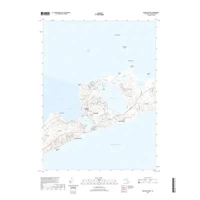
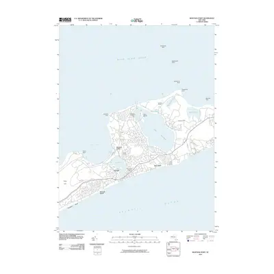 2010 Montauk Point2010 Print · USGSCovers Montauk Beach, including East Hampton, Montauk, and other nearby areas
 - 2013 Map of Montauk Point, 2013 Print
 2013 Montauk Point2013 Print · USGSCovers Montauk Beach, including East Hampton, Montauk, and other nearby areas
 - 2016 Map of Montauk Point, 2016 Print
 2016 Montauk Point2016 Print · USGSCovers Montauk Beach, including East Hampton, Montauk, and other nearby areas
 - 2019 Map of Montauk Point, 2019 Print
 2019 Montauk Point2019 Print · USGSCovers Montauk Beach, including East Hampton, Montauk, and other nearby areas
 - 2023 Map of Montauk Point, 2023 Print
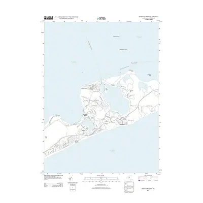
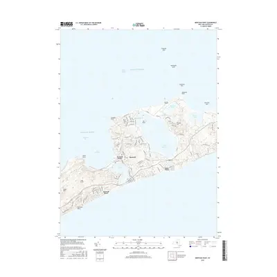
 2023 Montauk Point2023 Print · USGSEastern Long Island at the 2020s shows a landscape defined by maritime heritage and glacial ponds. Researchers can trace the rail terminus at Montauk Station, the local airfield at Montauk Airport, and the historic Fort Hill Cem.
End of results
Showing maps 1-15 of 15
Top cities near Montauk Beach
- East Hampton historical maps
- Southold historical maps
- Springs historical maps
- East Hampton North historical maps
- Northwest Harbor historical maps
- Montauk historical maps
See more
Frequently asked questions
- What are the different types of historical maps available for Montauk Beach?
- What is the oldest map of Montauk Beach?
- Where can I purchase historical maps of Montauk Beach for my home or office?
- Where can I download high-res historical maps of Montauk Beach?
- Are there historical topographic maps available for Montauk Beach?
- Is there historical aerial imagery available for Montauk Beach?
- Where are historical maps of Montauk Beach sourced from?