Old Maps of Smithtown, New York for Academic Research
Study the evolution of Smithtown with 75 high-resolution historic maps. Whether you're teaching, researching, or modeling changes in land use, these maps provide essential visual documentation of urban, environmental, and geographic change.
- Analyze long-term change: Track patterns in development, transportation, and natural features.
- Ideal for environmental or urban studies: Support academic projects with primary historical map data.
- Use in the classroom or lab: Educators and researchers rely on these maps to bring historical context to life.
These maps are a powerful tool for teaching, research, and visualizing how Smithtown has changed over the decades.
Smithtown, NY maps
(75)- 1891 Map of Bridgeport
 1891 Bridgeport1891 Print · USGSThe industrial shoreline of Fairfield County comes to life in this late Victorian survey, capturing the region's intense rail and maritime activity. Trace the early street grids of Bridgeport and Milford, or locate family landmarks near Moodys Mill Pond and Nichols Farms.
 - 1892 Map of Norwalk
 1892 Norwalk1892 Print · USGSThe Fairfield County coastline and its rural hinterlands are seen here in the late nineteenth century, showing the early density of harbor towns and scattered ridge-top farms. Genealogists can trace family lands near Greenfield Hill or follow the rails to the Five Mile River Sta. and Winnipauk.
 - 1893 Map of Bridgeport
 1893 Bridgeport1893 Print · USGSCoastal Connecticut thrived in the 1890s as a hub of manufacturing and rail transport. Genealogists and historians can trace the early street grids of Bridgeport, find old landmarks like Berkshire Mill Pond, and locate family sites in Nichols Farms.8 unique versions available
 - 1893 Map of Norwalk
 1893 Norwalk1893 Print · USGSThe Connecticut coastline thrives in the 1890s as a hub of rail transit and maritime trade. Genealogists and local researchers can trace old family landmarks across Belden Hill, the historic centers of Norwalk, and the early stops of the Danbury and Norwalk R.R.12 unique versions available
 - 1901 Map of Northport, 1962 Print
 1901 Northport1962 Print · USGSThe North Shore of Long Island is captured here at the turn of the century, showing a landscape defined by deep harbors and maritime navigation. You can trace the early rail routes of the Long Island RR and locate historic coastal landmarks like Eatons Neck L.H. and Fort Salonga.
 - 1902 Map of Setauket, 1959 Print
 1902 Setauket1959 Print · USGSSuffolk County’s north and south shores are captured here at the start of the twentieth century. Researchers can trace the Port Jefferson Branch rail lines, the grounds of the State Hospital, and the early layout of Setauket and Bohemia.
 - 1903 Map of Northport
 1903 Northport1903 Print · USGSThe North Shore of Long Island at the turn of the century reveals a landscape defined by deep harbors and the expanding railroad. Genealogists and historians can trace the early layouts of Northport and Huntington, or locate landmarks like Eaton Neck L.H. and Kings Park.8 unique versions available
 - 1904 Map of Setauket
 1904 Setauket1904 Print · USGSSuffolk County at the start of the century shows a North Shore landscape of maritime villages and inland rail depots. Genealogists can trace family names and institutions from Stony Brook to the State Hospital For The Insane and Patchogue.7 unique versions available
 - 1904 Map of Islip
 1904 Islip1904 Print · USGSSuffolk County at the start of the century reveals a landscape defined by deep north-shore harbors and the expansive Great South Bay. Genealogists and local historians can trace early rail lines through Kings Park and Stony Brook, or locate the sprawling State Hospital and St. Dominic Convent.5 unique versions available
 - 1919 Map of Setauket
 1919 Setauket1919 Print · USGSLong Island's north and south shores meet in this post-war tactical survey, documenting the transition from maritime villages to rail-linked townships. Genealogists and researchers can trace early century landmarks like the State Hospital for the Insane and the original Setauket Sta.
 - 1920 Map of Bridgeport
 1920 Bridgeport1920 Print · USGSCoastal Connecticut comes alive in the early twentieth century as a hub of maritime commerce and industrial growth. Researchers can trace the development of Bridgeport and Milford, or locate specific landmarks like Charles Island and Beardsley Park.
 - 1942 Map of Islip, 1943 Print
 1942 Islip1943 Print · USGSCentral Suffolk County is shown during the early years of the war, as the automobile began to reshape the distance between historic North Shore harbors and the South Shore bays. Researchers can trace the path of the Long Island Motor Parkway, locate family plots at Pinelawn Cem, and identify coastal landmarks like Eaton Neck L H.
 - 1947 Map of St James
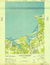 1947 St James1947 Print · USGSThe North Shore of Long Island is captured here in the years following the war, featuring the intricate tidal marshlands of Smithtown Bay. Genealogists and historians can trace the grounds of the Kings Park State Hospital for the Insane and the residential clusters at St. James and Stony Brook.2 unique versions available
 - 1947 Map of Northport
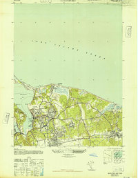 1947 Northport1947 Print · USGSNorthport and the surrounding North Shore communities are captured in the late 1940s during a period of significant growth. Researchers can trace family estates and local institutions from the W K Vanderbilt Estate to the Northport Rural Cem and St Josephs Ch & Sch.
 - 1947 Map of Central Islip
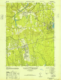 1947 Central Islip1947 Print · USGSSuffolk County is captured in the mid-1940s as institutional grounds and early aviation hubs began to reshape the Long Island interior. Researchers can trace the sprawling grounds of the Central Islip State Hospital and the early layout of Islip Airport.
 - 1947 Map of Patchogue
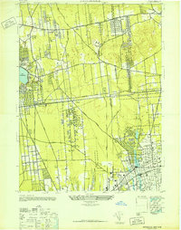 1947 Patchogue1947 Print · USGSCentral Suffolk County is documented just after the war, showing the distinct village identities of the south shore and the rural interior. Trace local genealogy and property development through the street grids of Patchogue, Bohemia, and the rail-oriented Ronkonkoma.
 - 1947 Map of Sherwood Point
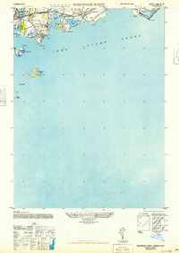 1947 Sherwood Point1947 Print · USGSCoastal Connecticut at the end of the 1940s reveals a shoreline of growing seaside communities and preserved marshlands. Researchers can trace the development of Saugatuck Shores, the historic Compo Beach, and the offshore reaches of Cockenoe Island.
 - 1947 Map of Greenlawn
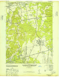 1947 Greenlawn1947 Print · USGSMid-century Suffolk County is captured here during its transition from an estate-dotted landscape to a growing suburban corridor. Genealogists and local historians can trace legacy properties like the Anna Gould Estate and early industry such as the Golden Pickle Works or Pilgrim Sand & Gravel Co.
 - 1947 Map of Hartford, 1955 Print
 1947 Hartford1955 Print · USGSSouthern New England and the Hudson Valley are shown in detail during the post-war expansion era. Genealogists and researchers can trace local landmarks from the State Capitol and Yale University to the Stratford Lighthouse and Woodlawn Cem.2 unique versions available
 - 1948 Map of Hartford
 1948 Hartford1948 Print · USGSSouthern New England is captured here in the late 1940s, showcasing a landscape of thriving industrial cities and developing parkways. Genealogists and historians can trace the rail networks of the New York New Haven and Hartford RR or locate coastal defense sites like Fort Terry and Camp Shanks.2 unique versions available
 - 1949 Map of New York, 1951 Print
 1949 New York1951 Print · USGSLong Island and its surrounding waters are documented here in the late 1940s, just as the postwar suburban boom began to transform the region. Genealogists and historians can trace the early layouts of Idlewild Airport, Mitchell Field, and the established routes of the Long Island RR.
 - 1951 Map of Sherwood Point, 1952 Print
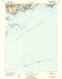 1951 Sherwood Point1952 Print · USGSThe Connecticut coast at the start of the 1950s shows a landscape of growing seaside neighborhoods and maritime heritage. Genealogists and local historians can trace family-named landmarks from Hale Court and Compo Hills to the shores of Sherwood Millpond.4 unique versions available
 - 1954 Map of New York
 1954 New York1954 Print · USGSLong Island and the New York metropolitan area are shown during the height of post-war suburbanization. Genealogists and historians can trace the growth of Levittown, the infrastructure of the Long Island Rail Road, and landmarks like Mitchel Afb.2 unique versions available
 - 1954 Map of Northport, 1955 Print
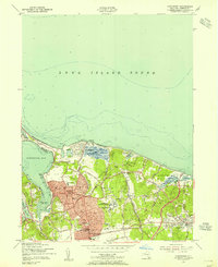 1954 Northport1955 Print · USGSNorthport and the surrounding harbors are shown during the post-war growth of the mid-fifties. Genealogists and local historians can trace the development of East Northport, find family plots at Skidmore Cem, and locate the Central State Hosp.2 unique versions available
 - 1954 Map of Greenlawn, 1956 Print
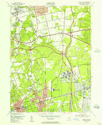 1954 Greenlawn1956 Print · USGSWestern Suffolk County is shown here in the mid-fifties as suburban grids begin to surround massive institutional grounds and parkways. Genealogists can trace family burial sites like Buffett Cem and Carll Cem or locate the Deer Park Airport and Pilgrim State Hospital.2 unique versions available
Showing maps 1-25 of 75
Top cities near Smithtown
- Brookhaven historical maps
- Islip historical maps
- Oyster Bay historical maps
- Babylon historical maps
- Huntington historical maps
- Bridgeport historical maps
See more
Top neighborhoods of Smithtown
- Smithtown historical maps
- Kings Park historical maps
- Saint James historical maps
- Nesconset historical maps
- the Branch historical maps
- Nissequogue historical maps
See more
Frequently asked questions
- What are the different types of historical maps available for Smithtown?
- What is the oldest map of Smithtown?
- Where can I purchase historical maps of Smithtown for my home or office?
- Where can I download high-res historical maps of Smithtown?
- Are there historical topographic maps available for Smithtown?
- Is there historical aerial imagery available for Smithtown?
- Where are historical maps of Smithtown sourced from?