1990s Maps of Denning, New York
Explore 4 historic maps of Denning from the 1990s. These maps offer a rare glimpse into what life looked like during the 1990s — showing old roads, neighborhoods, homes, and landmarks that have changed or disappeared over time.
Whether you're researching your family's past, planning a metal detecting trip, or studying how Denning's landscape evolved across the 1990s, these high-resolution maps are a powerful tool for exploring the history of this region.
- Focus on a specific era: All maps on this page are from the 1990s, giving you a focused view of this time period.
- See what’s changed: Compare century-old streets, trails, and buildings to today's modern landscape using overlays and satellite layers.
- Research with precision: Use these maps for genealogy, historical research, land use analysis, or educational projects.
- View, download, or print: Maps are fully viewable online in high resolution, and can be downloaded or printed for your own records.
Start exploring Denning's history through authentic maps from the 1990s. This is your window into the past.
Denning, NY maps
(4)- 1997 Map of Willowemoc, 2000 Print
 1997 Willowemoc2000 Print · USGSSullivan County and the Catskill highlands are shown here in the late twentieth century, centered on the recreational and conservation lands of the forest preserve. Researchers can locate the State Fish Hatchery and local Cem, or trace the waters of Willowemoc Creek and the Neversink Res.
 - 1997 Map of Shandaken, 2001 Print
 1997 Shandaken2001 Print · USGSHigh peaks and deep hollows define this Ulster County landscape in the late nineties, where mountain hamlets sit within protected forest land. Trace the steep terrain between Slide Mtn and Panther Mtn or find old valley markers like Winnisook Lake and Big Indian.
 - 1997 Map of Peekamoose Mtn, 2001 Print
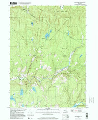
 1997 Peekamoose Mtn2001 Print · USGSThe high peaks and river headwaters of the Catskills appear here as they were managed in the late twentieth century. Researchers can trace remote settlements like Sundown and Denning or find family landmarks such as Bangle Hill and Peekamoose Lake.
 - 1997 Map of West Shokan, 2001 Print
 1997 West Shokan2001 Print · USGSThe Catskill peaks and the western edge of the Ashokan Reservoir are captured here as they appeared in the late nineties. Genealogists and researchers can trace old family roads to the Palentown Cem or explore the mountain hamlets of Samsonville and West Shokan.
End of results
Showing maps 1-4 of 4
Top cities near Denning
- Thompson historical maps
- Fallsburg historical maps
- Wawarsing historical maps
- Liberty historical maps
- Rochester historical maps
- Gardiner historical maps
See more
Top neighborhoods of Denning
- Branch historical maps
- Sundown historical maps
- Peekamoose historical maps
- Frost Valley historical maps
- Bull Run historical maps
- Greenville historical maps
See more
Frequently asked questions
- What are the different types of historical maps available for Denning?
- What is the oldest map of Denning?
- Where can I purchase historical maps of Denning for my home or office?
- Where can I download high-res historical maps of Denning?
- Are there historical topographic maps available for Denning?
- Is there historical aerial imagery available for Denning?
- Where are historical maps of Denning sourced from?