1960s Maps of Denning, New York
Explore 9 historic maps of Denning from the 1960s. These maps offer a rare glimpse into what life looked like during the 1960s — showing old roads, neighborhoods, homes, and landmarks that have changed or disappeared over time.
Whether you're researching your family's past, planning a metal detecting trip, or studying how Denning's landscape evolved across the 1960s, these high-resolution maps are a powerful tool for exploring the history of this region.
- Focus on a specific era: All maps on this page are from the 1960s, giving you a focused view of this time period.
- See what’s changed: Compare century-old streets, trails, and buildings to today's modern landscape using overlays and satellite layers.
- Research with precision: Use these maps for genealogy, historical research, land use analysis, or educational projects.
- View, download, or print: Maps are fully viewable online in high resolution, and can be downloaded or printed for your own records.
Start exploring Denning's history through authentic maps from the 1960s. This is your window into the past.
Denning, NY maps
(9)- 1960 Map of Shandaken, 1961 Print
 1960 Shandaken1961 Print · USGSThe northern Catskills appear in great detail during the early sixties, showing the rail-and-river corridor through Big Indian and Shandaken. Trace the high-altitude Winnisook Club near Slide Mtn or follow the New York Central line as it snakes along Esopus Creek.4 unique versions available
 - 1962 Map of Scranton, 1977 Print
 1962 Scranton1977 Print · USGSThe industrial heart of eastern Pennsylvania and the New York Catskills are captured here in the early sixties. Genealogists and historians can trace the dense valley settlements from Scranton to Wilkes-Barre and the rail lines of the Erie Lackawanna Railroad.2 unique versions available
 - 1963 Map of Binghamton
 1963 Binghamton1963 Print · USGSThe Southern Tier and Catskill peaks are shown in the early sixties as new reservoirs reshaped the valleys. Trace historic rail corridors like the Erie Lackawanna RR and explore lakeside settlements such as Cooperstown and Oneonta.
 - 1965 Map of Scranton
 1965 Scranton1965 Print · USGSThe tri-state highlands of Pennsylvania, New York, and New Jersey come alive in the mid-sixties as industry and recreation converge. Trace the intricate rail lines of the Erie Lackawanna RR or locate landmarks like the U S Military Academy.2 unique versions available
 - 1966 Map of Willowemoc, 1968 Print
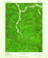
 1966 Willowemoc1968 Print · USGSSullivan County during the mid-1960s remains a bastion of the Catskill wilderness, centered on the flow of Willowemoc Creek. Genealogists and historians can trace old homesteads and landmarks like the State Fish Hatchery and the settlement of Debruce.3 unique versions available
 - 1966 Map of Claryville, 1968 Print
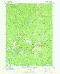
 1966 Claryville1968 Print · USGSThe Upper Neversink Valley in the mid-1960s remains a landscape of protected forests and quiet river junctions. Researchers can trace the path of the Delaware Aqueduct and locate historic local landmarks like the Covered Bridge and the Lookout Tower near Claryville.3 unique versions available
 - 1969 Map of Rondout Reservoir, 1971 Print
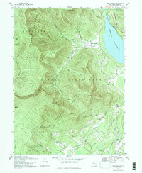
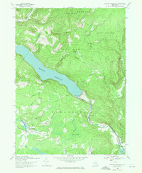 1969 Rondout Reservoir1971 Print · USGSThe Catskill highlands and the critical water infrastructure of the late sixties are captured here on the Ulster and Sullivan county line. Genealogists and hikers can trace old mountain roads and sites like Furman Cem, Ulster Heights, and the Covered Bridge near the reservoir.3 unique versions available
 - 1969 Map of Peekamoose Mtn, 1971 Print
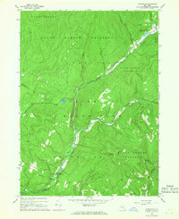
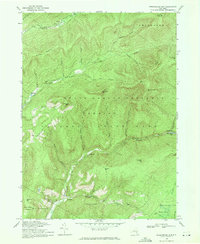 1969 Peekamoose Mtn1971 Print · USGSUpper Ulster County in the late sixties remained a landscape of remote mountain hamlets and deep forest preserves. Local historians can trace the road networks connecting Denning and Sundown or locate landmarks like Peekamoose Lake and Buttermilk Falls Brook.2 unique versions available
 - 1969 Map of West Shokan, 1971 Print
 1969 West Shokan1971 Print · USGSThe eastern Catskills meet the waters of the Ashokan Reservoir in the late 1960s. Genealogists and hikers can trace old mountain roads to Samsonville, find the Palentown Cem, or locate landmarks like High Point (Samson).3 unique versions available
End of results
Showing maps 1-9 of 9
Top cities near Denning
- Thompson historical maps
- Fallsburg historical maps
- Wawarsing historical maps
- Liberty historical maps
- Rochester historical maps
- Gardiner historical maps
See more
Top neighborhoods of Denning
- Branch historical maps
- Sundown historical maps
- Peekamoose historical maps
- Frost Valley historical maps
- Bull Run historical maps
- Greenville historical maps
See more
Frequently asked questions
- What are the different types of historical maps available for Denning?
- What is the oldest map of Denning?
- Where can I purchase historical maps of Denning for my home or office?
- Where can I download high-res historical maps of Denning?
- Are there historical topographic maps available for Denning?
- Is there historical aerial imagery available for Denning?
- Where are historical maps of Denning sourced from?