Old Maps of Davis Corners, Olive for Genealogy
Trace your family roots with 16 historic maps of Davis Corners. These high-res maps reveal old neighborhoods, homesites, landmarks, and streets — helping you uncover where your ancestors lived and how the area evolved over time.
- Explore historic neighborhoods: Identify where your relatives may have lived in the 1800s or 1900s.
- Compare maps over time: Trace the changes in streets, buildings, and landmarks for multi-generational research.
- Perfect for genealogy & ancestry research: Used by family historians and researchers to map out lineage and migration.
These maps are an incredible resource for exploring your personal connection to Davis Corners's past.
Davis Corners, Olive maps
(16)- 1901 Map of Rosendale, 1961 Print
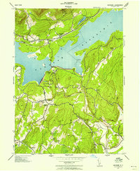
 1901 Rosendale1961 Print · USGSUlster County at the dawn of the century shows a landscape in transition as the Ashokan Reservoir reshaped the valley. Genealogists and historians can trace defunct rail stops and early hamlets from Kripplebush and Whiteport to the busy docks at Wilbur.
 - 1903 Map of Rosendale
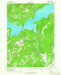
 1903 Rosendale1903 Print · USGSUlster County was a hub of canal and rail transport at the turn of the century, centered on the Delaware and Hudson Canal. Genealogists can trace family footprints through historic settlements like Browns Station, Kripplebush, and Lomontville.11 unique versions available
 - 1942 Map of Ashokan, 1958 Print
 1942 Ashokan1958 Print · USGSUlster County's mountainous terrain and massive water infrastructure are frozen in time during the early 1940s. Genealogists and local historians can trace family-named settlements like Lomontville and Atwood, or locate rural landmarks including the Vly Church and Acorn Hill Chapel.2 unique versions available
 - 1943 Map of Ashokan, 1944 Print
 1943 Ashokan1944 Print · USGSMid-century Ulster County is defined by the massive shoreline of the Ashokan Reservoir as it appeared during the war years. Local researchers can trace old family lands and community hubs like Olive Bridge, Atwood, and the Acorn Hill Chapel.
 - 1950 Map of Scranton, 1952 Print
 1950 Scranton1952 Print · USGSMid-century Northeast Pennsylvania and the Hudson Valley come alive in this survey of the tri-state region. Genealogists and historians can trace the dense rail networks of the Erie RR and DL&W RR between industrial hubs like Scranton and Wilkes-Barre.
 - 1953 Map of Scranton
 1953 Scranton1953 Print · USGSNortheastern Pennsylvania and the Catskills are shown in great detail during the early fifties, a time when rail lines and river valleys dictated the region's growth. Genealogists and historians can trace the industrial hearts of Scranton and Wilkes-Barre or locate remote landmarks like High Point and Lake Wallenpaupack.
 - 1959 Map of Scranton
 1959 Scranton1959 Print · USGSThe northern coalfields and the Hudson Valley meet in this mid-century survey of the Pennsylvania and New York borderlands. Genealogists and historians can trace the intricate rail networks of the Erie Railroad and the vast waters of Lake Wallenpaupack.2 unique versions available
 - 1962 Map of Scranton, 1977 Print
 1962 Scranton1977 Print · USGSThe industrial heart of eastern Pennsylvania and the New York Catskills are captured here in the early sixties. Genealogists and historians can trace the dense valley settlements from Scranton to Wilkes-Barre and the rail lines of the Erie Lackawanna Railroad.2 unique versions available
 - 1964 Map of Ashokan, 1966 Print
 1964 Ashokan1966 Print · USGSThe Ashokan Reservoir region in the mid-1960s reveals a landscape defined by massive water works and quiet mountain hamlets. Researchers can trace the Catskill Aqueduct, locate the Covered Bridge on Esopus Creek, and find family names near Tongore Cem.3 unique versions available
 - 1965 Map of Scranton
 1965 Scranton1965 Print · USGSThe tri-state highlands of Pennsylvania, New York, and New Jersey come alive in the mid-sixties as industry and recreation converge. Trace the intricate rail lines of the Erie Lackawanna RR or locate landmarks like the U S Military Academy.2 unique versions available
 - 1986 Map of Monticello
 1986 Monticello1986 Print · USGSThe Catskills and Shawangunk Ridge meet in the mid-eighties, showing a landscape defined by massive reservoirs and valley towns. Genealogists and researchers can trace the growth of Monticello, Ellenville, and New Paltz alongside landmarks like Mohonk Preserve and Stewart Airport.2 unique versions available
 - 2010 Map of Ashokan, 2010 Print
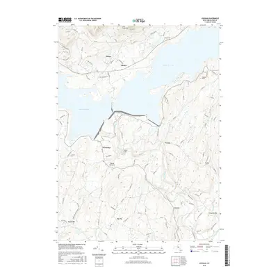
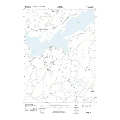 2010 Ashokan2010 Print · USGSCovers Davis Corners, including Hurley, Marbletown, and other nearby areas
 - 2013 Map of Ashokan, 2013 Print
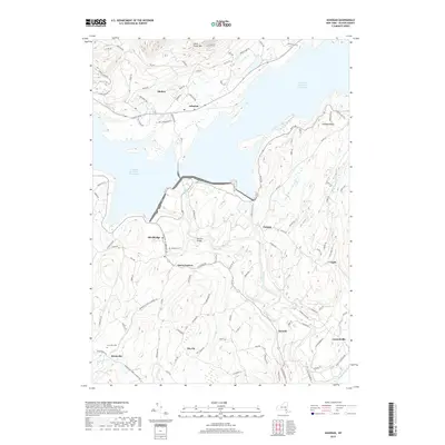
 2013 Ashokan2013 Print · USGSCovers Davis Corners, including Hurley, Marbletown, and other nearby areas
 - 2016 Map of Ashokan, 2016 Print
 2016 Ashokan2016 Print · USGSCovers Davis Corners, including Hurley, Marbletown, and other nearby areas
 - 2019 Map of Ashokan, 2019 Print
 2019 Ashokan2019 Print · USGSCovers Davis Corners, including Hurley, Marbletown, and other nearby areas
 - 2023 Map of Ashokan, 2023 Print
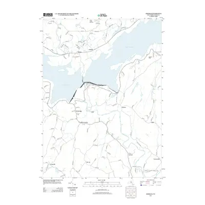
 2023 Ashokan2023 Print · USGSUlster County's landscape is defined here by the massive waters of the Ashokan Reservoir East Basin and the surrounding rural communities. Genealogists and historians can locate family burial grounds at Tongore Cem and trace the residential layout of Shokan and Lomontville.
End of results
Showing maps 1-16 of 16
Top cities near Davis Corners
- Kingston historical maps
- Saugerties historical maps
- New Paltz historical maps
- Shawangunk historical maps
- Wawarsing historical maps
- Ulster historical maps
See more
Frequently asked questions
- What are the different types of historical maps available for Davis Corners?
- What is the oldest map of Davis Corners?
- Where can I purchase historical maps of Davis Corners for my home or office?
- Where can I download high-res historical maps of Davis Corners?
- Are there historical topographic maps available for Davis Corners?
- Is there historical aerial imagery available for Davis Corners?
- Where are historical maps of Davis Corners sourced from?