1940s Maps of Shawangunk, New York
Explore 10 historic maps of Shawangunk from the 1940s. These maps offer a rare glimpse into what life looked like during the 1940s — showing old roads, neighborhoods, homes, and landmarks that have changed or disappeared over time.
Whether you're researching your family's past, planning a metal detecting trip, or studying how Shawangunk's landscape evolved across the 1940s, these high-resolution maps are a powerful tool for exploring the history of this region.
- Focus on a specific era: All maps on this page are from the 1940s, giving you a focused view of this time period.
- See what’s changed: Compare century-old streets, trails, and buildings to today's modern landscape using overlays and satellite layers.
- Research with precision: Use these maps for genealogy, historical research, land use analysis, or educational projects.
- View, download, or print: Maps are fully viewable online in high resolution, and can be downloaded or printed for your own records.
Start exploring Shawangunk's history through authentic maps from the 1940s. This is your window into the past.
Shawangunk, NY maps
(10)- 1942 Map of Walden, 1958 Print
 1942 Walden1958 Print · USGSOrange County's Wallkill Valley at the height of the war era reveals a landscape of riverside industry and family-owned dairy farms. Genealogists and local historians can trace legacy sites like the Borden Estate, Montgomery Worsted Mills, and Goodwill Church.
 - 1942 Map of Ellenville, 1959 Print
 1942 Ellenville1959 Print · USGSThe valleys surrounding Ellenville and the Shawangunk Mountains are seen here at a mid-century crossroads of transport history. Genealogists can locate family-named landmarks like Poplar Grove Cem and several rural schoolhouses, including Sandburg Rend Sch and Greenwood Sch.2 unique versions available
 - 1943 Map of Clintondale
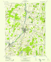
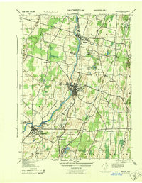
 1943 Clintondale1943 Print · USGSMid-Hudson Valley farm country and orchards are shown here during the early years of the Second World War. Researchers can locate vanished landmarks such as the Normal Sch or trace early rail lines like the New York New Haven and Hartford.
 - 1943 Map of Gardiner
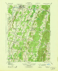
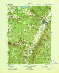
 1943 Gardiner1943 Print · USGSUlster County's mountain resorts and valley farms are captured here during the early war years. Researchers can trace the legacy of the Shawangunk ridge at Wildmere House or locate family roots at the Bruynswick Cemetery and Galeville School.
 - 1943 Map of Napanoch
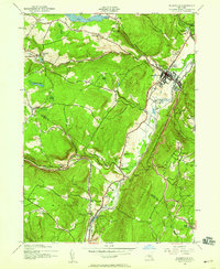
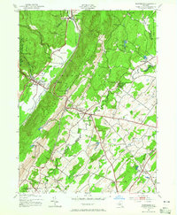
 1943 Napanoch1943 Print · USGSThe Shawangunk Mountains and the valley of the Rondout Creek are captured here in the early 1940s. Genealogists and historians can trace family properties like V Mahon and H Hall or locate rural landmarks such as Crawford Church and the Union District School.
 - 1943 Map of Walden
 1943 Walden1943 Print · USGSOrange County's riverfront villages and dairy heritage are captured here in the early 1940s. Genealogists can locate family landmarks like the Borden Estate or St Marys Cemetery, while tracing the paths of the Wallkill Valley Branch railroad.
 - 1943 Map of Ellenville
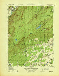
 1943 Ellenville1943 Print · USGSThe Shawangunk valley corridor during the war years shows a landscape defined by the Delaware and Hudson Canal and the O&W railroad. Trace local roots at Fantine Cemetery or find historic sites like the Pepsi Cola Bottling Co and Greenwood School.
 - 1943 Map of Pinebush, 1944 Print
 1943 Pinebush1944 Print · USGSThe rural borderlands of Orange and Ulster counties come alive in the 1940s, anchored by the rail hub at Pinebush. Genealogists can trace family homesteads like C. Judson and M. Durnin or locate landmarks like the Brimstone School and Hopewell Cemetery.
 - 1943 Map of Wurtsboro, 1954 Print
 1943 Wurtsboro1954 Print · USGSSullivan and Orange County hillsides were undergoing a transit transition during the early years of the war. Researchers can trace the legacy of the Delaware and Hudson Canal, find family names at Sylvan Cem, and locate rural landmarks like Prosperous Valley Sch.3 unique versions available
 - 1946 Map of Newburgh, 1964 Print
 1946 Newburgh1964 Print · USGSMid-Hudson Valley life in the mid-forties is captured here, showing the region as it transitioned from a rural agricultural economy to a postwar industrial hub. Genealogists and local historians can locate dozens of small schools and cemeteries, from the New Paltz Cemetery to the Montgomery Worsted Mills.
End of results
Showing maps 1-10 of 10
Top cities near Shawangunk
- Newburgh historical maps
- Wallkill historical maps
- Middletown historical maps
- Newburgh historical maps
- New Windsor historical maps
- Montgomery historical maps
See more
Top neighborhoods of Shawangunk
- Bruynswick historical maps
- Borden Estate historical maps
- Crawford historical maps
- Dwaarkill historical maps
- Red Mills historical maps
- Saint Elmo historical maps
See more
Frequently asked questions
- What are the different types of historical maps available for Shawangunk?
- What is the oldest map of Shawangunk?
- Where can I purchase historical maps of Shawangunk for my home or office?
- Where can I download high-res historical maps of Shawangunk?
- Are there historical topographic maps available for Shawangunk?
- Is there historical aerial imagery available for Shawangunk?
- Where are historical maps of Shawangunk sourced from?