Old Maps of Ruby, Ulster for Genealogy
Trace your family roots with 52 historic maps of Ruby. These high-res maps reveal old neighborhoods, homesites, landmarks, and streets — helping you uncover where your ancestors lived and how the area evolved over time.
- Explore historic neighborhoods: Identify where your relatives may have lived in the 1800s or 1900s.
- Compare maps over time: Trace the changes in streets, buildings, and landmarks for multi-generational research.
- Perfect for genealogy & ancestry research: Used by family historians and researchers to map out lineage and migration.
These maps are an incredible resource for exploring your personal connection to Ruby's past.
Ruby, Ulster maps
(52)- 1892 Map of Kaaterskill, 1957 Print
 1892 Kaaterskill1957 Print · USGSThe high Catskills of the 1890s reveal a landscape of grand hotels and rugged peaks during the peak of the mountain resort era. Genealogists and historians can trace the foundations of Onteora Park, the route of the Elevating R. R., and lost hamlets like Dutch Settlement.3 unique versions available
 - 1893 Map of Kaaterskill
 1893 Kaaterskill1893 Print · USGSThe high peaks and resort colonies of the late nineteenth century are mapped here in exceptional detail. Genealogists and rail historians can trace the paths of the Otis Elevating R R and the Catskill Mtn R R or locate old sites like Dutch Settlement and Mountain House.
 - 1894 Map of Kaaterskill
 1894 Kaaterskill1894 Print · USGSThe Catskills come alive in the 1890s as a premier destination for mountain tourism and timber. You can trace the early rail lines serving the Mountain House, locate the Victorian-era enclaves of Onteora Park and Twilight Park, or find family roots in Yankeetown.
 - 1895 Map of Catskill
 1895 Catskill1895 Print · USGSThe Hudson River valley at the close of the 19th century was a landscape of bustling river ports and expanding rail lines. Genealogists and researchers can trace family lands near Saugerties, locate the old Burden Dock, or follow the route of the Catskill Mountain and Cairo R. R.10 unique versions available
 - 1899 Map of Kaaterskill
 1899 Kaaterskill1899 Print · USGSThe Catskills in the late nineteenth century show a unique landscape of mountain tourism and rail infrastructure. Trace the early hotel era through the Mountain House, the Otis Elevating Ry., and the high-elevation hamlets of Tannersville and Onteora Park.2 unique versions available
 - 1901 Map of Rosendale, 1961 Print
 1901 Rosendale1961 Print · USGSUlster County at the dawn of the century shows a landscape in transition as the Ashokan Reservoir reshaped the valley. Genealogists and historians can trace defunct rail stops and early hamlets from Kripplebush and Whiteport to the busy docks at Wilbur.
 - 1903 Map of Rosendale
 1903 Rosendale1903 Print · USGSUlster County was a hub of canal and rail transport at the turn of the century, centered on the Delaware and Hudson Canal. Genealogists can trace family footprints through historic settlements like Browns Station, Kripplebush, and Lomontville.11 unique versions available
 - 1903 Map of Kaaterskill, 1906 Print
 1903 Kaaterskill1906 Print · USGSThe Catskills come alive in the early twentieth century through this record of mountain resorts and steep-grade rail lines. Researchers can trace the legendary Mountain House, the Otis Elevating R.R., and the remote Dutch Settlement.10 unique versions available
 - 1934 Map of Catskill, 1960 Print
 1934 Catskill1960 Print · USGSThe Hudson Valley during the mid-1930s shows a landscape of riverfront commerce and deep-rooted rural townships. Genealogists and local historians can locate country schools like Schuylerhook Sch and historic landmarks like the Birthplace of Robert Livingston.2 unique versions available
 - 1938 Map of Catskill
 1938 Catskill1938 Print · USGSThe Hudson Valley in the late thirties remains a landscape of river-side industry and deep colonial heritage. Researchers can trace family sites from Kiskatom Ch to the Birthplace of Robert Livingston or locate vanished local landmarks like Walker Mill.2 unique versions available
 - 1941 Map of Catskill, 1945 Print
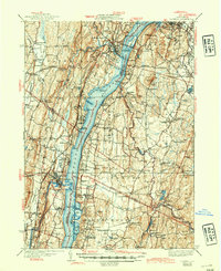 1941 Catskill1945 Print · USGSThe Hudson River valley at the start of the Second World War shows a landscape defined by historic estates and new river crossings. Genealogists and historians can trace the foundations of Bard College, locate the Birthplace of Robert Livingston, and explore early hamlets like Katsbaan and Cheviot.
 - 1942 Map of Kingston West, 1950 Print
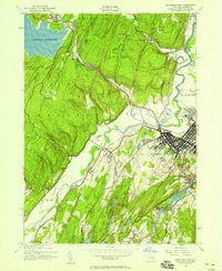 1942 Kingston West1950 Print · USGSThe area around Kingston during the early 1940s reveals a landscape shaped by the rail lines of the New York Central and the waters of the Ashokan Reservoir. Genealogists and historians can locate specific community centers like St Johns Ch, West Hurley RR Station, and the Lower Sawkill School.
 - 1943 Map of Kingston West
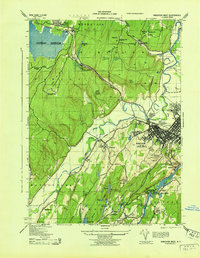 1943 Kingston West1943 Print · USGSMid-century Ulster County comes into focus as the Ashokan Reservoir and the New York Central railroad shape the valley corridor. Genealogists can trace family names at the Boice Brothers Dairy or locate old schoolhouses like the Stony Hollow School and Sawkill School.
 - 1945 Map of Woodstock, 1963 Print
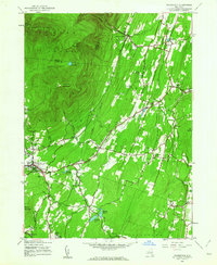 1945 Woodstock1963 Print · USGSUlster County's mountainous borderlands come into focus at the end of the Second World War as the region's rural character remains largely intact. Genealogists and hikers can trace old property lines and landmarks from West Saugerties to Overlook Mountain, including several legacy schoolhouses like School No 15.4 unique versions available
 - 1946 Map of Plattekill
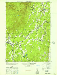 1946 Plattekill1946 Print · USGSMid-century Ulster County unfolds from the high peaks of the Catskills down to the reservoir systems of the lower valleys. Genealogists and researchers can trace local school districts like School No 14 and long-standing cemeteries such as Chestnut Hill Rural Cem.
 - 1948 Map of Albany, 1951 Print
 1948 Albany1951 Print · USGSThe Hudson and Connecticut River valleys are captured here in the late 1940s, showing the vital rail and water corridors of the Northeast. You can trace the Boston and Maine tracks past Mt Greylock or locate early settlements like Great Barrington and Bennington.
 - 1948 Map of Binghamton, 1980 Print
 1948 Binghamton1980 Print · USGSCentral New York and the Southern Tier thrive in the late 1940s as a hub of rail traffic and mountain industry. Researchers can trace historic transit lines like the Erie Railroad through Binghamton or find old valley settlements near Oneonta and Delhi.
 - 1950 Map of Binghamton
 1950 Binghamton1950 Print · USGSBinghamton and the surrounding Southern Tier are shown in the mid-century era, highlighting the intricate rail and river networks that drove local industry. Researchers can trace the path of the Erie Railroad and locate landmarks from Otsego Lake to Sidney Mountain.2 unique versions available
 - 1950 Map of Scranton, 1952 Print
 1950 Scranton1952 Print · USGSMid-century Northeast Pennsylvania and the Hudson Valley come alive in this survey of the tri-state region. Genealogists and historians can trace the dense rail networks of the Erie RR and DL&W RR between industrial hubs like Scranton and Wilkes-Barre.
 - 1953 Map of Scranton
 1953 Scranton1953 Print · USGSNortheastern Pennsylvania and the Catskills are shown in great detail during the early fifties, a time when rail lines and river valleys dictated the region's growth. Genealogists and historians can trace the industrial hearts of Scranton and Wilkes-Barre or locate remote landmarks like High Point and Lake Wallenpaupack.
 - 1956 Map of Albany, 1968 Print
 1956 Albany1968 Print · USGSThe industrial heart of the Northeast is revealed in the mid-1950s, from the Hudson Valley to the Connecticut River. Researchers can trace the legacy of the Quabbin Reservoir, locate Westover Air Force Base, or follow the Rutland RR through the Green Mountains.2 unique versions available
 - 1957 Map of Albany
 1957 Albany1957 Print · USGSThe Tri-State region and Connecticut River Valley are captured here during a period of significant postwar growth and infrastructure expansion. Genealogists and historians can trace the rail-and-river economy through landmarks like the Boston and Maine railroad, Quabbin Reservoir, and Westover Air Force Base.
 - 1958 Map of Binghamton
 1958 Binghamton1958 Print · USGSCentral New York in the late fifties was a network of manufacturing cities and river valleys connected by vital rail lines. Genealogists and historians can trace family roots in Oneonta, Norwich, and Cooperstown or locate long-standing farms along Schoharie Creek.
 - 1959 Map of Scranton
 1959 Scranton1959 Print · USGSThe northern coalfields and the Hudson Valley meet in this mid-century survey of the Pennsylvania and New York borderlands. Genealogists and historians can trace the intricate rail networks of the Erie Railroad and the vast waters of Lake Wallenpaupack.2 unique versions available
 - 1959 Map of Albany
 1959 Albany1959 Print · USGSThe Hudson and Connecticut River valleys are captured here during the late fifties, showing the region's dense rail networks and massive water projects. Researchers can trace the New York State Thruway or locate local landmarks like Mt Greylock and the Quabbin Reservoir.
Showing maps 1-25 of 52
Top cities near Ruby
- Kingston historical maps
- Hyde Park historical maps
- Saugerties historical maps
- New Paltz historical maps
- Ulster historical maps
- Catskill historical maps
See more
Frequently asked questions
- What are the different types of historical maps available for Ruby?
- What is the oldest map of Ruby?
- Where can I purchase historical maps of Ruby for my home or office?
- Where can I download high-res historical maps of Ruby?
- Are there historical topographic maps available for Ruby?
- Is there historical aerial imagery available for Ruby?
- Where are historical maps of Ruby sourced from?