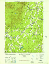
1946 Map of Plattekill
USGS Topo · Published 1946About this map
Catskill State Park dominates the western half of this 1945 study, where the steep elevations of Indian Head Mtn, Plattekill Mtn, and Overlook Mtn overlook the dramatic Plattekill Clove. The rugged terrain transitions into a more settled landscape to the east and south, defined by a network of water management for surrounding municipalities. Multiple water bodies including Saugerties Reservoir and a series of numbered basins such as Kingston Reservoir No 1 and Kingston Reservoir No 4 are visible, connected by the winding Saw Kill and Plattekill Creek.
Find a feature on this map
39 named features on this map. Tap any name to fly to it.
Don’t see what you’re looking for? This feature index may not catch every label — zoom into the map to look around manually.
Map Details
Editions of this 1946 Plattekill Map
This is the sole edition of this map. No revisions or reprints were ever made.
Other maps of this area

1892 · Kaaterskill
USGS Topo · 1:62,500

1893 · Kaaterskill
USGS Topo · 1:62,500

1894 · Kaaterskill
USGS Topo · 1:62,500

1895 · Catskill
USGS Topo · 1:62,500

1898 · Rhinebeck
USGS Topo · 1:62,500

1899 · Kaaterskill
USGS Topo · 1:62,500

1901 · Rosendale
USGS Topo · 1:62,500

1903 · Rosendale
USGS Topo · 1:62,500

1903 · Kaaterskill
USGS Topo · 1:62,500

1934 · Rhinebeck
USGS Topo · 1:48,000