Old Maps of Wawarsing, New York for Academic Research
Study the evolution of Wawarsing with 70 high-resolution historic maps. Whether you're teaching, researching, or modeling changes in land use, these maps provide essential visual documentation of urban, environmental, and geographic change.
- Analyze long-term change: Track patterns in development, transportation, and natural features.
- Ideal for environmental or urban studies: Support academic projects with primary historical map data.
- Use in the classroom or lab: Educators and researchers rely on these maps to bring historical context to life.
These maps are a powerful tool for teaching, research, and visualizing how Wawarsing has changed over the decades.
Wawarsing, NY maps
(70)- 1903 Map of Slide Mountain, 1961 Print
 1903 Slide Mountain1961 Print · USGSThe high peaks and deep hollows of Ulster County are captured here at the dawn of the reservoir era. Genealogists and hikers can trace old homesteads and roads near Sundown, Lackawack, and the isolated Peekamoose Lodge.
 - 1904 Map of Ellenville, 1956 Print
 1904 Ellenville1956 Print · USGSThe Shawangunk Mountains and Wallkill Valley are captured here at the start of the twentieth century, showing a landscape of high ridges and industrial valleys. Researchers can trace the D. & H. Canal (Abandoned), the New York Ontario and Western RR, and historic centers like Ellenville or Wurtsboro.
 - 1905 Map of Slide Mountain
 1905 Slide Mountain1905 Print · USGSThe Catskill high peaks meet the industrializing Rondout valley in the early twentieth century. Researchers can trace old mountain outposts like Peekamoose Lodge and Sundown, or follow the New York Ontario and Western RR through Kerhonkson.8 unique versions available
 - 1906 Map of Ellenville
 1906 Ellenville1906 Print · USGSThe Shawangunk ridge and Mamakating Hollow are captured here in the early 1900s, showing the region's shift from canal to rail transport. Genealogists can locate family homes and landmarks across Ellenville, Cragsmoor, and Wurtsboro, or trace the Delaware and Hudson Canal.7 unique versions available
 - 1909 Map of Monticello, 1956 Print
 1909 Monticello1956 Print · USGSSullivan County at the dawn of the twentieth century was a landscape of rail-connected resort communities and developing water systems. Researchers can trace the routes of the New York Ontario and Western RR to historic stops like Hurleyville Luzon Sta or the secluded Hartwood Club.
 - 1910 Map of Neversink
 1910 Neversink1910 Print · USGSSullivan and Ulster counties appear here in the early twentieth century, showing a region of mountain hamlets and sprawling ponds before major reservoir construction. Genealogists can trace family footprints in Grahamsville, Eureka, and Loch Sheldrake, or follow the Ontario and Western RR through Liberty.6 unique versions available
 - 1911 Map of Monticello
 1911 Monticello1911 Print · USGSSullivan County at the height of its early resort era shows a landscape shaped by competing railroads and mountain valleys. Genealogists and historians can trace the New York Ontario and Western RR through Hurleyville Luzon Sta or locate the Delaware and Hudson Canal (Abandoned).6 unique versions available
 - 1942 Map of Neversink, 1958 Print
 1942 Neversink1958 Print · USGSThe Catskills come alive in this wartime survey, showing the deep river valleys and high peaks of Sullivan and Ulster counties. Trace old rail lines like the NYO AND W RR or find family landmarks in hamlets such as Claryville, Loch Sheldrake, and Grahamsville.2 unique versions available
 - 1942 Map of Lackawack, 1959 Print
 1942 Lackawack1959 Print · USGSUlster County's Rondout Valley is captured here during the 1940s, just as reservoir construction began to transform the local landscape forever. Genealogists and historians can trace the final years of valley communities like Montela and Lackawack, alongside family-named landmarks such as Furman Cem and Yagerville Sch.
 - 1942 Map of Kerhonkson, 1959 Print
 1942 Kerhonkson1959 Print · USGSUlster County's transport and settlement patterns are frozen in time during the early 1940s. Genealogists and historians can trace the New York Ontario and Western line, the old Rondout and Western Canal, and local landmarks like Soccanissing Sch.
 - 1942 Map of Ellenville, 1959 Print
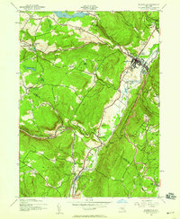 1942 Ellenville1959 Print · USGSThe valleys surrounding Ellenville and the Shawangunk Mountains are seen here at a mid-century crossroads of transport history. Genealogists can locate family-named landmarks like Poplar Grove Cem and several rural schoolhouses, including Sandburg Rend Sch and Greenwood Sch.2 unique versions available
 - 1943 Map of Peekamoose Mountain
 1943 Peekamoose Mountain1943 Print · USGSIn the heart of the Catskill Mountains during the mid-forties, this area remains a landscape of high summits and isolated valley settlements. Researchers can trace remote family homesteads and local institutions like the Greenville School, Richmond Camp, and the Slide Mountain Fire Tower.3 unique versions available
 - 1943 Map of Lackawack
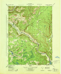 1943 Lackawack1943 Print · USGSThe Ulster County uplands are captured here during a period of massive hydraulic engineering. Genealogists and local historians can trace family farmsteads and rural schools like Stangle Hill School near the massive footprint of the Merriman Dam.
 - 1943 Map of Napanoch
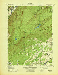 1943 Napanoch1943 Print · USGSThe Shawangunk Mountains and the valley of the Rondout Creek are captured here in the early 1940s. Genealogists and historians can trace family properties like V Mahon and H Hall or locate rural landmarks such as Crawford Church and the Union District School.
 - 1943 Map of Kerhonkson
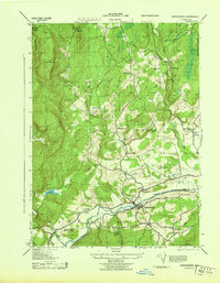 1943 Kerhonkson1943 Print · USGSMid-century Ulster County comes to life through this survey of the Rondout Valley and the Ontario and Western rail corridor. Genealogists can trace family holdings and local schools like Wawarsing School, Cherrytown, and the Frank Utter Colony Farm.
 - 1943 Map of Ellenville
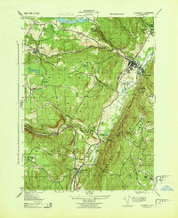 1943 Ellenville1943 Print · USGSThe Shawangunk valley corridor during the war years shows a landscape defined by the Delaware and Hudson Canal and the O&W railroad. Trace local roots at Fantine Cemetery or find historic sites like the Pepsi Cola Bottling Co and Greenwood School.
 - 1943 Map of Monticello, 1961 Print
 1943 Monticello1961 Print · USGSSullivan County's resort and rail corridor comes into focus in the 1940s, highlighting the area's transition into a premier vacation destination. Local historians can trace the paths of the New York Ontario and Western RR and find specific seasonal hubs like Luzon Sta or the private Merriewold Park.3 unique versions available
 - 1943 Map of Monticello, 1964 Print
 1943 Monticello1964 Print · USGSSullivan County in the early 1940s is shown at a peak of its rural development before mid-century modernization changed the landscape. Genealogists and researchers can trace local roots through numerous district schools like the Bushville School and family landmarks such as the Stewart Cem or the industrial Dye Works.
 - 1944 Map of Monticello
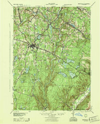 1944 Monticello1944 Print · USGSSullivan County in the 1940s is a landscape of mountain resorts and essential rail corridors during the height of the area's growth. Trace the rail-dependent growth of Monticello or find old family connections in settlements like Mountaindale and Hurleyville.
 - 1944 Map of Neversink
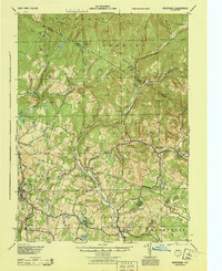 1944 Neversink1944 Print · USGSThe Catskills of the mid-1940s come alive in this survey of the river valleys before later reservoir development. Genealogists and historians can trace old homesteads near Willowemoc, follow the NYO AND W RR through Ferndale, and locate Union Ch and Divine Corners.
 - 1950 Map of Scranton, 1952 Print
 1950 Scranton1952 Print · USGSMid-century Northeast Pennsylvania and the Hudson Valley come alive in this survey of the tri-state region. Genealogists and historians can trace the dense rail networks of the Erie RR and DL&W RR between industrial hubs like Scranton and Wilkes-Barre.
 - 1953 Map of Scranton
 1953 Scranton1953 Print · USGSNortheastern Pennsylvania and the Catskills are shown in great detail during the early fifties, a time when rail lines and river valleys dictated the region's growth. Genealogists and historians can trace the industrial hearts of Scranton and Wilkes-Barre or locate remote landmarks like High Point and Lake Wallenpaupack.
 - 1956 Map of Napanoch, 1958 Print
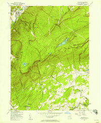 1956 Napanoch1958 Print · USGSThe Shawangunk Mountains define the landscape of Ulster County in the mid-fifties, separating the industrial valley from upland summer camps. Researchers can trace the New York Ontario and Western rail line through Napanoch or locate landmarks like Red Mills and the State Institution for Male Defective Delinquents.4 unique versions available
 - 1959 Map of Scranton
 1959 Scranton1959 Print · USGSThe northern coalfields and the Hudson Valley meet in this mid-century survey of the Pennsylvania and New York borderlands. Genealogists and historians can trace the intricate rail networks of the Erie Railroad and the vast waters of Lake Wallenpaupack.2 unique versions available
 - 1962 Map of Scranton, 1977 Print
 1962 Scranton1977 Print · USGSThe industrial heart of eastern Pennsylvania and the New York Catskills are captured here in the early sixties. Genealogists and historians can trace the dense valley settlements from Scranton to Wilkes-Barre and the rail lines of the Erie Lackawanna Railroad.2 unique versions available
Showing maps 1-25 of 70
Top cities near Wawarsing
- Wallkill historical maps
- Montgomery historical maps
- Thompson historical maps
- Fallsburg historical maps
- Shawangunk historical maps
- Mamakating historical maps
See more
Top neighborhoods of Wawarsing
- Spring Glen historical maps
- Dairyland historical maps
- Lackawack historical maps
- Port Ben historical maps
- Ulster Heights historical maps
- Brownville historical maps
See more
Frequently asked questions
- What are the different types of historical maps available for Wawarsing?
- What is the oldest map of Wawarsing?
- Where can I purchase historical maps of Wawarsing for my home or office?
- Where can I download high-res historical maps of Wawarsing?
- Are there historical topographic maps available for Wawarsing?
- Is there historical aerial imagery available for Wawarsing?
- Where are historical maps of Wawarsing sourced from?