2020s Maps of Lewisboro, New York
Explore 5 historic maps of Lewisboro from the 2020s. These maps offer a rare glimpse into what life looked like during the 2020s — showing old roads, neighborhoods, homes, and landmarks that have changed or disappeared over time.
Whether you're researching your family's past, planning a metal detecting trip, or studying how Lewisboro's landscape evolved across the 2020s, these high-resolution maps are a powerful tool for exploring the history of this region.
- Focus on a specific era: All maps on this page are from the 2020s, giving you a focused view of this time period.
- See what’s changed: Compare century-old streets, trails, and buildings to today's modern landscape using overlays and satellite layers.
- Research with precision: Use these maps for genealogy, historical research, land use analysis, or educational projects.
- View, download, or print: Maps are fully viewable online in high resolution, and can be downloaded or printed for your own records.
Start exploring Lewisboro's history through authentic maps from the 2020s. This is your window into the past.
Lewisboro, NY maps
(5)- 2021 Map of Norwalk North, 2021 Print
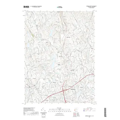 2021 Norwalk North2021 Print · USGSCovers Lewisboro, including Norwalk, Westport, and other nearby areas
 - 2023 Map of Pound Ridge, 2023 Print
 2023 Pound Ridge2023 Print · USGSThe Westchester and Connecticut borderlands are documented here during a period of modern preservation and suburban maturity. Genealogists can locate numerous family burial sites, from Burial Hill to the Potters Field of Stamford Cem, while tracing the wooded depths of Mianus Gorge.
 - 2023 Map of Peach Lake, 2023 Print
 2023 Peach Lake2023 Print · USGSThe Westchester and Putnam County borderlands meet Connecticut in this recent survey of the North Salem area. Genealogists can locate family sites at the Peach Pond Friends Cem or trace the early paths of Old Post Rd near Waccabuc.
 - 2023 Map of Croton Falls, 2023 Print
 2023 Croton Falls2023 Print · USGSThe Westchester and Putnam county line near the reservoirs is shown here in modern detail. Researchers can trace family history at Saint Josephs Cem or locate the historic Mount Zion church and landmarks like Watermelon Hill.
 - 2024 Map of Norwalk North, 2024 Print
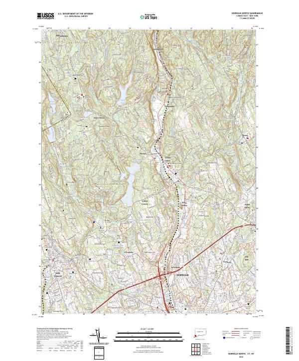 2024 Norwalk North2024 Print · USGSFairfield County’s modern landscape preserves deep roots in this survey of the communities between Ridgefield and Norwalk. Genealogists can trace family heritage through sites like Zion Hill Methodist Episcopal Cem and the Platt Burial Ground or explore the early settlements of Cannondale and Silvermine.
End of results
Showing maps 1-5 of 5
Top cities near Lewisboro
- Stamford historical maps
- Greenburgh historical maps
- Norwalk historical maps
- Danbury historical maps
- Greenwich historical maps
- White Plains historical maps
See more
Top neighborhoods of Lewisboro
- Twin Lakes Village historical maps
- Waccabuc historical maps
- Vista historical maps
- South Salem historical maps
- Truesdale Lake historical maps
- Goldens Bridge historical maps
Frequently asked questions
- What are the different types of historical maps available for Lewisboro?
- What is the oldest map of Lewisboro?
- Where can I purchase historical maps of Lewisboro for my home or office?
- Where can I download high-res historical maps of Lewisboro?
- Are there historical topographic maps available for Lewisboro?
- Is there historical aerial imagery available for Lewisboro?
- Where are historical maps of Lewisboro sourced from?