Old Maps of Mamaroneck, New York for Metal Detecting
Plan your next treasure hunt with 38 historic maps of Mamaroneck. Find old homesites, ghost towns, trails, and gathering spots that may be lost to time — perfect for identifying promising metal detecting locations.
- Locate forgotten sites: Uncover places like long-lost settlements, abandoned rail lines, or gathering spots.
- Plan better hunts: Use map overlays combined with LiDAR or satellite views to narrow in on historically rich areas.
- Made for detectorists: Thousands of hobbyists use these maps to discover relics, coins, and hidden history.
Use these historic maps to boost your research and find new opportunities beneath the surface of Mamaroneck.
Mamaroneck, NY maps
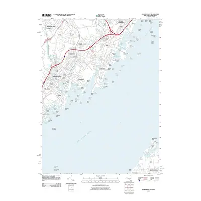
(38)- 1891 Map of Harlem
 1891 Harlem1891 Print · USGSUpper Manhattan and the Bronx met the burgeoning towns of Westchester and Bergen County in the late 1800s. Researchers can trace the path of the Croton Aqueduct, locate the historic site of Bulls Ferry, and explore the early rail-connected villages of Schraalenburgh and Pelhamville.
 - 1897 Map of Harlem, 1956 Print
 1897 Harlem1956 Print · USGSUpper Manhattan and Westchester thrive at the end of the nineteenth century as rail lines and reservoirs reshape the landscape. Trace early neighborhoods and landmarks like Schraalenburg, Woodlawn Cemetery, and the Jerome Park Reservoir.4 unique versions available
 - 1897 Map of Oyster Bay, 1963 Print
 1897 Oyster Bay1963 Print · USGSThe North Shore and Westchester coastline are captured here in the late nineteenth century as maritime trade and rail travel transformed the region. Researchers can trace the early layouts of Sea Cliff, Port Washington, and Larchmont alongside historic navigation aids like Sands Point Light.
 - 1898 Map of Harlem
 1898 Harlem1898 Print · USGSThe northern reaches of the city and its surrounding suburbs are shown in late-Victorian detail as rail lines expanded across the Hudson. Researchers can trace the early layouts of Woodlawn Cemetery, the site of Grants Tomb, and the fortifications at Fort Schuyler.
 - 1898 Map of Oyster Bay
 1898 Oyster Bay1898 Print · USGSNassau County and the Westchester shoreline are shown in detail at the end of the century, before the massive population shifts of the next century. Genealogists and maritime historians can trace the early village footprints of Sea Cliff and Oyster Bay, or locate historical markers like the Sands Point Light.
 - 1900 Map of Harlem
 1900 Harlem1900 Print · USGSUpper Manhattan and the surrounding boroughs are shown at a pivotal moment of growth before the mid-century building boom. Genealogists can trace family footprints through the streets of Yonkers Park or locate ancestors in the sprawling Woodlawn Cemetery.16 unique versions available
 - 1900 Map of Oyster Bay
 1900 Oyster Bay1900 Print · USGSThe North Shore of Long Island is captured at the turn of the century as its maritime villages and sprawling estates began to transition into refined commuter suburbs. Genealogists can trace property and neighborhood development in Sea Cliff, Glen Cove, and Oyster Bay before the automobile era.15 unique versions available
 - 1947 Map of Mamaroneck
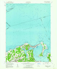
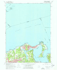
 1947 Mamaroneck1947 Print · USGSCoastal Westchester and Nassau Counties are shown here just after the war as the region's grand estates and suburban centers flourished. Genealogists and historians can locate private landmarks like the J P Morgan property, Pratts Estate, and St Thomas Ch.
 - 1947 Map of Mt Vernon
 1947 Mt Vernon1947 Print · USGSWestchester County and the northern Bronx are captured in the late 1940s during a period of rapid suburban maturation. Genealogists and historians can trace family roots through numerous landmarks like Woodlawn Cem, Sarah Lawrence College, and the grounds of Fort Slocum.
 - 1949 Map of New York, 1951 Print
 1949 New York1951 Print · USGSLong Island and its surrounding waters are documented here in the late 1940s, just as the postwar suburban boom began to transform the region. Genealogists and historians can trace the early layouts of Idlewild Airport, Mitchell Field, and the established routes of the Long Island RR.
 - 1954 Map of New York
 1954 New York1954 Print · USGSLong Island and the New York metropolitan area are shown during the height of post-war suburbanization. Genealogists and historians can trace the growth of Levittown, the infrastructure of the Long Island Rail Road, and landmarks like Mitchel Afb.2 unique versions available
 - 1954 Map of Bayville, 1956 Print
 1954 Bayville1956 Print · USGSThe Gold Coast of Long Island is captured here in the mid-fifties, showing the transition from grand estates to post-war residential growth. Genealogists and historians can trace family plots at Pratt Cem or locate local landmarks like Mill Neck Manor and the Monastery.2 unique versions available
 - 1955 Map of Mamaroneck, 1958 Print
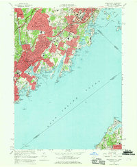
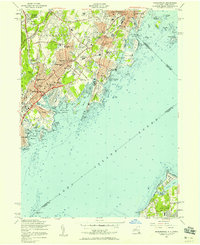 1955 Mamaroneck1958 Print · USGSThe Westchester shoreline and Long Island Sound are captured here during a decade of suburban expansion and parkway development. Genealogists and historians can locate family landmarks from Greenwood Union Cemetery to the Webb Institute or the Execution Rocks Lighthouse.2 unique versions available
 - 1956 Map of Mount Vernon, 1958 Print
 1956 Mount Vernon1958 Print · USGSLower Westchester and the Northern Bronx thrive in the mid-fifties as parkways and parklands reshape the landscape. Researchers can trace family roots through neighborhood schools like PS 112 or locate ancestors at Beechwood Cemetery and Holy Sepulchre Cemetery.2 unique versions available
 - 1957 Map of New York, 1975 Print
 1957 New York1975 Print · USGSLong Island and the New York metropolitan area are shown in this mid-century survey during a period of massive suburban growth and industrial expansion. Researchers can trace the Long Island RR network and locate landmarks like Fort Tilden or the Brookhaven National Laboratory.
 - 1958 Map of New York
 1958 New York1958 Print · USGSLong Island at the height of its postwar expansion reveals a landscape of rapidly growing suburbs and critical military installations. Genealogists and historians can trace the early footprints of Levittown, the terminals of Idlewild Airport, and the grounds of Brookhaven National Laboratory.3 unique versions available
 - 1960 Map of New York, 1979 Print
 1960 New York1979 Print · USGSLong Island and the five boroughs are shown at a transformative moment mid-century as suburban expansion reshaped the landscape. Researchers can trace family roots through evolving neighborhoods from Rockville Centre to Sayville, or locate historic maritime landmarks like Eatons Neck and Montauk Point.2 unique versions available
 - 1966 Map of Mount Vernon, 1970 Print
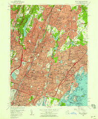
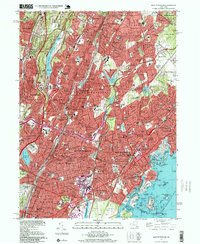
 1966 Mount Vernon1970 Print · USGSLower Westchester County and the northern Bronx are captured here during a period of intense suburban density and parkway expansion. Researchers can trace the midcentury footprints of Sarah Lawrence College, the Fort Slocum Mil Res, and the historic Beechwoods Cemetery.4 unique versions available
 - 1967 Map of Bayville, 1968 Print
 1967 Bayville1968 Print · USGSThe North Shore of Long Island is captured here in the late sixties, showcasing the prestigious harbor-side communities of Bayville and Locust Valley. Genealogists and historians can locate the Sagamore Hill Nat Historical Site, St Johns Ch, and the Smith Cem.3 unique versions available
 - 1967 Map of Mamaroneck, 1969 Print
 1967 Mamaroneck1969 Print · USGSCoastal Westchester County and northern Long Island meet across the sound in the late sixties. Genealogists and local historians can trace the estates and institutions of the era, from Haviland Cem to the Van Amringe Millpond and Dosoris Island.2 unique versions available
 - 1969 Map of New York
 1969 New York1969 Print · USGSLong Island and the New York harbor area are shown here during a peak era of suburban expansion and Cold War defense. Trace the growth of Levittown, the infrastructure of Idlewild NY International Airport, and the reach of the Long Island RR.
 - 1984 Map of Long Island West, 1986 Print
 1984 Long Island West1986 Print · USGSWestern Long Island in the mid-eighties shows a mature suburban landscape defined by its famous expressways and historic rail lines. Researchers can trace the development of planned communities like Levittown or locate landmarks such as Fort Totten Mil Res and Stony Brook.2 unique versions available
 - 1995 Map of Mount Vernon, 1999 Print
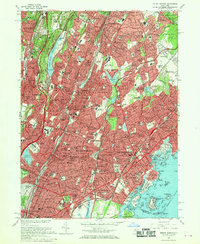
 1995 Mount Vernon1999 Print · USGSSouthern Westchester County and the northern Bronx appear here at a moment of late-century suburban maturity. Genealogists and local researchers can locate numerous parish schools and resting places like Mount Hope Cem and the Wartburg Orphanage.
 - 2010 Map of Mount Vernon, 2010 Print
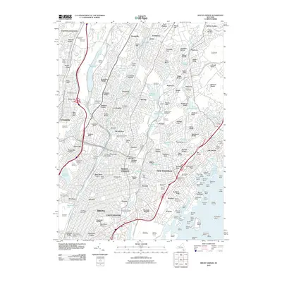 2010 Mount Vernon2010 Print · USGSCovers Mamaroneck, including New York, Yonkers, and other nearby areas
 - 2011 Map of Mamaroneck, 2011 Print
 2011 Mamaroneck2011 Print · USGSCovers Mamaroneck, including North Hempstead, New Rochelle, and other nearby areas
Showing maps 1-25 of 38
Top cities near Mamaroneck
- New York historical maps
- Hempstead historical maps
- Oyster Bay historical maps
- North Hempstead historical maps
- Yonkers historical maps
- Huntington historical maps
See more
Top neighborhoods of Mamaroneck
Frequently asked questions
- What are the different types of historical maps available for Mamaroneck?
- What is the oldest map of Mamaroneck?
- Where can I purchase historical maps of Mamaroneck for my home or office?
- Where can I download high-res historical maps of Mamaroneck?
- Are there historical topographic maps available for Mamaroneck?
- Is there historical aerial imagery available for Mamaroneck?
- Where are historical maps of Mamaroneck sourced from?