Old Maps of Somers, New York for Hiking & Exploration
Hike through history with 54 historic maps of Somers. Explore old trails, ghost towns, and forgotten backroads — perfect for outdoor adventurers and local explorers.
- Rediscover forgotten places: Map out old mining camps, roads, and footpaths that no longer exist on modern maps.
- Layer with modern tools: Combine with LiDAR or satellite views to plan hikes through historical terrain.
- Made for exploration: Popular among hikers, overlanders, and local history lovers.
Use these maps to find adventure and explore the hidden past of Somers.
Somers, NY maps
(54)- 1892 Map of Stamford
 1892 Stamford1892 Print · USGSThe Connecticut and New York borderlands meet in the late nineteenth century, showing a coastal landscape defined by early rail lines and maritime harbors. Genealogists and local historians can trace family-named sites and vanished post offices from Banksville and Stanwich to the docks of Coscob Harbor.
 - 1892 Map of West Point
 1892 West Point1892 Print · USGSThe Hudson Highlands and river valley are captured here in the early 1890s, when iron mining and river-side rail travel defined the region. Trace ancestral roots and old landmarks from the military grounds at West Point to the iron operations at Mahopac Mine and the rail hub at Peekskill.
 - 1892 Map of Carmel
 1892 Carmel1892 Print · USGSThe Putnam and Westchester borderlands are captured here in the late 1800s, showcasing a landscape of critical rail junctions and expanding reservoirs. Genealogists and historians can trace family-named sites like Coles Mills and Towner, or follow the industrial activity at the Tilly Foster Mine.
 - 1892 Map of Tarrytown
 1892 Tarrytown1892 Print · USGSThe Hudson River valley in the late nineteenth century was a corridor of engineering and industrial growth. Researchers can trace the path of the Croton Aqueduct, locate the State Prison at Sing Sing, or find family names near Merritts Corners and Samsondale.
 - 1893 Map of Carmel
 1893 Carmel1893 Print · USGSLower New York and western Connecticut appear here in the final decade of the nineteenth century, as the Croton watershed was being engineered for the city. Genealogists and historians can trace rail lines like the Mahopac Branch and find local landmarks such as the Tilly Foster Mine and Somers Center.
 - 1893 Map of Stamford
 1893 Stamford1893 Print · USGSThe Connecticut and New York borderlands near the Long Island Sound come alive in this late nineteenth-century study of maritime and rail connectivity. Genealogists and local historians can trace the early development of Stamford, Greenwich, and Port Chester along the shoreline, or locate inland crossroads like Armonk and Banksville.
 - 1893 Map of Tarrytown
 1893 Tarrytown1893 Print · USGSThe Hudson Valley was a powerhouse of transit and utility in the late 1800s, serving as the corridor for New York’s water and rail networks. Genealogists can trace family names and old landings from Haverstraw to Tarrytown, including features like the State Prison and the massive Croton Dam.3 unique versions available
 - 1894 Map of West Point
 1894 West Point1894 Print · USGSThe Hudson Highlands in the late nineteenth century were a hub of river commerce and rail expansion. Genealogists and local historians can trace the footprint of the West Point military grounds, the industrial Mahopac Mines, and early settlements like Yorktown Heights.3 unique versions available
 - 1894 Map of Carmel
 1894 Carmel1894 Print · USGSLower New York and western Connecticut appear here in the late nineteenth century as the Croton watershed was being heavily reshaped. Researchers can trace the early footprints of Brewster, the depths of the Tilly Foster Mine, and the original rail paths of the Mahopac Branch.8 unique versions available
 - 1899 Map of Stamford
 1899 Stamford1899 Print · USGSCoastal Connecticut and southeastern New York thrive at the turn of the century as the rail networks expand through the hills and shorelines. Researchers can trace historic property boundaries and early village sites like Banksville, Scott Corners, and the maritime approaches near Stamford Harbor L.H.13 unique versions available
 - 1899 Map of West Point
 1899 West Point1899 Print · USGSThe Hudson Highlands and military grounds at West Point are detailed in this survey from the closing years of the nineteenth century. Genealogists can trace old family-named sites like Mc Keel Corners or Travis Corners, while historians can locate the Mahopac Mines and the Albany Post Road.
 - 1901 Map of West Point
 1901 West Point1901 Print · USGSThe Hudson Highlands and West Point are shown at the turn of the century, when river railroads and mountain mines defined the local economy. Genealogists can trace family landmarks and hamlets like Nelsonville, Mahopac Mines, and Yorktown Heights.12 unique versions available
 - 1902 Map of Tarrytown
 1902 Tarrytown1902 Print · USGSThe Hudson River valley at the turn of the century shows a landscape of busy river landings and nascent suburbs. Genealogists and historians can trace old homesteads and landmarks like Waldberg Landing, the State Prison at Ossining, and the Croton Aqueduct.11 unique versions available
 - 1928 Map of Carmel
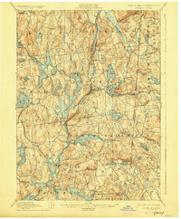 1928 Carmel1928 Print · USGSNear the New York and Connecticut border during the late 1920s, this landscape shows a network of massive reservoirs built to serve the city. Genealogists and historians can trace rail-era developments like the New York and Harlem RR and locate sites such as the Tilly Foster Mine and Farmers Mills.5 unique versions available
 - 1936 Map of West Point
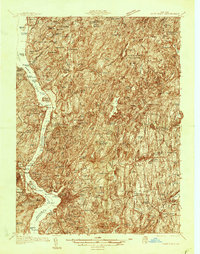 1936 West Point1936 Print · USGSThe Hudson Highlands in the mid-1930s reveal a landscape of strategic military grounds and evolving state parks. Genealogists and historians can trace old family burial grounds like Halstead Cem, the workings of the Mahopac Mines, and the early layout of West Point.2 unique versions available
 - 1936 Map of Ossining
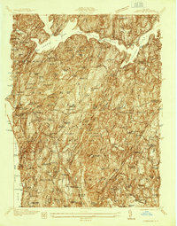 1936 Ossining1936 Print · USGSWestchester County in the mid-thirties exhibits a landscape of growing suburban centers and massive public works. Genealogists and historians can trace the foundations of Briarcliff Manor and Pleasantville, alongside landmarks like Sing Sing State Prison and the Croton Dam.
 - 1937 Map of Tarrytown
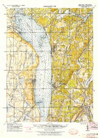 1937 Tarrytown1937 Print · USGSThe Hudson River valley during the 1930s serves as a busy corridor of rail, water, and infrastructure. Genealogists and local historians can trace the old landings at Waldberg Landing, the grounds of the State Prison in Ossining, and the rail lines through Nyack.
 - 1941 Map of West Point
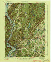 1941 West Point1941 Print · USGSThe Hudson Highlands were undergoing significant change in the years leading up to the war, blending heavy industry with expanding military installations. Genealogists can trace family lines through Continental Village, Hillside Cem, and the various schools like Manitou Sch.3 unique versions available
 - 1943 Map of Ossining
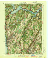 1943 Ossining1943 Print · USGSMid-century Westchester County comes into focus as the riverfront villages expand into the surrounding hills. Genealogists and historians can trace the grounds of Sing Sing Prison, the Maryknoll Seminary, and the storied Sleepy Hollow Country Club.4 unique versions available
 - 1944 Map of Croton Falls
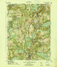 1944 Croton Falls1944 Print · USGSUpper Westchester and Putnam counties are seen here during the mid-forties, characterized by a vast network of reservoirs and the New York Central rail line. Researchers can locate family landmarks like the Wandell Cem, trace the early grounds of the Reformatory, and find community centers like Somers and Purdy.2 unique versions available
 - 1947 Map of West Point
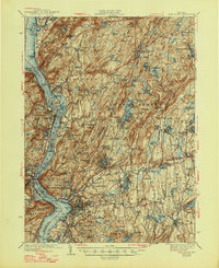 1947 West Point1947 Print · USGSThe Hudson Highlands and the Peekskill waterfront are captured just before the post-war boom, showing the critical junction of river, rail, and early parkways. Genealogists can trace family landmarks and burial sites like Cold Spring Cem, Amawalk Cem, and the historic Mahopac Mines.
 - 1947 Map of Hartford, 1955 Print
 1947 Hartford1955 Print · USGSSouthern New England and the Hudson Valley are shown in detail during the post-war expansion era. Genealogists and researchers can trace local landmarks from the State Capitol and Yale University to the Stratford Lighthouse and Woodlawn Cem.2 unique versions available
 - 1948 Map of Hartford
 1948 Hartford1948 Print · USGSSouthern New England is captured here in the late 1940s, showcasing a landscape of thriving industrial cities and developing parkways. Genealogists and historians can trace the rail networks of the New York New Haven and Hartford RR or locate coastal defense sites like Fort Terry and Camp Shanks.2 unique versions available
 - 1955 Map of Mount Kisco, 1956 Print
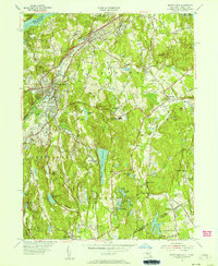 1955 Mount Kisco1956 Print · USGSUpper Westchester County is seen here during the mid-fifties, showing the sophisticated estate-and-commuter landscape of New York and Connecticut. Trace family history at Oakwood Cem, the Old Quaker Burial Ground, or local landmarks like Westfield State Farm.5 unique versions available
 - 1955 Map of Ossining, 1958 Print
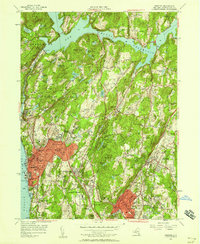 1955 Ossining1958 Print · USGSWestchester County's riverfront and wooded interior are shown here during the mid-fifties, just as suburban expansion began to accelerate. Researchers can trace the grounds of Sing Sing Prison, local family landmarks like Barnum Cem, and the historic campus of Briarcliff Manor.2 unique versions available
Showing maps 1-25 of 54
Top cities near Somers
- Stamford historical maps
- Greenburgh historical maps
- Clarkstown historical maps
- Danbury historical maps
- Greenwich historical maps
- Rye historical maps
See more
Top neighborhoods of Somers
- Granite Springs historical maps
- Amawalk historical maps
- Whitehall Corners historical maps
- Butlerville historical maps
- Horton Estates historical maps
- Lake Purdy historical maps
See more
Frequently asked questions
- What are the different types of historical maps available for Somers?
- What is the oldest map of Somers?
- Where can I purchase historical maps of Somers for my home or office?
- Where can I download high-res historical maps of Somers?
- Are there historical topographic maps available for Somers?
- Is there historical aerial imagery available for Somers?
- Where are historical maps of Somers sourced from?