1960s Maps of Wyoming County, New York
Explore 8 historic maps of Wyoming County from the 1960s. These maps offer a rare glimpse into what life looked like during the 1960s — showing old roads, neighborhoods, homes, and landmarks that have changed or disappeared over time.
Whether you're researching your family's past, planning a metal detecting trip, or studying how Wyoming County's landscape evolved across the 1960s, these high-resolution maps are a powerful tool for exploring the history of this region.
- Focus on a specific era: All maps on this page are from the 1960s, giving you a focused view of this time period.
- See what’s changed: Compare century-old streets, trails, and buildings to today's modern landscape using overlays and satellite layers.
- Research with precision: Use these maps for genealogy, historical research, land use analysis, or educational projects.
- View, download, or print: Maps are fully viewable online in high resolution, and can be downloaded or printed for your own records.
Start exploring Wyoming County's history through authentic maps from the 1960s. This is your window into the past.
Wyoming County, NY maps
(8)- 1960 Map of Buffalo
 1960 Buffalo1960 Print · USGSWestern New York and the Niagara Peninsula thrive during the mid-twentieth century industrial peak. Genealogists and historians can trace family-named points and early settlements from Dunkirk Light to the Allegany Indian Reservation.
 - 1962 Map of Elmira, 1969 Print
 1962 Elmira1969 Print · USGSThe Finger Lakes region and Southern Tier are captured here during a period of industrial maturity and highway expansion. Researchers can trace the path of the Erie Canal, the footprint of the Seneca Army Depot, and legacy rail lines through Elmira and Ithaca.4 unique versions available
 - 1962 Map of Buffalo, 1980 Print
 1962 Buffalo1980 Print · USGSThe Niagara Frontier and Western New York are captured here in the early sixties, showing the vital industrial and maritime nexus between the U.S. and Canada. Researchers can trace the path of the Welland Canal, locate the Allegany Indian Reservation, or find family sites near Chautauqua Lake.2 unique versions available
 - 1965 Map of Elmira
 1965 Elmira1965 Print · USGSThe Finger Lakes and Southern Tier regions are captured in the mid-sixties, showcasing a landscape of deep glacial valleys and heavy rail infrastructure. Trace old railroad corridors like the Pennsylvania RR or visit landmarks like Letchworth State Park and the Seneca Army Depot.
 - 1966 Map of Johnsonburg, 1968 Print
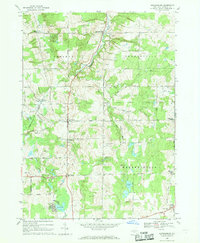 1966 Johnsonburg1968 Print · USGSWyoming County's rural character is preserved here in the mid-sixties, from the rail corridor in Johnsonburg to the waters of Java Lake. Genealogists can trace family landmarks like St Nicholas Cem, Southburg, and the remote Torrey Hill Cem.
 - 1966 Map of Bliss, 1968 Print
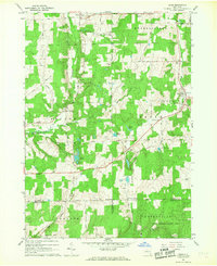 1966 Bliss1968 Print · USGSWestern New York's Wyoming County remains a landscape of rolling woodlots and rural crossroads in the mid-sixties. Genealogists and local historians can trace family-named routes and remote landmarks like Cooley Grave, Waldos Corners, and the hamlets of Bliss and Eagle.2 unique versions available
 - 1966 Map of Arcade, 1968 Print
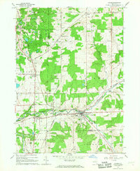 1966 Arcade1968 Print · USGSThe Arcade region of New York is shown here in the mid-1960s, a period when rural crossroads and small hamlets still anchored the landscape. Genealogists and local historians can trace the foundations of Arcade, Yorkshire, and Delevan while identifying rural landmarks like the Punkshire Cem and Camp Merrie Mill.2 unique versions available
 - 1967 Map of Buffalo
 1967 Buffalo1967 Print · USGSWestern New York and the Lake Erie shoreline are shown here during the mid-1960s industrial peak. Researchers can trace the massive rail networks of the Erie Railroad, locate the Cattaraugus Indian Reservation, or find historic sites like Fort Erie.
End of results
Showing maps 1-8 of 8
Top cities of Wyoming County
- Perry historical maps
- Attica historical maps
- Warsaw historical maps
- Arcade historical maps
- Perry historical maps
- Bennington historical maps
See more
Frequently asked questions
- What are the different types of historical maps available for Wyoming County?
- What is the oldest map of Wyoming County?
- Where can I purchase historical maps of Wyoming County for my home or office?
- Where can I download high-res historical maps of Wyoming County?
- Are there historical topographic maps available for Wyoming County?
- Is there historical aerial imagery available for Wyoming County?
- Where are historical maps of Wyoming County sourced from?