2000s (21st Century) Maps of Chestnut Hill, North Carolina
Explore 6 historic maps of Chestnut Hill from the 2000s (21st Century). These maps offer a rare glimpse into what life looked like during the 2000s — showing old roads, neighborhoods, homes, and landmarks that have changed or disappeared over time.
Whether you're researching your family's past, planning a metal detecting trip, or studying how Chestnut Hill's landscape evolved across the 2000s, these high-resolution maps are a powerful tool for exploring the history of this region.
- Focus on a specific era: All maps on this page are from the 2000s, giving you a focused view of this time period.
- See what’s changed: Compare century-old streets, trails, and buildings to today's modern landscape using overlays and satellite layers.
- Research with precision: Use these maps for genealogy, historical research, land use analysis, or educational projects.
- View, download, or print: Maps are fully viewable online in high resolution, and can be downloaded or printed for your own records.
Start exploring Chestnut Hill's history through authentic maps from the 2000s. This is your window into the past.
Chestnut Hill, NC maps
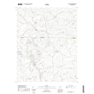
(6)- 2000 Map of Mouth Of Wilson, 2001 Print
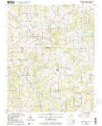 2000 Mouth Of Wilson2001 Print · USGSThe borderlands of Virginia and North Carolina are captured here at the turn of the millennium, centered on the winding New River. Researchers can trace rural lineages through numerous landmarks like Mouth of Wilson, Youngs Chapel, and Piney Creek High Sch.
 - 2010 Map of Mouth of Wilson, 2010 Print
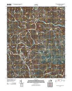 2010 Mouth of Wilson2010 Print · USGSCovers Chestnut Hill, including Weavers Ford, Kings Creek, and other nearby areas
 - 2013 Map of Mouth of Wilson, 2013 Print
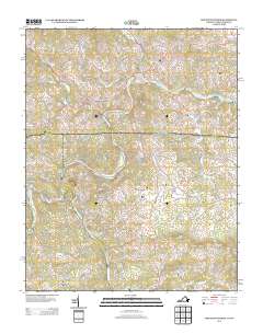 2013 Mouth of Wilson2013 Print · USGSCovers Chestnut Hill, including Weavers Ford, Kings Creek, and other nearby areas
 - 2016 Map of Mouth of Wilson, 2016 Print
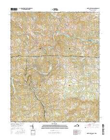 2016 Mouth of Wilson2016 Print · USGSCovers Chestnut Hill, including Weavers Ford, Kings Creek, and other nearby areas
 - 2019 Map of Mouth of Wilson, 2019 Print
 2019 Mouth of Wilson2019 Print · USGSCovers Chestnut Hill, including Weavers Ford, Kings Creek, and other nearby areas
 - 2022 Map of Mouth of Wilson, 2022 Print
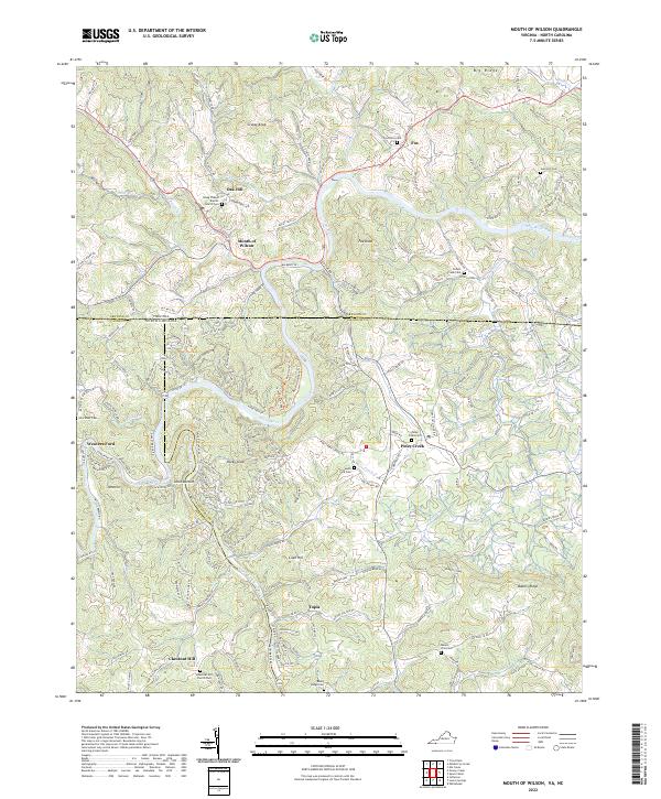 2022 Mouth of Wilson2022 Print · USGSThe Virginia-North Carolina state line bisects this river-carved landscape as it appeared in recent years. Researchers can trace rural lineages through numerous local burial grounds and churches such as Young Chapel Baptist Church, Rocky Ridge Cem, and Potato Creek Cem.
End of results
Showing maps 1-6 of 6
Top cities near Chestnut Hill
- Sparta historical maps
- Jefferson historical maps
- West Jefferson historical maps
- Independence historical maps
- Troutdale historical maps
- Lansing historical maps
Frequently asked questions
- What are the different types of historical maps available for Chestnut Hill?
- What is the oldest map of Chestnut Hill?
- Where can I purchase historical maps of Chestnut Hill for my home or office?
- Where can I download high-res historical maps of Chestnut Hill?
- Are there historical topographic maps available for Chestnut Hill?
- Is there historical aerial imagery available for Chestnut Hill?
- Where are historical maps of Chestnut Hill sourced from?