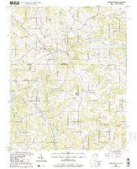
2000 Map of Mouth Of Wilson
USGS Topo · Published 2001About this map
The New River carves a deep, winding path through the borderlands of Virginia and North Carolina, serving as a primary geographical anchor for the communities of Mouth of Wilson and Piney Creek. This landscape is defined by its rural intersections, where family and community life centered around small churches and schools. The map highlights numerous local landmarks such as Youngs Chapel, Gold Hill Ch, and the Piney Creek High Sch, reflecting the importance of these institutions in Grayson, Ashe, and Alleghany counties.
Find a feature on this map
36 named features on this map. Tap any name to fly to it.
Don’t see what you’re looking for? This feature index may not catch every label — zoom into the map to look around manually.
Map Details
Editions of this 2000 Mouth Of Wilson Map
This is the sole edition of this map. No revisions or reprints were ever made.
Other maps of this area

1889 · Wytheville
USGS Topo · 1:125,000

1889 · Wilkesboro
USGS Topo · 1:125,000

1891 · Wilkesboro
USGS Topo · 1:125,000

1892 · Wytheville
USGS Topo · 1:125,000

1930 · Independence
USGS Topo · 1:48,000

1933 · Independence
USGS Topo · 1:62,500

1935 · Mouth of Wilson
USGS Topo · 1:48,000
1935 · Trout Dale
USGS Topo · 1:24,000

1935 · Middle Fox Creek
USGS Topo · 1:24,000

1940 · Mouth of Wilson
USGS Topo · 1:62,500