Old Maps of Butters, North Carolina for Metal Detecting
Plan your next treasure hunt with 10 historic maps of Butters. Find old homesites, ghost towns, trails, and gathering spots that may be lost to time — perfect for identifying promising metal detecting locations.
- Locate forgotten sites: Uncover places like long-lost settlements, abandoned rail lines, or gathering spots.
- Plan better hunts: Use map overlays combined with LiDAR or satellite views to narrow in on historically rich areas.
- Made for detectorists: Thousands of hobbyists use these maps to discover relics, coins, and hidden history.
Use these historic maps to boost your research and find new opportunities beneath the surface of Butters.
Butters, NC maps
(10)- 1953 Map of Florence, 1964 Print
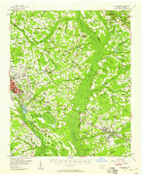
 1953 Florence1964 Print · USGSThe Carolina borderlands in the mid-fifties were a landscape of vast river swamps and rising rail towns. Trace the legacy of the Seaboard Air Line through Florence or explore the wetlands surrounding Lake Waccamaw and the Green Swamp.3 unique versions available
 - 1954 Map of Florence
 1954 Florence1954 Print · USGSThe Carolinas borderlands come alive in the early fifties, showing the vital rail-and-river networks of the coastal plain. Genealogists can trace family footprints across the Green Swamp or through settlements like Red Springs, Chadbourn, and McColl.
 - 1957 Map of Bladenboro, 1958 Print
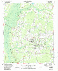
 1957 Bladenboro1958 Print · USGSCoastal plain swamp lands and small railroad towns meet in the 1950s along the border of Robeson and Bladen counties. Genealogists can trace family landmarks like Floyd Temple Ch, the Littlefield High Sch, and the historic path of the Old Stage Road.
 - 1982 Map of Elizabethtown, 1983 Print
 1982 Elizabethtown1983 Print · USGSSoutheastern North Carolina's coastal plain is captured here in the early eighties, showcasing a landscape defined by the Cape Fear River and mysterious Carolina Bays. Genealogists and researchers can trace the rail network of the Seaboard Coast Line through rural communities like Autryville, Ivanhoe, and the recreational hub of White Lake.
 - 1986 Map of Bladenboro, 1987 Print
 1986 Bladenboro1987 Print · USGSBladenboro and the surrounding swamps of southeastern North Carolina appear here during the mid-eighties as a landscape of rural congregations and family millponds. Researchers can trace local roots at Hickory Grove Church, Singletary Cemetery, and the old mills at Bridger Millpond.
 - 2010 Map of Bladenboro, 2010 Print
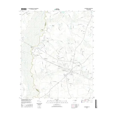
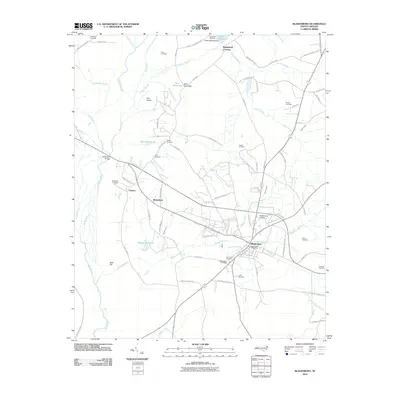 2010 Bladenboro2010 Print · USGSCovers Butters, including Bladenboro, Richardson, and other nearby areas
 - 2013 Map of Bladenboro, 2013 Print
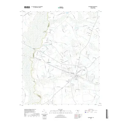
 2013 Bladenboro2013 Print · USGSCovers Butters, including Bladenboro, Richardson, and other nearby areas
 - 2016 Map of Bladenboro, 2016 Print
 2016 Bladenboro2016 Print · USGSCovers Butters, including Bladenboro, Richardson, and other nearby areas
 - 2019 Map of Bladenboro, 2019 Print
 2019 Bladenboro2019 Print · USGSCovers Butters, including Bladenboro, Richardson, and other nearby areas
 - 2022 Map of Bladenboro, 2022 Print
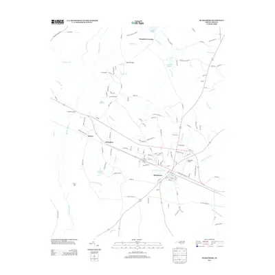
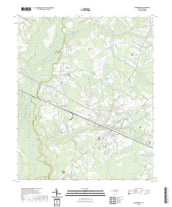 2022 Bladenboro2022 Print · USGSSoutheastern North Carolina's lowland landscape is on full display in this recent record of the Bladenboro area. Local historians can trace family ties at Pine Crest Cem and explore the rail-and-water economy at Bridger Millpond and along the Seaboard Coast Line.
End of results
Showing maps 1-10 of 10
Top cities near Butters
- Lumberton historical maps
- Whiteville historical maps
- Elizabethtown historical maps
- Chadbourn historical maps
- Bladenboro historical maps
- Clarkton historical maps
See more
Frequently asked questions
- What are the different types of historical maps available for Butters?
- What is the oldest map of Butters?
- Where can I purchase historical maps of Butters for my home or office?
- Where can I download high-res historical maps of Butters?
- Are there historical topographic maps available for Butters?
- Is there historical aerial imagery available for Butters?
- Where are historical maps of Butters sourced from?