2020s Maps of Elizabethtown, North Carolina
Explore 4 historic maps of Elizabethtown from the 2020s. These maps offer a rare glimpse into what life looked like during the 2020s — showing old roads, neighborhoods, homes, and landmarks that have changed or disappeared over time.
Whether you're researching your family's past, planning a metal detecting trip, or studying how Elizabethtown's landscape evolved across the 2020s, these high-resolution maps are a powerful tool for exploring the history of this region.
- Focus on a specific era: All maps on this page are from the 2020s, giving you a focused view of this time period.
- See what’s changed: Compare century-old streets, trails, and buildings to today's modern landscape using overlays and satellite layers.
- Research with precision: Use these maps for genealogy, historical research, land use analysis, or educational projects.
- View, download, or print: Maps are fully viewable online in high resolution, and can be downloaded or printed for your own records.
Start exploring Elizabethtown's history through authentic maps from the 2020s. This is your window into the past.
Elizabethtown, NC maps
(4)- 2022 Map of Elizabethtown South, 2022 Print
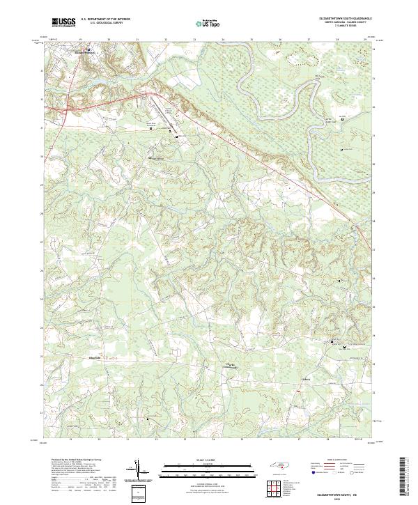 2022 Elizabethtown South2022 Print · USGSCoastal plains and river bends define Bladen County in the early 2020s, where rural life centers on the winding Cape Fear River. Researchers can trace generations of local history through family burial grounds like Lee Cem and Watson Cem or the settlement at Lisbon.
 - 2022 Map of Dublin, 2022 Print
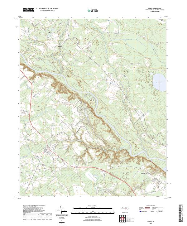 2022 Dublin2022 Print · USGSBladen County's unique wetlands and settlements are documented in the early 2020s, showing the landscape between Dublin and Elizabethtown. Researchers can trace the modern campus of Bladen Community College and several named Carolina bays like Salters Lake.
 - 2022 Map of Elizabethtown North, 2022 Print
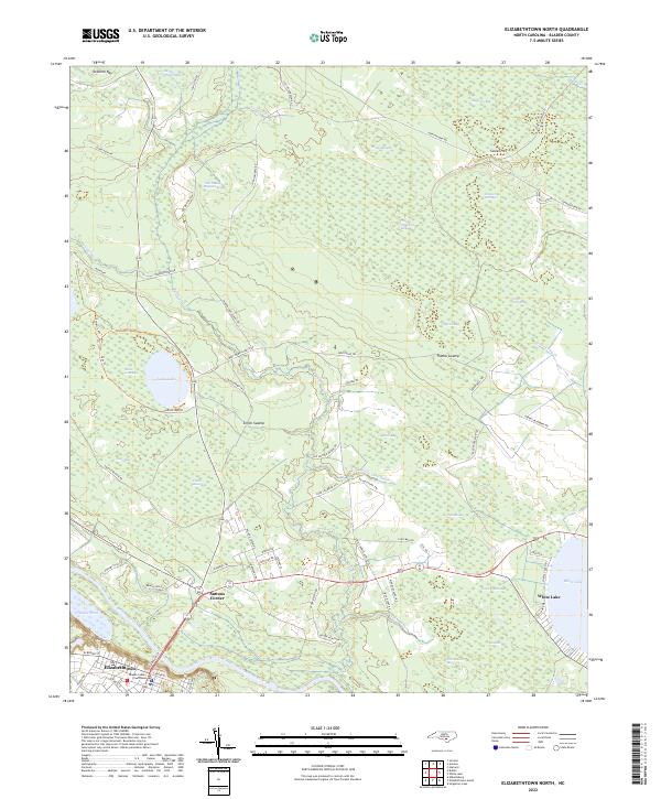 2022 Elizabethtown North2022 Print · USGSElizabethtown and the surrounding Carolina bays are documented in this recent survey of the Bladen County interior. Researchers can trace the riverfront at Elizabethtown or locate rural landmarks like the Bladen County Courthouse and Suttons Corner.
 - 2022 Map of Abbottsburg, 2022 Print
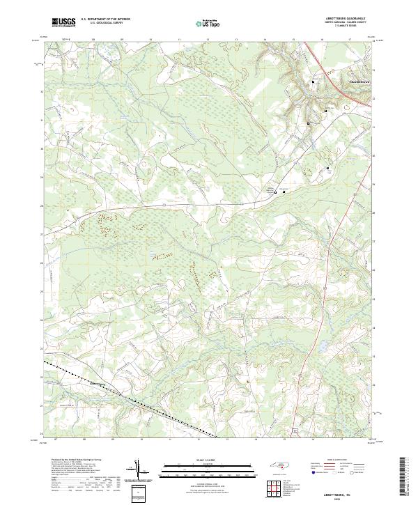 2022 Abbottsburg2022 Print · USGSBladen County's wetland-rich interior is mapped here in the early 2020s, showing a landscape shaped by drainage canals and expansive swamps. Genealogists and local researchers can trace family lands near Abbottsburg, the Bladen Memorial Gardens, and landmarks like Paris Millpond.
End of results
Showing maps 1-4 of 4
Top cities near Elizabethtown
- Bladenboro historical maps
- Clarkton historical maps
- White Lake historical maps
- Dublin historical maps
- Tar Heel historical maps
Frequently asked questions
- What are the different types of historical maps available for Elizabethtown?
- What is the oldest map of Elizabethtown?
- Where can I purchase historical maps of Elizabethtown for my home or office?
- Where can I download high-res historical maps of Elizabethtown?
- Are there historical topographic maps available for Elizabethtown?
- Is there historical aerial imagery available for Elizabethtown?
- Where are historical maps of Elizabethtown sourced from?