Old Maps of Bald Head Island, North Carolina
Explore 19 old maps of Bald Head Island, spanning from 1942 to today. These high-resolution historic maps reveal how streets, neighborhoods, landmarks, and natural features evolved over time — perfect for genealogy, metal detecting, research, and local history exploration.
What you can do with these maps:
- See how Bald Head Island changed over time: Compare historical maps to modern-day views to trace roads, homesites, rail lines & more.
- View detailed metadata: Each map includes creators, publishers, year, scale, and archive source.
- Overlay maps with satellite & LiDAR: Visualize the past alongside modern tools to explore terrain & human change.
- Trusted historical sources: Maps sourced from the USGS, Library of Congress, and other archives.
- Access maps your way: View online, download high-res files, or order prints for personal or research use.
Start exploring old maps of Bald Head Island to uncover forgotten places, hidden landmarks, and the deep history beneath your feet.
Bald Head Island, NC maps
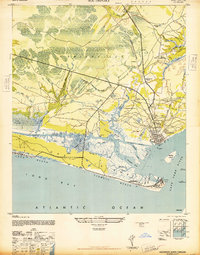
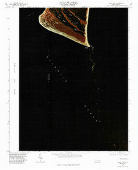
(19)- 1942 Map of Cape Fear, 1956 Print
 1942 Cape Fear1956 Print · USGSCovers Bald Head Island, including New Hanover County, Brunswick County, and other nearby areas
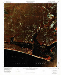
 - 1946 Map of Southport
 1946 Southport1946 Print · USGSCovers Bald Head Island, including Oak Island, Boiling Spring Lakes, and other nearby areas
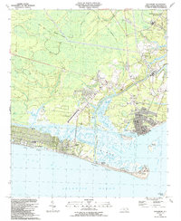
 - 1946 Map of Snow Marsh
 1946 Snow Marsh1946 Print · USGSCovers Bald Head Island, including Southport, Kure Beach, and other nearby areas
 - 1949 Map of Georgetown, 1953 Print
 1949 Georgetown1953 Print · USGSCovers Bald Head Island, including Goose Creek, Myrtle Beach, and other nearby areas
 - 1967 Map of Georgetown
 1967 Georgetown1967 Print · USGSCovers Bald Head Island, including Goose Creek, Myrtle Beach, and other nearby areas
 - 1969 Map of Southport
 1969 Southport1969 Print · USGSCovers Bald Head Island, including Oak Island, Boiling Spring Lakes, and other nearby areas
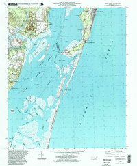
 - 1970 Map of Kure Beach, 1972 Print
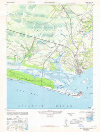
 1970 Kure Beach1972 Print · USGSCovers Bald Head Island, including Southport, Kure Beach, and other nearby areas2 unique versions available
 - 1970 Map of Cape Fear, 1972 Print
 1970 Cape Fear1972 Print · USGSCovers Bald Head Island, including New Hanover County, Brunswick County, and other nearby areas
 - 1974 Map of Georgetown, 1978 Print
 1974 Georgetown1978 Print · USGSCovers Bald Head Island, including Goose Creek, Myrtle Beach, and other nearby areas2 unique versions available
 - 1980 Map of Kure Beach, 1985 Print
 1980 Kure Beach1985 Print · USGSCovers Bald Head Island, including Southport, Kure Beach, and other nearby areas
 - 1980 Map of Cape Fear, 1985 Print
 1980 Cape Fear1985 Print · USGSCovers Bald Head Island, including New Hanover County, Brunswick County, and other nearby areas2 unique versions available
 - 1980 Map of Southport, 1985 Print
 1980 Southport1985 Print · USGSCovers Bald Head Island, including Oak Island, Boiling Spring Lakes, and other nearby areas
 - 1984 Map of Cape Fear, 1985 Print
 1984 Cape Fear1985 Print · USGSCovers Bald Head Island, including Southport, Kure Beach, and other nearby areas
 - 1986 Map of Myrtle Beach
 1986 Myrtle Beach1986 Print · USGSCovers Bald Head Island, including Myrtle Beach, Conway, and other nearby areas
 - 1990 Map of Myrtle Beach
 1990 Myrtle Beach1990 Print · USGSCovers Bald Head Island, including Myrtle Beach, Conway, and other nearby areas
 - 1990 Map of Cape Fear
 1990 Cape Fear1990 Print · USGSCovers Bald Head Island, including Southport, Kure Beach, and other nearby areas
 - 1990 Map of Southport, 1991 Print
 1990 Southport1991 Print · USGSCovers Bald Head Island, including Oak Island, Boiling Spring Lakes, and other nearby areas
 - 1997 Map of Kure Beach, 1999 Print
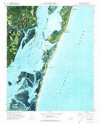
 1997 Kure Beach1999 Print · USGSCovers Bald Head Island, including Southport, Kure Beach, and other nearby areas
 - 1999 Map of Cape Fear, 2001 Print
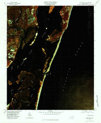
 1999 Cape Fear2001 Print · USGSCovers Bald Head Island, including New Hanover County, Brunswick County, and other nearby areas
End of results
Showing maps 1-19 of 19
Top cities near Bald Head Island
- Oak Island historical maps
- Boiling Spring Lakes historical maps
- Carolina Beach historical maps
- Southport historical maps
- Kure Beach historical maps
- Caswell Beach historical maps
See more
Frequently asked questions
- What are the different types of historical maps available for Bald Head Island?
- What is the oldest map of Bald Head Island?
- Where can I purchase historical maps of Bald Head Island for my home or office?
- Where can I download high-res historical maps of Bald Head Island?
- Are there historical topographic maps available for Bald Head Island?
- Is there historical aerial imagery available for Bald Head Island?
- Where are historical maps of Bald Head Island sourced from?