1990s Maps of Boiling Spring Lakes, North Carolina
Explore 5 historic maps of Boiling Spring Lakes from the 1990s. These maps offer a rare glimpse into what life looked like during the 1990s — showing old roads, neighborhoods, homes, and landmarks that have changed or disappeared over time.
Whether you're researching your family's past, planning a metal detecting trip, or studying how Boiling Spring Lakes's landscape evolved across the 1990s, these high-resolution maps are a powerful tool for exploring the history of this region.
- Focus on a specific era: All maps on this page are from the 1990s, giving you a focused view of this time period.
- See what’s changed: Compare century-old streets, trails, and buildings to today's modern landscape using overlays and satellite layers.
- Research with precision: Use these maps for genealogy, historical research, land use analysis, or educational projects.
- View, download, or print: Maps are fully viewable online in high resolution, and can be downloaded or printed for your own records.
Start exploring Boiling Spring Lakes's history through authentic maps from the 1990s. This is your window into the past.
Boiling Spring Lakes, NC maps
(5)- 1990 Map of Myrtle Beach
 1990 Myrtle Beach1990 Print · USGSThe Grand Strand and the North Carolina borderlands are captured here in the decade before the base closure. Genealogists and historians can trace the development of Myrtle Beach and North Myrtle Beach alongside rural landmarks like Star Bluff Crossroads and Fort Caswell.
 - 1990 Map of Whiteville
 1990 Whiteville1990 Print · USGSSoutheastern North Carolina and the South Carolina borderlands appear in the late twentieth century, showing a landscape of river-swamps and tobacco towns. Researchers can trace family history through sites like Mount Olive Ch, the Seaboard Coast Line RR, and rural centers like Tabor City.
 - 1990 Map of Southport, 1991 Print
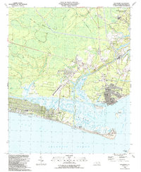 1990 Southport1991 Print · USGSThe Brunswick County coast in the late eighties shows a dynamic mix of military heritage and beach community growth. Researchers can trace the development of Southport and Long Beach or locate family landmarks like St Peters Ch and Bethel Cem.
 - 1990 Map of Funston, 1991 Print
 1990 Funston1991 Print · USGSBrunswick County at the start of the nineties reveals a landscape of growing residential developments and coastal defense. Researchers can trace family sites at Lebanon Ch and Funston or locate the sprawling Military Ocean Terminal Sunny Point.
 - 1990 Map of Bolivia, 1991 Print
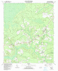 1990 Bolivia1991 Print · USGSIn the early 1990s, the Brunswick County landscape around Bolivia maintained a quiet balance between coastal wetlands and rural growth. Genealogists and local historians can trace family-named sites like Harvell and Lynch alongside Brunswick Community College and Half Hell.
End of results
Showing maps 1-5 of 5
Top cities near Boiling Spring Lakes
- Wilmington historical maps
- Leland historical maps
- Oak Island historical maps
- Carolina Beach historical maps
- Southport historical maps
- Kure Beach historical maps
See more
Frequently asked questions
- What are the different types of historical maps available for Boiling Spring Lakes?
- What is the oldest map of Boiling Spring Lakes?
- Where can I purchase historical maps of Boiling Spring Lakes for my home or office?
- Where can I download high-res historical maps of Boiling Spring Lakes?
- Are there historical topographic maps available for Boiling Spring Lakes?
- Is there historical aerial imagery available for Boiling Spring Lakes?
- Where are historical maps of Boiling Spring Lakes sourced from?