Old Maps of Boiling Spring Lakes, North Carolina for Genealogy
Trace your family roots with 35 historic maps of Boiling Spring Lakes. These high-res maps reveal old neighborhoods, homesites, landmarks, and streets — helping you uncover where your ancestors lived and how the area evolved over time.
- Explore historic neighborhoods: Identify where your relatives may have lived in the 1800s or 1900s.
- Compare maps over time: Trace the changes in streets, buildings, and landmarks for multi-generational research.
- Perfect for genealogy & ancestry research: Used by family historians and researchers to map out lineage and migration.
These maps are an incredible resource for exploring your personal connection to Boiling Spring Lakes's past.
Boiling Spring Lakes, NC maps
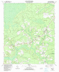
(35)- 1943 Map of Funston, 1962 Print
 1943 Funston1962 Print · USGSCoastal Brunswick County during the early 1940s is shown here as a landscape of interconnected wetlands and small rural outposts. Researchers can trace family-named water features and local landmarks like Brunswick Station, Christian Chapel, and Orton Pond.2 unique versions available
 - 1943 Map of Bolivia, 1962 Print
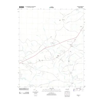
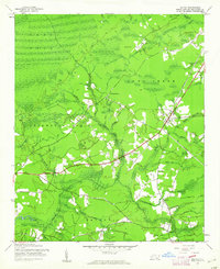 1943 Bolivia1962 Print · USGSCoastal Brunswick County in the early 1940s is characterized by its sprawling wetlands and small crossroads communities. Genealogists and researchers can trace local landmarks like Mt Olive Ch, the Bolivia Lookout Tower, and the settlement of Antioch.
 - 1944 Map of Bolivia
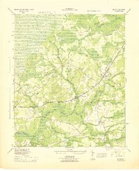 1944 Bolivia1944 Print · USGSMid-century Brunswick County is captured here during a period of transition for its coastal swamp communities. Genealogists and historians can trace family-named landmarks and old congregations at St Johns Ch, Antioch Ch, and the settlement of Bolivia.
 - 1946 Map of Southport
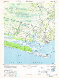
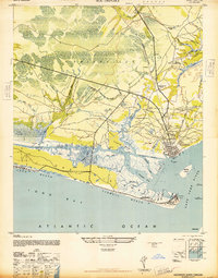 1946 Southport1946 Print · USGSImmediately following the war, this coastal area shows the intersection of maritime defense and river-based commerce. Researchers can trace family landmarks and civic sites like the Brunswick Co Home, Browns Ch, and the grounds of Fort Caswell.
 - 1949 Map of Georgetown, 1953 Print
 1949 Georgetown1953 Print · USGSThe South Carolina coast and North Carolina borderlands appear here in the mid-century, prior to the major modern development of the Grand Strand. Genealogists and historians can trace the rail networks of the Seaboard Air Line Railroad and locate coastal landmarks from Fort Caswell to McClellanville.
 - 1953 Map of Florence, 1964 Print
 1953 Florence1964 Print · USGSThe Carolina borderlands in the mid-fifties were a landscape of vast river swamps and rising rail towns. Trace the legacy of the Seaboard Air Line through Florence or explore the wetlands surrounding Lake Waccamaw and the Green Swamp.3 unique versions available
 - 1954 Map of Florence
 1954 Florence1954 Print · USGSThe Carolinas borderlands come alive in the early fifties, showing the vital rail-and-river networks of the coastal plain. Genealogists can trace family footprints across the Green Swamp or through settlements like Red Springs, Chadbourn, and McColl.
 - 1967 Map of Georgetown
 1967 Georgetown1967 Print · USGSThe South Carolina Lowcountry and Grand Strand meet in the late sixties, showcasing a coastal landscape transitioning from river-based industry to seaside tourism. Researchers can trace the Intracoastal Waterway past Georgetown or locate historical sites like Fort Fisher and Murrells Inlet.
 - 1969 Map of Southport
 1969 Southport1969 Print · USGSThe mouth of the Cape Fear River and the surrounding marshes are captured here during a period of transition for coastal North Carolina. Genealogists and historians can locate family landmarks such as Browns Ch, the Brunswick Co Home, and the grounds of Fort Caswell.
 - 1974 Map of Georgetown, 1978 Print
 1974 Georgetown1978 Print · USGSThe Carolina coast and Pee Dee region are shown here in the mid-seventies, just as the Grand Strand was maturing into a premier destination. Researchers can trace the inland rail corridors of the Seaboard Coast Line Railroad or explore the coastal reaches of the Cape Romain National Wildlife Refuge and Myrtle Beach State Park.2 unique versions available
 - 1980 Map of Bolivia, 1985 Print
 1980 Bolivia1985 Print · USGSCoastal Brunswick County in the early eighties is captured here in striking detail, showing the rural landscape around Bolivia. Researchers can trace the path of the Lockwoods Folly River and find local settlements like Piney Grove and Antioch.
 - 1980 Map of Funston, 1985 Print
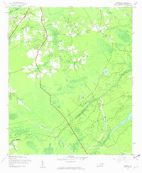
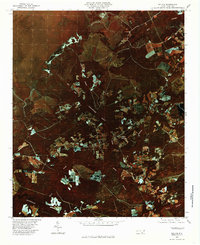
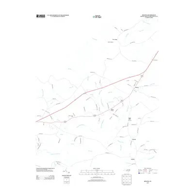
 1980 Funston1985 Print · USGSCoastal development meets the low-lying wetlands of Brunswick County in the early eighties as Boiling Spring Lakes begins to expand. Researchers can trace the layout of residential streets near Brunswick Station and follow the intricate waterways of Orton Creek and Bell Swamp.
 - 1980 Map of Southport, 1985 Print
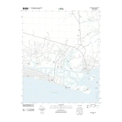
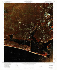 1980 Southport1985 Print · USGSThe Brunswick County coast comes into focus in the early eighties, showing the transition from historic river ports to growing beach communities. Genealogists and historians can trace the foundations of Yaupon Beach, the fortifications at Fort Caswell, and the waterfront at Southport.
 - 1986 Map of Whiteville
 1986 Whiteville1986 Print · USGSSoutheastern North Carolina and the South Carolina borderlands are captured here in the mid-1980s as a landscape of vast swamps and rail towns. Researchers can trace historic rail routes through Chadbourn, locate the namesake Lake Waccamaw, and explore family-named sites like Peacocks.
 - 1986 Map of Myrtle Beach
 1986 Myrtle Beach1986 Print · USGSThe Grand Strand and Brunswick County coast are captured in the mid-eighties before the late-century development boom. Researchers can trace the footprint of the Myrtle Beach Air Force Base and old coastal settlements like Atlantic Beach and Socastee.
 - 1990 Map of Myrtle Beach
 1990 Myrtle Beach1990 Print · USGSThe Grand Strand and the North Carolina borderlands are captured here in the decade before the base closure. Genealogists and historians can trace the development of Myrtle Beach and North Myrtle Beach alongside rural landmarks like Star Bluff Crossroads and Fort Caswell.
 - 1990 Map of Whiteville
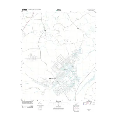
 1990 Whiteville1990 Print · USGSSoutheastern North Carolina and the South Carolina borderlands appear in the late twentieth century, showing a landscape of river-swamps and tobacco towns. Researchers can trace family history through sites like Mount Olive Ch, the Seaboard Coast Line RR, and rural centers like Tabor City.
 - 1990 Map of Southport, 1991 Print
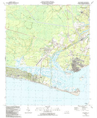 1990 Southport1991 Print · USGSThe Brunswick County coast in the late eighties shows a dynamic mix of military heritage and beach community growth. Researchers can trace the development of Southport and Long Beach or locate family landmarks like St Peters Ch and Bethel Cem.
 - 1990 Map of Funston, 1991 Print
 1990 Funston1991 Print · USGSBrunswick County at the start of the nineties reveals a landscape of growing residential developments and coastal defense. Researchers can trace family sites at Lebanon Ch and Funston or locate the sprawling Military Ocean Terminal Sunny Point.
 - 1990 Map of Bolivia, 1991 Print
 1990 Bolivia1991 Print · USGSIn the early 1990s, the Brunswick County landscape around Bolivia maintained a quiet balance between coastal wetlands and rural growth. Genealogists and local historians can trace family-named sites like Harvell and Lynch alongside Brunswick Community College and Half Hell.
 - 2010 Map of Southport, 2010 Print
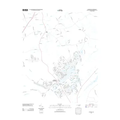
 2010 Southport2010 Print · USGSCovers Boiling Spring Lakes, including Oak Island, Southport, and other nearby areas
 - 2010 Map of Bolivia, 2010 Print
 2010 Bolivia2010 Print · USGSCovers Boiling Spring Lakes, including Bolivia, Piney Grove, and other nearby areas
 - 2011 Map of Funston, 2011 Print
 2011 Funston2011 Print · USGSCovers Boiling Spring Lakes, including Mill Creek, Funston, and other nearby areas
 - 2013 Map of Bolivia, 2013 Print
 2013 Bolivia2013 Print · USGSCovers Boiling Spring Lakes, including Bolivia, Piney Grove, and other nearby areas
 - 2013 Map of Funston, 2013 Print
 2013 Funston2013 Print · USGSCovers Boiling Spring Lakes, including Mill Creek, Funston, and other nearby areas
Showing maps 1-25 of 35
Top cities near Boiling Spring Lakes
- Wilmington historical maps
- Leland historical maps
- Oak Island historical maps
- Carolina Beach historical maps
- Southport historical maps
- Kure Beach historical maps
See more
Frequently asked questions
- What are the different types of historical maps available for Boiling Spring Lakes?
- What is the oldest map of Boiling Spring Lakes?
- Where can I purchase historical maps of Boiling Spring Lakes for my home or office?
- Where can I download high-res historical maps of Boiling Spring Lakes?
- Are there historical topographic maps available for Boiling Spring Lakes?
- Is there historical aerial imagery available for Boiling Spring Lakes?
- Where are historical maps of Boiling Spring Lakes sourced from?