1900s (20th Century) Maps of Lanvale, North Carolina
Explore 9 historic maps of Lanvale from the 1900s (20th Century). These maps offer a rare glimpse into what life looked like during the 1900s — showing old roads, neighborhoods, homes, and landmarks that have changed or disappeared over time.
Whether you're researching your family's past, planning a metal detecting trip, or studying how Lanvale's landscape evolved across the 1900s, these high-resolution maps are a powerful tool for exploring the history of this region.
- Focus on a specific era: All maps on this page are from the 1900s, giving you a focused view of this time period.
- See what’s changed: Compare century-old streets, trails, and buildings to today's modern landscape using overlays and satellite layers.
- Research with precision: Use these maps for genealogy, historical research, land use analysis, or educational projects.
- View, download, or print: Maps are fully viewable online in high resolution, and can be downloaded or printed for your own records.
Start exploring Lanvale's history through authentic maps from the 1900s. This is your window into the past.
Lanvale, NC maps
(9)- 1943 Map of Winnabow, 1962 Print
 1943 Winnabow1962 Print · USGSCoastal North Carolina's rural interior comes into focus here during the early 1940s, showing a landscape defined by timber, swamps, and small community hubs. Researchers can trace family history through old landmarks like Bell Swamp Sch, Benton Cem, and the Abandoned Railroad Grade.2 unique versions available
 - 1944 Map of Winnabow
 1944 Winnabow1944 Print · USGSCoastal Brunswick County is captured here during the mid-forties, showing a landscape defined by tidewater creeks and rural crossroads. Researchers can trace family sites and local landmarks like Winnabow School, Nelson Cem, and the discontinued Wilmington Brunswick and Southern railroad.
 - 1950 Map of Winnabow
 1950 Winnabow1950 Print · USGSCoastal Brunswick County is shown here during a mid-century period of shifting transit as rail service was winding down. Genealogists can locate family landmarks like Dora Benton Cem, Easy Hill, and the Wayside Church near Winnabow.
 - 1953 Map of Florence, 1964 Print
 1953 Florence1964 Print · USGSThe Carolina borderlands in the mid-fifties were a landscape of vast river swamps and rising rail towns. Trace the legacy of the Seaboard Air Line through Florence or explore the wetlands surrounding Lake Waccamaw and the Green Swamp.3 unique versions available
 - 1954 Map of Florence
 1954 Florence1954 Print · USGSThe Carolinas borderlands come alive in the early fifties, showing the vital rail-and-river networks of the coastal plain. Genealogists can trace family footprints across the Green Swamp or through settlements like Red Springs, Chadbourn, and McColl.
 - 1980 Map of Winnabow, 1985 Print
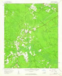
 1980 Winnabow1985 Print · USGSIn the early 1980s, the Brunswick County coastal plain remained a patchwork of dense timber and quiet settlements. Researchers can trace rural property boundaries and old community hubs like Winnabow, Lanvale, and the winding banks of Town Creek.
 - 1986 Map of Whiteville
 1986 Whiteville1986 Print · USGSSoutheastern North Carolina and the South Carolina borderlands are captured here in the mid-1980s as a landscape of vast swamps and rail towns. Researchers can trace historic rail routes through Chadbourn, locate the namesake Lake Waccamaw, and explore family-named sites like Peacocks.
 - 1990 Map of Whiteville
 1990 Whiteville1990 Print · USGSSoutheastern North Carolina and the South Carolina borderlands appear in the late twentieth century, showing a landscape of river-swamps and tobacco towns. Researchers can trace family history through sites like Mount Olive Ch, the Seaboard Coast Line RR, and rural centers like Tabor City.
 - 1990 Map of Winnabow, 1991 Print
 1990 Winnabow1991 Print · USGSCoastal Brunswick County comes into focus in this late-century survey of the terrain surrounding Town Creek and Leland. Researchers can trace old transportation routes and community landmarks like the Old Railroad Grade, Winnabow Airport, and Damascus Rd Ch.2 unique versions available
End of results
Showing maps 1-9 of 9
Top cities near Lanvale
- Wilmington historical maps
- Leland historical maps
- Boiling Spring Lakes historical maps
- Carolina Beach historical maps
- Southport historical maps
- Kure Beach historical maps
See more
Frequently asked questions
- What are the different types of historical maps available for Lanvale?
- What is the oldest map of Lanvale?
- Where can I purchase historical maps of Lanvale for my home or office?
- Where can I download high-res historical maps of Lanvale?
- Are there historical topographic maps available for Lanvale?
- Is there historical aerial imagery available for Lanvale?
- Where are historical maps of Lanvale sourced from?