Old Maps of South Hominy, North Carolina for Metal Detecting
Plan your next treasure hunt with 17 historic maps of South Hominy. Find old homesites, ghost towns, trails, and gathering spots that may be lost to time — perfect for identifying promising metal detecting locations.
- Locate forgotten sites: Uncover places like long-lost settlements, abandoned rail lines, or gathering spots.
- Plan better hunts: Use map overlays combined with LiDAR or satellite views to narrow in on historically rich areas.
- Made for detectorists: Thousands of hobbyists use these maps to discover relics, coins, and hidden history.
Use these historic maps to boost your research and find new opportunities beneath the surface of South Hominy.
South Hominy, NC maps
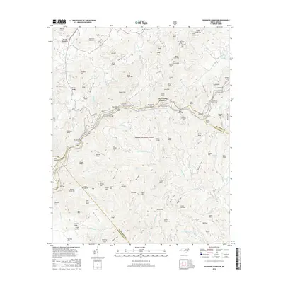
(17)- 1905 Map of Pisgah, 1956 Print
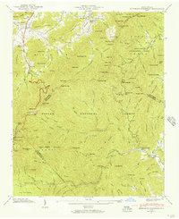
 1905 Pisgah1956 Print · USGSThe North Carolina high country around the turn of the century reveals a land of timber tracts and emerging mountain retreats. Genealogists and hikers can trace early routes to Buck Spring Lodge, follow the Southern RR tracks, and locate vanished settlements like Angeline and Calhoun.
 - 1906 Map of Pisgah, 1934 Print
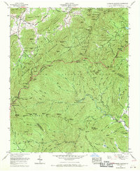
 1906 Pisgah1934 Print · USGSThe Blue Ridge highlands at the turn of the century reveal a landscape of mountain river valleys and early timber frontiers. Genealogists and historians can trace family-named bridges and crossings like Graham Bridge or locate vanished settlements such as Grange and Retreat.2 unique versions available
 - 1936 Map of Dunsmore Mountain
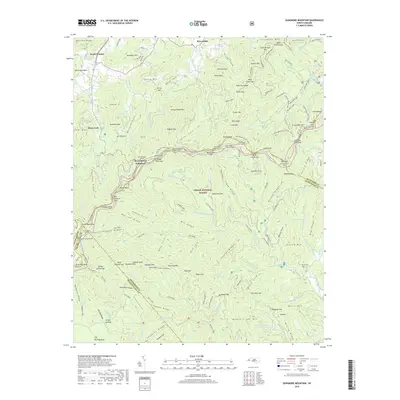
 1936 Dunsmore Mountain1936 Print · USGSThe Pisgah National Forest region comes alive in the mid-1930s, showing a landscape of remote mountain churches and early forest management. Genealogists can trace family landmarks like Kelly Cem, Stony Fork Sch, and the high-elevation Buck Spring Lodge.
 - 1942 Map of Dunsmore Mountain, 1957 Print
 1942 Dunsmore Mountain1957 Print · USGSThe high peaks and deep coves of the Pisgah National Forest are meticulously mapped here in the early 1940s. Genealogists and local historians can locate early landmarks such as Buck Spring Lodge, the Kelly Cem, and Pisgah Ch.2 unique versions available
 - 1943 Map of Dunsmore Mountain
 1943 Dunsmore Mountain1943 Print · USGSThe high peaks of the Blue Ridge were a focus of federal forest management and early recreation during the early 1940s. Genealogists and hikers can trace the geography of Buck Spring Lodge, The Pink Beds, and the Kelly Cem.
 - 1955 Map of Knoxville
 1955 Knoxville1955 Print · USGSThe Southern Appalachians and the Smoky Mountains are shown here at a peak of mid-century development and conservation. Genealogists and historians can trace the early road networks connecting Gatlinburg, Waynesville, and the Cherokee Indian Reservation across the high ridges.
 - 1957 Map of Knoxville, 1966 Print
 1957 Knoxville1966 Print · USGSThe Southern Appalachians of Tennessee and North Carolina are mapped here during the mid-twentieth century as new highways reached the high country. Genealogists and historians can trace the topography between Knoxville and Asheville, locating family landmarks near Fontana Lake or along the Blue Ridge Parkway.4 unique versions available
 - 1960 Map of Knoxville
 1960 Knoxville1960 Print · USGSThe Southern Appalachians come alive in the 1950s, showing the intersection of new national park tourism and deep-rooted mountain industry. Trace old rail lines like the Clinchfield RR and find high-altitude landmarks from Mt Le Conte to the Cherokee Indian Reservation.2 unique versions available
 - 1964 Map of Knoxville
 1964 Knoxville1964 Print · USGSThe Southern Appalachians and Great Smokies are captured here during the mid-sixties, showing the rugged borderlands of Tennessee and North Carolina. Researchers can trace historic mountain routes like U S 441, the expanse of Pisgah National Forest, and the growing footprints of Asheville and Knoxville.
 - 1967 Map of Dunsmore Mountain, 1970 Print
 1967 Dunsmore Mountain1970 Print · USGSThe high ridges of the Pisgah mountains appear in the late 1960s as a complex network of forest experimental grounds and wildlife management areas. Genealogists and hikers can trace the Blue Ridge Parkway past Mt Pisgah Church and the Kelley Cem.3 unique versions available
 - 1986 Map of Hendersonville
 1986 Hendersonville1986 Print · USGSThe Blue Ridge foothills of North and South Carolina are documented here in the mid-eighties as modern highways began to reshape mountain travel. Local historians can trace the paths of the Southern Railway through Hendersonville or locate landmarks like Looking Glass Rock and Inman Mills.2 unique versions available
 - 1997 Map of Dunsmore Mountain, 2001 Print
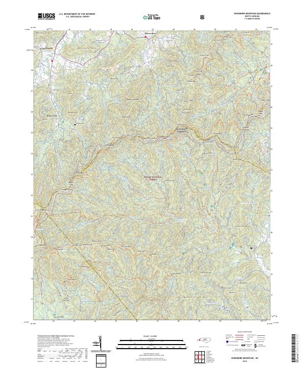
 1997 Dunsmore Mountain2001 Print · USGSThe high ridges and deep gaps of the Blue Ridge south of Asheville are shown here in the late twentieth century. Genealogists and hikers can trace old mountain congregations at Mt Pisgah Church or find historic burial sites like Stony Fork Cem and Stuart Cem.
 - 2011 Map of Dunsmore Mountain, 2011 Print
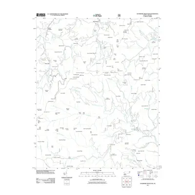 2011 Dunsmore Mountain2011 Print · USGSCovers South Hominy, including Bent Creek, Stony Fork, and other nearby areas
 - 2013 Map of Dunsmore Mountain, 2013 Print
 2013 Dunsmore Mountain2013 Print · USGSCovers South Hominy, including Bent Creek, Stony Fork, and other nearby areas
 - 2016 Map of Dunsmore Mountain, 2016 Print
 2016 Dunsmore Mountain2016 Print · USGSCovers South Hominy, including Bent Creek, Stony Fork, and other nearby areas
 - 2019 Map of Dunsmore Mountain, 2019 Print
 2019 Dunsmore Mountain2019 Print · USGSCovers South Hominy, including Bent Creek, Stony Fork, and other nearby areas
 - 2022 Map of Dunsmore Mountain, 2022 Print
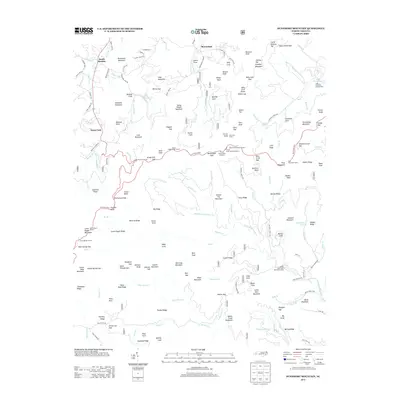
 2022 Dunsmore Mountain2022 Print · USGSThe high ridges of the Blue Ridge southwest of Asheville are captured here in the early twenty-first century, showing the intersection of four North Carolina counties. Local historians and hikers can trace family sites like O'Kelley Cem and the Stuart Cem or explore the extensive trail systems near Lake Powhatan and the Blue Ridge Parkway.
End of results
Showing maps 1-17 of 17
Top cities near South Hominy
- Asheville historical maps
- Fletcher historical maps
- Brevard historical maps
- Mills River historical maps
- Royal Pines historical maps
- Canton historical maps
See more
Frequently asked questions
- What are the different types of historical maps available for South Hominy?
- What is the oldest map of South Hominy?
- Where can I purchase historical maps of South Hominy for my home or office?
- Where can I download high-res historical maps of South Hominy?
- Are there historical topographic maps available for South Hominy?
- Is there historical aerial imagery available for South Hominy?
- Where are historical maps of South Hominy sourced from?