1900s (20th Century) Maps of Craven County, North Carolina
Explore 66 historic maps of Craven County from the 1900s (20th Century). These maps offer a rare glimpse into what life looked like during the 1900s — showing old roads, neighborhoods, homes, and landmarks that have changed or disappeared over time.
Whether you're researching your family's past, planning a metal detecting trip, or studying how Craven County's landscape evolved across the 1900s, these high-resolution maps are a powerful tool for exploring the history of this region.
- Focus on a specific era: All maps on this page are from the 1900s, giving you a focused view of this time period.
- See what’s changed: Compare century-old streets, trails, and buildings to today's modern landscape using overlays and satellite layers.
- Research with precision: Use these maps for genealogy, historical research, land use analysis, or educational projects.
- View, download, or print: Maps are fully viewable online in high resolution, and can be downloaded or printed for your own records.
Start exploring Craven County's history through authentic maps from the 1900s. This is your window into the past.
Craven County, NC maps
(66)- 1901 Map of New Bern, 1961 Print
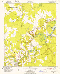
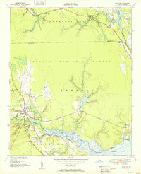
 1901 New Bern1961 Print · USGSCoastal North Carolina at the turn of the century is a world of river traffic and rail expansion centered on New Bern. Genealogists and local historians can trace old river landings, ferries like Nelsons Old Ferry, and early rail stops at Rhems and Tuscarora.2 unique versions available
 - 1902 Map of Ayden, 1962 Print
 1902 Ayden1962 Print · USGSCoastal plains and swampy bottomlands at the turn of the century reveal a landscape reliant on river transport and early rail. Genealogists can trace family-named river landings like Biddle Ldg. and Pearce Ldg. or follow the Atlantic Coast Line through Ayden.2 unique versions available
 - 1902 Map of Vanceboro, 1968 Print
 1902 Vanceboro1968 Print · USGSCoastal North Carolina at the turn of the century was a landscape of deep swamps and river landings. Genealogists and historians can trace timber tramroads through the Big Pocoson and locate family-named landings like Heath Ldg. and Ipock Ldg. along the Neuse River.
 - 1903 Map of New Bern, 1935 Print
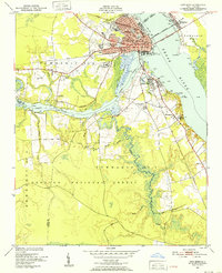
 1903 New Bern1935 Print · USGSCoastal North Carolina thrived on river traffic and rail expansion during the first years of the new century. Genealogists and historians can trace the foundations of New Bern and James City alongside early river crossings like Streets Ferry and Nelsons Old Ferry.2 unique versions available
 - 1903 Map of Trent River, 1961 Print
 1903 Trent River1961 Print · USGSCoastal North Carolina at the turn of the century reveals a landscape defined by river landings and dense pocosin swamps. Genealogists can trace family connections through river landmarks like Murrill Landing or the crossroads at Phillips Crossroads and Olivers.2 unique versions available
 - 1904 Map of Ayden
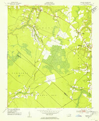
 1904 Ayden1904 Print · USGSCoastal plain life at the dawn of the twentieth century revolved around the river bends and newly laid tracks of the Atlantic Coast Line. Researchers can trace ancestral landings like Village Ldg. and Pearce Ldg. or locate vanished sites like Honolulu and Redalia.4 unique versions available
 - 1904 Map of Trent River, 1936 Print
 1904 Trent River1936 Print · USGSJones and Craven Counties are defined by riverine trade and timber at the turn of the century. Genealogists and historians can trace family-named sites like Fosque Landing and Phillips Crossroads or the path of the Atlantic and North Carolina railroad.3 unique versions available
 - 1904 Map of Vanceboro, 1936 Print
 1904 Vanceboro1936 Print · USGSCoastal North Carolina at the turn of the century shows a landscape dominated by vast wetlands and the early timber industry. Researchers can trace historic river landings like Vanceboro Ldg. and Wilkes Ldg. or follow the old Tramroad routes through the Big Pocoson.
 - 1905 Map of Vanceboro, 1945 Print
 1905 Vanceboro1945 Print · USGSEastern North Carolina at the turn of the century is a landscape of expansive wetlands and river commerce. Genealogists and historians can trace the early timber industry through networks of Tramroad routes and find long-established river landings like Heath Ldg. and Ipock Ldg. along the Neuse River.
 - 1942 Map of Maysville
 1942 Maysville1942 Print · USGSCoastal North Carolina during the early years of the war is captured here through its networks of swamp forests and river settlements. Genealogists and local historians can trace the rural landscape through White Oak Sch, the Hadnot Ch, and rail stops along the Atlantic Coast Line Railroad.
 - 1948 Map of Maysville
 1948 Maysville1948 Print · USGSCoastal North Carolina's river-fed lowlands come to life in this late-forties survey of the Jones and Onslow county borderlands. Genealogists and local historians can trace the rural landscape from Polloksville down to Stella, locating landmarks like Tabernacle Sch and Lees Ch.
 - 1949 Map of Havelock, 1952 Print
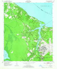 1949 Havelock1952 Print · USGSCoastal North Carolina at the dawn of the fifties shows a landscape of deep pine forests and growing military infrastructure. Researchers can trace the early layout of the Cherry Point Air Station and locate local landmarks like Brice Creek Ch and the Croatan Lookout Tower.4 unique versions available
 - 1949 Map of Merrimon, 1983 Print
 1949 Merrimon1983 Print · USGSCoastal life in mid-century North Carolina centered on the intricate waterways of the Neuse River and the Intracoastal route. Genealogists can trace family footprints through rural landmarks like Reels Chapel, Oak Grove Ch, and the Adams Creek Sch.
 - 1949 Map of Newport, 1983 Print
 1949 Newport1983 Print · USGSCoastal Carteret County in the late 1940s is captured here at the edge of the great coastal forests and tidal rivers. Genealogists can trace the environs of Newport, finding specific local landmarks like Hymans Chapel, the Newport Cem, and the Prison Camp.
 - 1949 Map of Cherry Point, 1984 Print
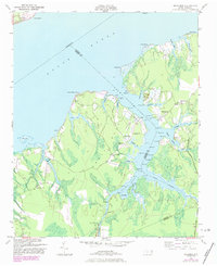
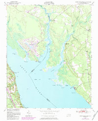
 1949 Cherry Point1984 Print · USGSThe Neuse River shoreline just after World War II shows a landscape defined by the arrival of the Cherry Point Marine Base and the depth of the Croatan National Forest. Genealogists and local historians can trace rural landmarks like Weeping Mary Ch, Cahoogue Creek Sch, and the riverside Minnesott Beach.
 - 1949 Map of Core Creek, 1984 Print
 1949 Core Creek1984 Print · USGSCoastal Carteret County is mapped here in the mid-twentieth century as the maritime and timber economies shaped the shoreline. Genealogists and local researchers can trace early homesteads and community life through Crab Point Village, Tattles Grove Ch, and the Barge Landing Basin.2 unique versions available
 - 1949 Map of Masontown, 1984 Print
 1949 Masontown1984 Print · USGSCoastal North Carolina's pocosin wilderness and expanding rail-side settlements are captured here in the late 1940s. Genealogists and historians can trace the development of Havelock, Masontown, and Camp Bryan along the Atlantic and East Carolina railroad.
 - 1950 Map of Pollocksville, 1952 Print
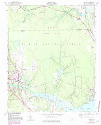
 1950 Pollocksville1952 Print · USGSThe Jones and Craven County line comes alive in the 1950s as a network of river landings and coastal plain settlements. Researchers can trace family roots at Wesley Chapel, locate the old Rocky Run Sch, and follow the Atlantic and East Carolina Railroad through the Croatan National Forest.3 unique versions available
 - 1950 Map of New Bern, 1952 Print
 1950 New Bern1952 Print · USGSCoastal North Carolina comes alive in this mid-century portrait of the riverfront and surrounding forest. Genealogists can trace family names across Evergreen Cem and Greenwood Cem, or explore neighborhoods like James City and De Graffenried Park.5 unique versions available
 - 1950 Map of Edward, 1953 Print
 1950 Edward1953 Print · USGSCoastal North Carolina's rural interior comes into focus during the early fifties, showing the rail-dependent hamlets of Beaufort and Craven counties. Genealogists can locate family landmarks like Smyrna Ch, Coxs Crossroads, and the post office at Blounts Creek.3 unique versions available
 - 1950 Map of Upper Broad Creek, 1984 Print
 1950 Upper Broad Creek1984 Print · USGSCoastal North Carolina comes alive in this survey of the riverbanks where Craven and Pamlico counties meet. Genealogists can trace family names through Cayton Cem and Lees Landing, or locate old commerce at Scotts Store.2 unique versions available
 - 1951 Map of Newport
 1951 Newport1951 Print · USGSCoastal North Carolina during the early fifties reveals a landscape of tidal rivers and timberlands within the Croatan National Forest. Researchers can trace old family sites and local landmarks like Hymans Chapel, the Prison Camp, and the historic rail line at Newport.3 unique versions available
 - 1951 Map of Core Creek
 1951 Core Creek1951 Print · USGSCoastal Carteret County in the early fifties shows a landscape defined by the Intracoastal Waterway and the Croatan National Forest. Genealogists can locate family landmarks like Crab Point Village and several country churches, including Live Oak Grove Ch and Freewill Ch.3 unique versions available
 - 1951 Map of Merrimon
 1951 Merrimon1951 Print · USGSCoastal North Carolina's maritime character is on full display in the mid-century as the Intracoastal Waterway cuts through the lowlands of Craven and Carteret counties. Genealogy researchers can trace family landmarks and rural community centers like Reels Chapel, Merrimon Ch, and Adams Creek Sch.2 unique versions available
 - 1951 Map of Cherry Point
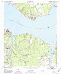
 1951 Cherry Point1951 Print · USGSCoastal Craven County comes alive in the early fifties as military installations and riverfront camps began to define the Neuse River shoreline. Genealogists and historians can trace the footprint of the US Marine Corps Air Station Cherry Point or locate local landmarks like Weeping Mary Ch and Minnesott Beach.2 unique versions available
Showing maps 1-25 of 66
Top cities of Craven County
- New Bern historical maps
- Havelock historical maps
- James City historical maps
- Trent Woods historical maps
- Brices Creek historical maps
- River Bend historical maps
See more
Frequently asked questions
- What are the different types of historical maps available for Craven County?
- What is the oldest map of Craven County?
- Where can I purchase historical maps of Craven County for my home or office?
- Where can I download high-res historical maps of Craven County?
- Are there historical topographic maps available for Craven County?
- Is there historical aerial imagery available for Craven County?
- Where are historical maps of Craven County sourced from?