1990s Maps of Craven County, North Carolina
Explore 15 historic maps of Craven County from the 1990s. These maps offer a rare glimpse into what life looked like during the 1990s — showing old roads, neighborhoods, homes, and landmarks that have changed or disappeared over time.
Whether you're researching your family's past, planning a metal detecting trip, or studying how Craven County's landscape evolved across the 1990s, these high-resolution maps are a powerful tool for exploring the history of this region.
- Focus on a specific era: All maps on this page are from the 1990s, giving you a focused view of this time period.
- See what’s changed: Compare century-old streets, trails, and buildings to today's modern landscape using overlays and satellite layers.
- Research with precision: Use these maps for genealogy, historical research, land use analysis, or educational projects.
- View, download, or print: Maps are fully viewable online in high resolution, and can be downloaded or printed for your own records.
Start exploring Craven County's history through authentic maps from the 1990s. This is your window into the past.
Craven County, NC maps
(15)- 1990 Map of Morehead City
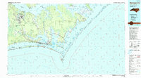 1990 Morehead City1990 Print · USGSCoastal Carteret County at the start of the nineties reveals a landscape balanced between military installations and expansive national seashores. Trace the shoreline from Cherry Point down to the Lighthouse at Cape Lookout and the historic streets of Beaufort.
 - 1991 Map of New River
 1991 New River1991 Print · USGSCoastal Onslow and Pender counties appear here in the early 1990s as the military and maritime economies matured. Researchers can trace the expansive Camp Lejeune grounds and find rural landings like Fulcher Landing and Sanders Landing.
 - 1994 Map of Masontown, 1997 Print
 1994 Masontown1997 Print · USGSCoastal North Carolina at the end of the twentieth century shows a landscape of deep swamps and managed forests. Genealogists and historians can locate residential pockets like Masontown and Holly Springs or trace the early paths of Nine Foot Road and the Atlantic and East Carolina rail line.2 unique versions available
 - 1994 Map of Newport, 1997 Print
 1994 Newport1997 Print · USGSThe coastal forest and river lowlands of eastern North Carolina are captured here in the mid-1990s. Researchers can trace the East Carolina Railroad through Newport and locate historical landmarks like Hymans Chapel and the Prison Camp near the river.
 - 1994 Map of Pollocksville, 1997 Print
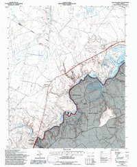 1994 Pollocksville1997 Print · USGSJones and Craven counties appear here in the mid-nineties as the Trent River landscape balances forest conservation and rural growth. Researchers can locate family landmarks like Simmons Corner and Jones Corner alongside historic sites like Wesley Chapel.2 unique versions available
 - 1994 Map of Catfish Lake, 1997 Print
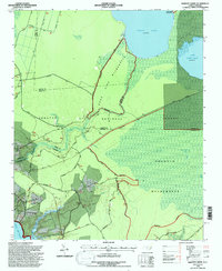
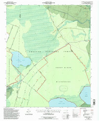 1994 Catfish Lake1997 Print · USGSThe Croatan National Forest wilderness in the mid-1990s is captured here, showing the swampy pocosin terrain and natural lakes. Researchers can trace the boundaries of the Sheep Ridge Wilderness and primitive routes like Moyle Road.2 unique versions available
 - 1994 Map of Havelock, 1997 Print
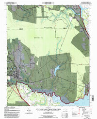
 1994 Havelock1997 Print · USGSCoastal North Carolina's military and forest lands meet in the mid-nineties, where the sprawling U.S. Marine Corps Air Station Cherry Point sits alongside the Croatan National Forest. Researchers can trace the Atlantic and East Carolina rail line through Riverdale or locate historic sites like the Brice Creek Ch.
 - 1994 Map of Core Creek, 1997 Print
 1994 Core Creek1997 Print · USGSCoastal Carteret County is mapped here in the mid-nineties, showing the critical junction where the Intracoastal Waterway meets the Newport River. Local historians can trace established communities like Crab Point Village and Bayview alongside rural landmarks like Graham Chapel.2 unique versions available
 - 1994 Map of New Bern, 1997 Print
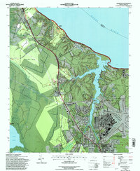
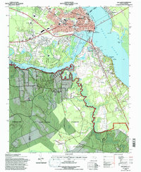 1994 New Bern1997 Print · USGSThe confluence of the Neuse and Trent Rivers defines this coastal landscape in the mid-nineties. Genealogists can trace family names through the National Cemetery and St Pauls Church or explore the riverfront at Bridgeton and James City.3 unique versions available
 - 1994 Map of Upper Broad Creek, 1997 Print
 1994 Upper Broad Creek1997 Print · USGSThe Pamlico County riverfront in the mid-1990s shows a landscape of tidal creeks and evolving coastal settlements. Researchers can locate historic rural centers like Scotts Store and Amity Ch or trace the shoreline from McCotter Pt to Kendall Beach.
 - 1994 Map of Cherry Point, 1997 Print
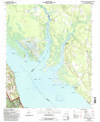
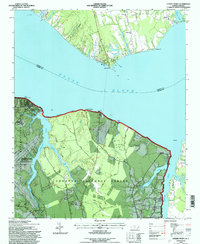 1994 Cherry Point1997 Print · USGSThe Neuse River shoreline in the mid-1990s showcases the sprawling US Marine Corps Air Station Cherry Point and the Croatan National Forest. Researchers can locate riverside landmarks like Minnesott Beach, Camp Seagull, and rural sites like Mt Zion Ch.
 - 1994 Map of Hadnot Creek, 1997 Print
 1994 Hadnot Creek1997 Print · USGSCoastal North Carolina wetlands and military grounds are captured in the mid-nineties, showing the intersection of the Croatan National Forest and Camp Lejeune. Genealogists and local historians can locate Hadnot Ch and traces of family cemeteries near the White Oak River.2 unique versions available
 - 1997 Map of Wilmar, 2000 Print
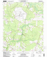 1997 Wilmar2000 Print · USGSThe rural borders of Pitt, Beaufort, and Craven counties are captured here in the late nineties, featuring the expansive VOICE OF AMERICA (Site B) facility. Genealogists and local historians can locate several rural congregations, including Oak Grove Ch and Tabernacle Ch, plus numerous unnamed cemeteries.
 - 1997 Map of Hackney, 2001 Print
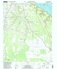 1997 Hackney2001 Print · USGSCoastal North Carolina lowlands appear in detail near the turn of the millennium, showing a landscape defined by water and wetlands. Genealogists can trace family landmarks like Edwards Cem and local schoolhouses like Maple Grove Sch or Claybottom Sch.
 - 1998 Map of Ernul, 2001 Print
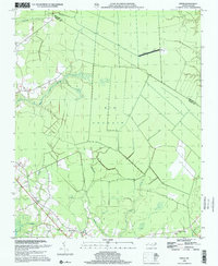 1998 Ernul2001 Print · USGSCoastal plain wetlands and small rural congregations define this pocket of Craven County at the close of the twentieth century. Researchers can trace family sites at Ernul or locate landmarks like Macedonia Ch and the expansive Big Pocosin.
End of results
Showing maps 1-15 of 15
Top cities of Craven County
- New Bern historical maps
- Havelock historical maps
- James City historical maps
- Trent Woods historical maps
- Brices Creek historical maps
- River Bend historical maps
See more
Frequently asked questions
- What are the different types of historical maps available for Craven County?
- What is the oldest map of Craven County?
- Where can I purchase historical maps of Craven County for my home or office?
- Where can I download high-res historical maps of Craven County?
- Are there historical topographic maps available for Craven County?
- Is there historical aerial imagery available for Craven County?
- Where are historical maps of Craven County sourced from?