1970s Maps of New Bern, North Carolina
Explore 3 historic maps of New Bern from the 1970s. These maps offer a rare glimpse into what life looked like during the 1970s — showing old roads, neighborhoods, homes, and landmarks that have changed or disappeared over time.
Whether you're researching your family's past, planning a metal detecting trip, or studying how New Bern's landscape evolved across the 1970s, these high-resolution maps are a powerful tool for exploring the history of this region.
- Focus on a specific era: All maps on this page are from the 1970s, giving you a focused view of this time period.
- See what’s changed: Compare century-old streets, trails, and buildings to today's modern landscape using overlays and satellite layers.
- Research with precision: Use these maps for genealogy, historical research, land use analysis, or educational projects.
- View, download, or print: Maps are fully viewable online in high resolution, and can be downloaded or printed for your own records.
Start exploring New Bern's history through authentic maps from the 1970s. This is your window into the past.
New Bern, NC maps
(3)- 1972 Map of Beaufort, 1975 Print
 1972 Beaufort1975 Print · USGSThe North Carolina coast in the early seventies shows a landscape defined by massive military bases and coastal sounds. Trace rural family roots at Sarecta and Catherine Lake or explore the barrier islands of the Cape Lookout National Seashore.
 - 1978 Map of Askin
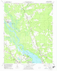 1978 Askin1978 Print · USGSCoastal Carolina river life comes into focus in the late seventies as the riverfront transitions between industry and recreation. Trace family roots at Beech Grove Ch, locate the old Streets Ferry crossing, or explore the rails through Askin and Bridgeton.2 unique versions available
 - 1978 Map of Jasper, 1979 Print
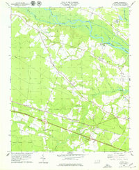 1978 Jasper1979 Print · USGSCoastal plain settlements and timberlands thrive along the Neuse River and the Atlantic and East Carolina rail line in the late seventies. Researchers can trace rural lineages through sites like Jasper, Hymans, and historic churches like St Marks Ch.2 unique versions available
End of results
Showing maps 1-3 of 3
Top cities near New Bern
- Havelock historical maps
- James City historical maps
- Trent Woods historical maps
- Brices Creek historical maps
- River Bend historical maps
- Fairfield Harbour historical maps
See more
Top neighborhoods of New Bern
- Craven Terrace historical maps
- Southgate historical maps
- Washington Forks historical maps
- Chelsea Square historical maps
- Colony Estates historical maps
- Cypress Shores historical maps
See more
Frequently asked questions
- What are the different types of historical maps available for New Bern?
- What is the oldest map of New Bern?
- Where can I purchase historical maps of New Bern for my home or office?
- Where can I download high-res historical maps of New Bern?
- Are there historical topographic maps available for New Bern?
- Is there historical aerial imagery available for New Bern?
- Where are historical maps of New Bern sourced from?