1900s (20th Century) Maps of New Bern, North Carolina
Explore 28 historic maps of New Bern from the 1900s (20th Century). These maps offer a rare glimpse into what life looked like during the 1900s — showing old roads, neighborhoods, homes, and landmarks that have changed or disappeared over time.
Whether you're researching your family's past, planning a metal detecting trip, or studying how New Bern's landscape evolved across the 1900s, these high-resolution maps are a powerful tool for exploring the history of this region.
- Focus on a specific era: All maps on this page are from the 1900s, giving you a focused view of this time period.
- See what’s changed: Compare century-old streets, trails, and buildings to today's modern landscape using overlays and satellite layers.
- Research with precision: Use these maps for genealogy, historical research, land use analysis, or educational projects.
- View, download, or print: Maps are fully viewable online in high resolution, and can be downloaded or printed for your own records.
Start exploring New Bern's history through authentic maps from the 1900s. This is your window into the past.
New Bern, NC maps
(28)- 1901 Map of New Bern, 1961 Print
 1901 New Bern1961 Print · USGSCoastal North Carolina at the turn of the century is a world of river traffic and rail expansion centered on New Bern. Genealogists and local historians can trace old river landings, ferries like Nelsons Old Ferry, and early rail stops at Rhems and Tuscarora.2 unique versions available
 - 1903 Map of New Bern, 1935 Print
 1903 New Bern1935 Print · USGSCoastal North Carolina thrived on river traffic and rail expansion during the first years of the new century. Genealogists and historians can trace the foundations of New Bern and James City alongside early river crossings like Streets Ferry and Nelsons Old Ferry.2 unique versions available
 - 1942 Map of Maysville
 1942 Maysville1942 Print · USGSCoastal North Carolina during the early years of the war is captured here through its networks of swamp forests and river settlements. Genealogists and local historians can trace the rural landscape through White Oak Sch, the Hadnot Ch, and rail stops along the Atlantic Coast Line Railroad.
 - 1948 Map of Maysville
 1948 Maysville1948 Print · USGSCoastal North Carolina's river-fed lowlands come to life in this late-forties survey of the Jones and Onslow county borderlands. Genealogists and local historians can trace the rural landscape from Polloksville down to Stella, locating landmarks like Tabernacle Sch and Lees Ch.
 - 1949 Map of Havelock, 1952 Print
 1949 Havelock1952 Print · USGSCoastal North Carolina at the dawn of the fifties shows a landscape of deep pine forests and growing military infrastructure. Researchers can trace the early layout of the Cherry Point Air Station and locate local landmarks like Brice Creek Ch and the Croatan Lookout Tower.4 unique versions available
 - 1950 Map of Pollocksville, 1952 Print
 1950 Pollocksville1952 Print · USGSThe Jones and Craven County line comes alive in the 1950s as a network of river landings and coastal plain settlements. Researchers can trace family roots at Wesley Chapel, locate the old Rocky Run Sch, and follow the Atlantic and East Carolina Railroad through the Croatan National Forest.3 unique versions available
 - 1950 Map of New Bern, 1952 Print
 1950 New Bern1952 Print · USGSCoastal North Carolina comes alive in this mid-century portrait of the riverfront and surrounding forest. Genealogists can trace family names across Evergreen Cem and Greenwood Cem, or explore neighborhoods like James City and De Graffenried Park.5 unique versions available
 - 1950 Map of Upper Broad Creek, 1984 Print
 1950 Upper Broad Creek1984 Print · USGSCoastal North Carolina comes alive in this survey of the riverbanks where Craven and Pamlico counties meet. Genealogists can trace family names through Cayton Cem and Lees Landing, or locate old commerce at Scotts Store.2 unique versions available
 - 1951 Map of Upper Broad Creek
 1951 Upper Broad Creek1951 Print · USGSThe Neuse River and its tidal creeks define the Craven and Pamlico county line in the early fifties. Genealogists can trace family names at Cayton Cem, Scotts Store, and Lees Landing along the marshy reaches of Goose Creek.2 unique versions available
 - 1953 Map of Rocky Mount, 1964 Print
 1953 Rocky Mount1964 Print · USGSEastern North Carolina in the mid-fifties is defined by its deep river basins and the vast wetlands of the Tidewater. Genealogists can trace family roots through hubs like Kinston and New Bern or explore the wilderness of Pettigrew State Park and Lake Mattamuskeet.4 unique versions available
 - 1953 Map of Beaufort, 1965 Print
 1953 Beaufort1965 Print · USGSThe North Carolina coastline in the mid-fifties reveals an era of massive military expansion alongside traditional maritime life. Genealogists can trace family names and small settlements from Sealevel to Sneads Ferry or locate landmarks like Fort Macon.3 unique versions available
 - 1954 Map of Rocky Mount
 1954 Rocky Mount1954 Print · USGSEastern North Carolina is mapped in the mid-fifties, showing a landscape of sounds, swamps, and steam-era rail lines. Genealogists can trace the rural road networks and rail spurs connecting towns like Tarboro, Greenville, and the remote Columbia.
 - 1954 Map of Beaufort
 1954 Beaufort1954 Print · USGSCoastal North Carolina in the mid-fifties reveals a landscape of strategic military installations, sprawling wetlands, and thriving rail towns. Genealogists and historians can trace the foundations of Wilmington, the rural reaches of Duplin County, and shoreline landmarks like Cape Lookout and Carolina Beach.
 - 1972 Map of Beaufort, 1975 Print
 1972 Beaufort1975 Print · USGSThe North Carolina coast in the early seventies shows a landscape defined by massive military bases and coastal sounds. Trace rural family roots at Sarecta and Catherine Lake or explore the barrier islands of the Cape Lookout National Seashore.
 - 1978 Map of Askin
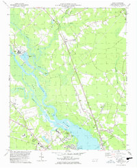 1978 Askin1978 Print · USGSCoastal Carolina river life comes into focus in the late seventies as the riverfront transitions between industry and recreation. Trace family roots at Beech Grove Ch, locate the old Streets Ferry crossing, or explore the rails through Askin and Bridgeton.2 unique versions available
 - 1978 Map of Jasper, 1979 Print
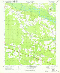 1978 Jasper1979 Print · USGSCoastal plain settlements and timberlands thrive along the Neuse River and the Atlantic and East Carolina rail line in the late seventies. Researchers can trace rural lineages through sites like Jasper, Hymans, and historic churches like St Marks Ch.2 unique versions available
 - 1984 Map of Catfish Lake
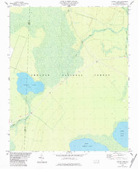 1984 Catfish Lake1984 Print · USGSCoastal North Carolina's pocosin wilderness remains largely untouched in the early eighties as the Croatan National Forest covers the landscape. Researchers can trace the swampy shoreline of Catfish Lake and the branching reaches of Brice Creek.
 - 1985 Map of Morehead City
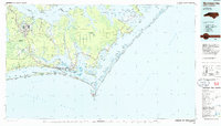 1985 Morehead City1985 Print · USGSCoastal Carteret County in the 1980s reveals a transition from military installations and industrial hubs to protected wilderness along the Outer Banks. Researchers can trace the development of Morehead City and Beaufort or explore the remote stretches of Shackleford Banks and Harkers Island.
 - 1985 Map of Kinston
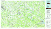 1985 Kinston1985 Print · USGSCoastal plain life and Cold War infrastructure meet in the mid-eighties as the Neuse River winds through agricultural heartlands. Researchers can locate family landmarks like Falling Creek Cem, old milling sites such as Tulls Mill, and the massive Voice of America Radio Towers.2 unique versions available
 - 1985 Map of Bayboro, 1990 Print
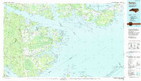 1985 Bayboro1990 Print · USGSCoastal Pamlico and Beaufort counties are shown in the mid-eighties as a maritime landscape of protected wetlands and river-mouth settlements. Researchers can trace the layout of waterfront towns like Oriental, Bayboro, and the historic village of Bath amidst the Pamlico Sound.
 - 1986 Map of New River
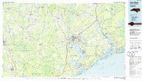 1986 New River1986 Print · USGSCoastal Onslow County in the mid-eighties shows a landscape shaped by military expansion and the preserved wetlands of the Carolina coast. Genealogists and historians can trace the foundations of Jacksonville and small outlying communities like Richlands and Swansboro.
 - 1990 Map of Morehead City
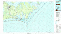 1990 Morehead City1990 Print · USGSCoastal Carteret County at the start of the nineties reveals a landscape balanced between military installations and expansive national seashores. Trace the shoreline from Cherry Point down to the Lighthouse at Cape Lookout and the historic streets of Beaufort.
 - 1991 Map of New River
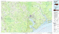 1991 New River1991 Print · USGSCoastal Onslow and Pender counties appear here in the early 1990s as the military and maritime economies matured. Researchers can trace the expansive Camp Lejeune grounds and find rural landings like Fulcher Landing and Sanders Landing.
 - 1994 Map of Pollocksville, 1997 Print
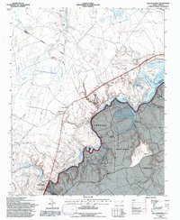 1994 Pollocksville1997 Print · USGSJones and Craven counties appear here in the mid-nineties as the Trent River landscape balances forest conservation and rural growth. Researchers can locate family landmarks like Simmons Corner and Jones Corner alongside historic sites like Wesley Chapel.2 unique versions available
 - 1994 Map of Catfish Lake, 1997 Print
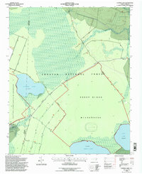 1994 Catfish Lake1997 Print · USGSThe Croatan National Forest wilderness in the mid-1990s is captured here, showing the swampy pocosin terrain and natural lakes. Researchers can trace the boundaries of the Sheep Ridge Wilderness and primitive routes like Moyle Road.2 unique versions available
Showing maps 1-25 of 28
Top cities near New Bern
- Havelock historical maps
- James City historical maps
- Trent Woods historical maps
- Brices Creek historical maps
- River Bend historical maps
- Fairfield Harbour historical maps
See more
Top neighborhoods of New Bern
- Craven Terrace historical maps
- Southgate historical maps
- Washington Forks historical maps
- Chelsea Square historical maps
- Colony Estates historical maps
- Cypress Shores historical maps
See more
Frequently asked questions
- What are the different types of historical maps available for New Bern?
- What is the oldest map of New Bern?
- Where can I purchase historical maps of New Bern for my home or office?
- Where can I download high-res historical maps of New Bern?
- Are there historical topographic maps available for New Bern?
- Is there historical aerial imagery available for New Bern?
- Where are historical maps of New Bern sourced from?