1970s Maps of Cumberland County, North Carolina
Explore 11 historic maps of Cumberland County from the 1970s. These maps offer a rare glimpse into what life looked like during the 1970s — showing old roads, neighborhoods, homes, and landmarks that have changed or disappeared over time.
Whether you're researching your family's past, planning a metal detecting trip, or studying how Cumberland County's landscape evolved across the 1970s, these high-resolution maps are a powerful tool for exploring the history of this region.
- Focus on a specific era: All maps on this page are from the 1970s, giving you a focused view of this time period.
- See what’s changed: Compare century-old streets, trails, and buildings to today's modern landscape using overlays and satellite layers.
- Research with precision: Use these maps for genealogy, historical research, land use analysis, or educational projects.
- View, download, or print: Maps are fully viewable online in high resolution, and can be downloaded or printed for your own records.
Start exploring Cumberland County's history through authentic maps from the 1970s. This is your window into the past.
Cumberland County, NC maps
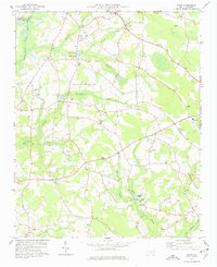
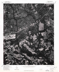
(11)- 1972 Map of Parkton, 1976 Print
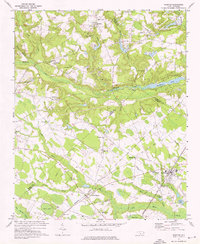 1972 Parkton1976 Print · USGSParkton and the surrounding North Carolina swamps are captured in the early 1970s as the regional rail network still tied together rural communities. Researchers can trace family history through sites like Pittman Grove Ch, McNatts Sta, and the SEABOARD COAST LINE rail corridor.2 unique versions available
 - 1973 Map of Erwin, 1975 Print
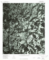
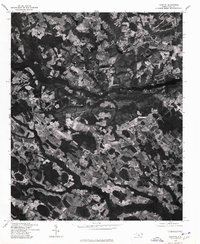
 1973 Erwin1975 Print · USGSHarnett and Cumberland Counties are captured in the early seventies as the Cape Fear and Little Rivers meet amid a landscape of small-town industry. Genealogists can trace family connections through the Averasboro Cem, Turlington Grove Ch, and the streets of Erwin.2 unique versions available
 - 1974 Map of Wade, 1977 Print
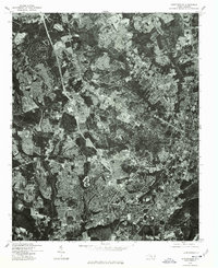
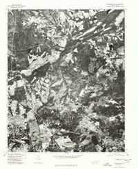
 1974 Wade1977 Print · USGSCumberland County communities like Wade and Godwin are shown in the mid-1970s as they balanced rural tradition with expanding transit corridors. Genealogists and local historians can trace family locations through numerous rural landmarks, including Westminster Cem, Spring Hill Ch, and the Averasboro Battleground Monument.2 unique versions available
 - 1974 Map of Stedman, 1977 Print
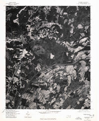
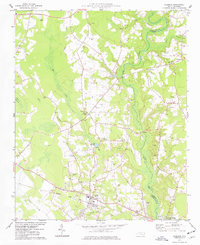 1974 Stedman1977 Print · USGSCumberland County’s coastal plain landscape is captured here in the mid-1970s, as rural communities thrived along the South River and the rail line. Researchers can trace family roots through numerous sites like Bethany Crossroads, Fisher Cem, and Magnolia Ch.2 unique versions available
 - 1974 Map of Mingo, 1977 Print
 1974 Mingo1977 Print · USGSSampson County's rural landscape is mapped here in the mid-seventies, showing a community defined by its sprawling swamp basins and country churches. Genealogists can trace family landmarks like Naylor Cem, Jackson Cem, and the Tart Millpond near the settlement of Mingo.
 - 1976 Map of Vander, 1978 Print
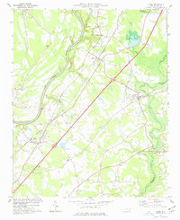
 1976 Vander1978 Print · USGSFayetteville and its eastern outskirts are captured in the mid-seventies, showing the intersection of urban growth and rural landscapes. Researchers can trace land use patterns and property boundaries near Fayetteville and the settlement of Vander.
 - 1976 Map of Fayetteville, 1978 Print
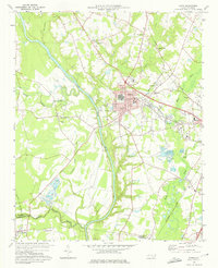
 1976 Fayetteville1978 Print · USGSMid-1970s Cumberland County is documented in this detailed aerial survey showing the rapid suburban growth of the era. Researchers can trace the exact layout of residential streets and land clearing around Fayetteville, Bonnie Doone, and Lakedale.
 - 1976 Map of Slocomb, 1978 Print
 1976 Slocomb1978 Print · USGSCumberland County rural life is captured in the mid-seventies just as the landscape remained defined by timber and traditional farming. Genealogists and land researchers can pinpoint homesteads and property boundaries near the Cape Fear River, Slocomb, and Lane.
 - 1976 Map of Clifdale, 1978 Print
 1976 Clifdale1978 Print · USGSThe area around Clifdale during the mid-seventies is captured here through detailed orthophotography. Genealogists and historians can trace property lines and land use near Clifdale, Caisson Hill, and Route 401.
 - 1976 Map of Parkton, 1978 Print
 1976 Parkton1978 Print · USGSRobeson County agricultural life is frozen in the mid-1970s in this detailed aerial study. Researchers can pinpoint property boundaries and rural development surrounding the towns of Parkton, Lumber Bridge, and Rockfish.
 - 1976 Map of Manchester, 1978 Print
 1976 Manchester1978 Print · USGSThe Fort Bragg military post and nearby Manchester are captured in this mid-seventies aerial survey. Researchers can trace the development of Fort Bragg and explore the residential layouts of Manchester and Twin Lakes.
End of results
Showing maps 1-11 of 11
Top cities of Cumberland County
- Fayetteville historical maps
- Hope Mills historical maps
- Spring Lake historical maps
- Stedman historical maps
- Wade historical maps
- Falcon historical maps
See more
Frequently asked questions
- What are the different types of historical maps available for Cumberland County?
- What is the oldest map of Cumberland County?
- Where can I purchase historical maps of Cumberland County for my home or office?
- Where can I download high-res historical maps of Cumberland County?
- Are there historical topographic maps available for Cumberland County?
- Is there historical aerial imagery available for Cumberland County?
- Where are historical maps of Cumberland County sourced from?