2020s Maps of Corolla, North Carolina
Explore 3 historic maps of Corolla from the 2020s. These maps offer a rare glimpse into what life looked like during the 2020s — showing old roads, neighborhoods, homes, and landmarks that have changed or disappeared over time.
Whether you're researching your family's past, planning a metal detecting trip, or studying how Corolla's landscape evolved across the 2020s, these high-resolution maps are a powerful tool for exploring the history of this region.
- Focus on a specific era: All maps on this page are from the 2020s, giving you a focused view of this time period.
- See what’s changed: Compare century-old streets, trails, and buildings to today's modern landscape using overlays and satellite layers.
- Research with precision: Use these maps for genealogy, historical research, land use analysis, or educational projects.
- View, download, or print: Maps are fully viewable online in high resolution, and can be downloaded or printed for your own records.
Start exploring Corolla's history through authentic maps from the 2020s. This is your window into the past.
Corolla, NC maps
(3)- 2022 Map of Corolla, 2022 Print
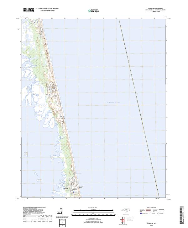 2022 Corolla2022 Print · USGSThe Outer Banks shoreline and Corolla appear here in the early 2020s, showing the dense residential growth along the Currituck Sound. Genealogists and researchers can trace local developments along Sandfiddler Rd and landmarks like Luark Hill or Currituck Beach.
 - 2022 Map of Mossey Islands, 2022 Print
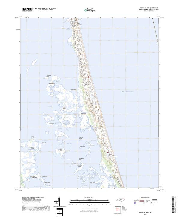 2022 Mossey Islands2022 Print · USGSThe Currituck Banks are shown here in the modern era as a narrow corridor of coastal development and intricate marshlands. Researchers can trace the layout of Currituck Beach or explore the many tidal features like Sanders Creek and Jarvis Channel.
 - 2023 Map of Jarvisburg, 2023 Print
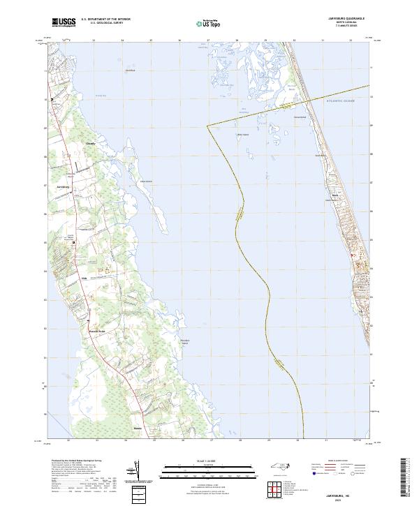 2023 Jarvisburg2023 Print · USGSCoastal Currituck County and the northern barrier islands are detailed here during their modern era of development. Genealogists and local historians can trace family sites like the Barco Family Cem or explore the geography of Jarvisburg, Mamie, and Duck.
End of results
Showing maps 1-3 of 3
Top cities near Corolla
- Kitty Hawk historical maps
- Grandy historical maps
- Southern Shores historical maps
- Duck historical maps
- Coinjock historical maps
Top neighborhoods of Corolla
- Ocean Hills historical maps
- Crown Point historical maps
- Monterey Shores historical maps
- Ocean Sands South historical maps
- Ocean Sands North historical maps
- Pine Island historical maps
See more
Frequently asked questions
- What are the different types of historical maps available for Corolla?
- What is the oldest map of Corolla?
- Where can I purchase historical maps of Corolla for my home or office?
- Where can I download high-res historical maps of Corolla?
- Are there historical topographic maps available for Corolla?
- Is there historical aerial imagery available for Corolla?
- Where are historical maps of Corolla sourced from?