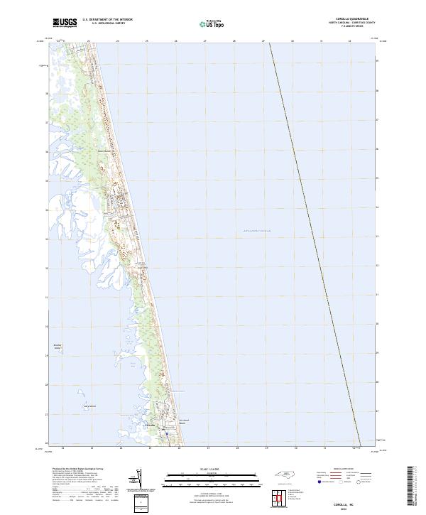
2022 Map of Corolla
USGS Topo · Published 2022About this map
The Outer Banks barrier island system is meticulously detailed here, centered on the coastal settlement of Corolla. This modern survey illustrates the residential expansion along the narrow strip between the Atlantic Ocean and the intricate wetlands of the sound. Streets like Corolla Village Rd and Sandfiddler Rd trace the north-south axis of the peninsula, providing access to Currituck Beach. The landscape is a mix of stabilized dunes like Luark Hill and low-lying estuarine features including Musketo Inlet and Raccoon Bay. To the west, the map documents the isolated terrain of Monkey Island and Mary Island within the Currituck Sound, illustrating the fragile geography where water and sand meet. The dense network of residential lanes such as Albatross Ln and Ocean Pearl Rd reflects the significant development of this coastal area by the early 2020s.
Find a feature on this map
30 named features on this map. Tap any name to fly to it.
Don’t see what you’re looking for? This feature index may not catch every label — zoom into the map to look around manually.
Map Details
Editions of this 2022 Corolla Map
This is the sole edition of this map. No revisions or reprints were ever made.
Other maps of this area

1893 · Virginia Beach
USGS Topo · 1:125,000

1916 · Back Bay
USGS Topo · 1:62,500

1940 · Barco
USGS Topo · 1:62,500

1943 · Back Bay
USGS Topo · 1:62,500

1946 · Eastville
USGS Topo · 1:250,000

1946 · Currituck Sound
USGS Topo · 1:250,000
1954 · Knotts Island
USGS Topo · 1:24,000

1961 · Eastville
USGS Topo · 1:250,000

1966 · Eastville
USGS Topo · 1:250,000
1982 · Barco
USGS Topo · 1:24,000