2020s Maps of Avon, North Carolina
Explore 2 historic maps of Avon from the 2020s. These maps offer a rare glimpse into what life looked like during the 2020s — showing old roads, neighborhoods, homes, and landmarks that have changed or disappeared over time.
Whether you're researching your family's past, planning a metal detecting trip, or studying how Avon's landscape evolved across the 2020s, these high-resolution maps are a powerful tool for exploring the history of this region.
- Focus on a specific era: All maps on this page are from the 2020s, giving you a focused view of this time period.
- See what’s changed: Compare century-old streets, trails, and buildings to today's modern landscape using overlays and satellite layers.
- Research with precision: Use these maps for genealogy, historical research, land use analysis, or educational projects.
- View, download, or print: Maps are fully viewable online in high resolution, and can be downloaded or printed for your own records.
Start exploring Avon's history through authentic maps from the 2020s. This is your window into the past.
Avon, NC maps
(2)- 2022 Map of Buxton OE E, 2022 Print
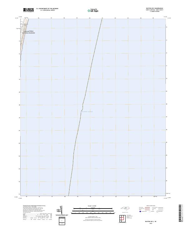 2022 Buxton OE E2022 Print · USGSThe North Carolina Outer Banks meet the sea in this recent coastal survey, where the barrier island faces the open Atlantic Ocean. Researchers can trace the protected boundaries of the Cape Hatteras National Seashore along the sands of Hatteras Island.
 - 2022 Map of Buxton, 2022 Print
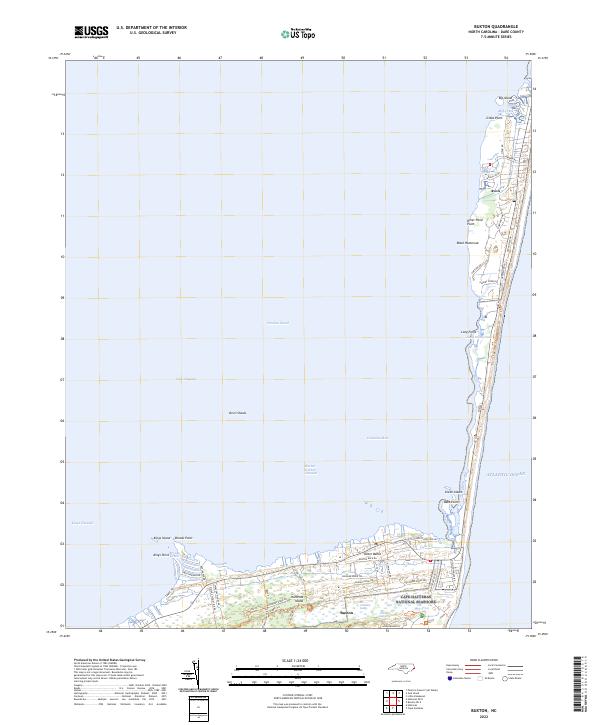 2022 Buxton2022 Print · USGSThe Outer Banks at the start of the 2020s shows the coastal communities of Buxton and Avon flanked by the sea. Trace the island's geography from the marshes of Jeanette Sedge to the historic corridors of Lighthouse Road.
End of results
Showing maps 1-2 of 2
Top cities near Avon
Frequently asked questions
- What are the different types of historical maps available for Avon?
- What is the oldest map of Avon?
- Where can I purchase historical maps of Avon for my home or office?
- Where can I download high-res historical maps of Avon?
- Are there historical topographic maps available for Avon?
- Is there historical aerial imagery available for Avon?
- Where are historical maps of Avon sourced from?