2020s Maps of Davie County, North Carolina
Explore 11 historic maps of Davie County from the 2020s. These maps offer a rare glimpse into what life looked like during the 2020s — showing old roads, neighborhoods, homes, and landmarks that have changed or disappeared over time.
Whether you're researching your family's past, planning a metal detecting trip, or studying how Davie County's landscape evolved across the 2020s, these high-resolution maps are a powerful tool for exploring the history of this region.
- Focus on a specific era: All maps on this page are from the 2020s, giving you a focused view of this time period.
- See what’s changed: Compare century-old streets, trails, and buildings to today's modern landscape using overlays and satellite layers.
- Research with precision: Use these maps for genealogy, historical research, land use analysis, or educational projects.
- View, download, or print: Maps are fully viewable online in high resolution, and can be downloaded or printed for your own records.
Start exploring Davie County's history through authentic maps from the 2020s. This is your window into the past.
Davie County, NC maps
(11)- 2022 Map of Churchland, 2022 Print
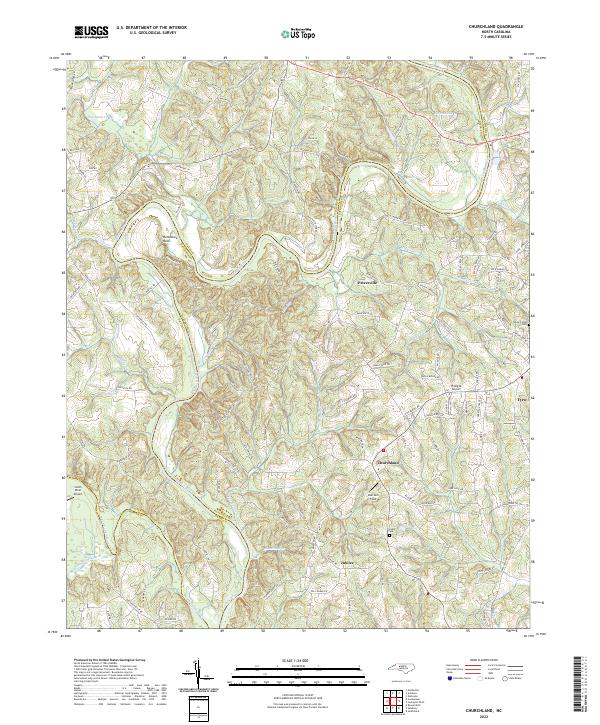 2022 Churchland2022 Print · USGSDavidson County’s rural riverfront comes into focus in this recent survey of the Yadkin River valley. Researchers can trace family landmarks and small communities like Churchland and Jubilee, or locate historic sites including Grubb Cem and Horseshoe Neck.
 - 2022 Map of Welcome, 2022 Print
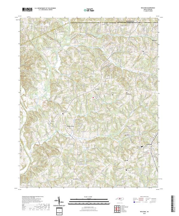 2022 Welcome2022 Print · USGSDavidson County settlement patterns are clearly visible in the early twenty-first century, showing the growth of communities between the Yadkin River and Winston-Salem. Genealogists can locate several historic burial grounds, including Friedberg Moravian God's Acre Cem and Good Hope United Methodist Church Cem.
 - 2022 Map of Calahaln, 2022 Print
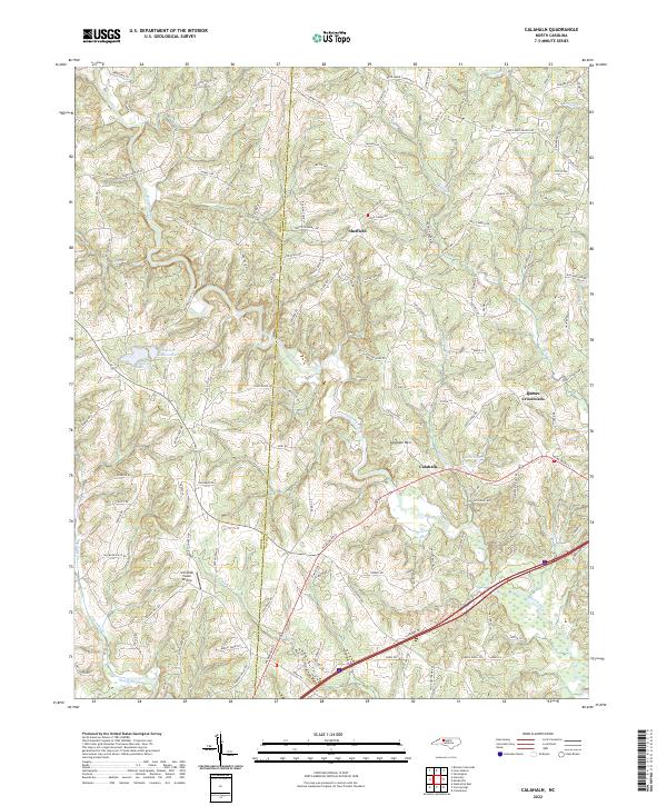 2022 Calahaln2022 Print · USGSDavie County's rolling Piedmont hills come alive in this recent survey of the rural landscape between the South Yadkin River and Hunting Creek. Genealogists and local historians can trace family-named roads near Sheffield, Ijames Crossroads, and the prominent Calahaln Mtn.
 - 2022 Map of Cooleemee, 2022 Print
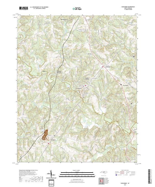 2022 Cooleemee2022 Print · USGSThe South Yadkin River valley at the Davie and Rowan county line comes into focus in this recent survey. Local historians can trace the street grids of Cooleemee or locate rural landmarks like Davie Crossroads and the community of Woodleaf.
 - 2022 Map of Mocksville, 2022 Print
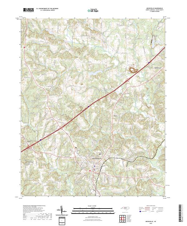 2022 Mocksville2022 Print · USGSDavie County at the start of the 2020s shows a landscape where modern thoroughfares meet historic Piedmont settlements. Genealogists and local historians can trace family roots through the detailed road network and sites like Joppa Cem, Rose Cemetery, and the community of Cana.
 - 2022 Map of Advance, 2022 Print
 2022 Advance2022 Print · USGSThe Yadkin River valley in Davie County comes into focus in this contemporary survey, capturing the landscape around Advance and Bermuda Run. Family historians can trace local roots at Elbaville Cem, Yadkin College, and Fork Baptist Church Cem.
 - 2022 Map of Cool Springs, 2022 Print
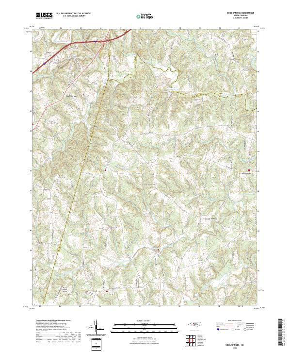 2022 Cool Springs2022 Print · USGSThe tri-county border of Rowan, Davie, and Iredell counties is captured here in the early 2020s. Researchers can trace the rural landscape from Cool Springs to Needmore, following watercourses like the South Yadkin River and Fourth Creek.
 - 2022 Map of Salisbury, 2022 Print
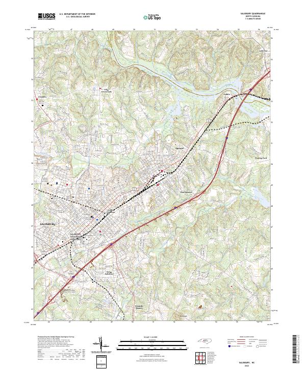 2022 Salisbury2022 Print · USGSSalisbury and the surrounding Rowan County landscape are captured here in the early 2020s, showcasing a dense network of educational institutions and rail infrastructure. Researchers can locate Salisbury National Cem Annex, Catawba College, and the namesake Granite Quarry.
 - 2022 Map of Clemmons, 2022 Print
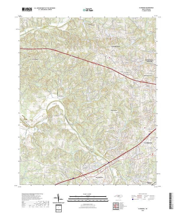 2022 Clemmons2022 Print · USGSSuburban growth meets the Piedmont's rural roots in this contemporary study of the Forsyth County area during its recent expansion. Researchers can trace family estates and local landmarks from Clemmons Station to the banks of the Yadkin River and Griffith Mill Pond.
 - 2022 Map of Farmington, 2022 Print
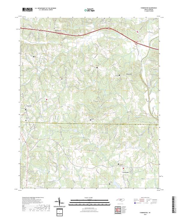 2022 Farmington2022 Print · USGSThe Yadkin River valley comes into sharp focus in this recent survey of the Davie and Yadkin county line. Researchers can trace ancestral locations at Farmington Community Cem, Huntsville, and Turners Creek Cem along the creek-carved Piedmont terrain.
 - 2022 Map of Lone Hickory, 2022 Print
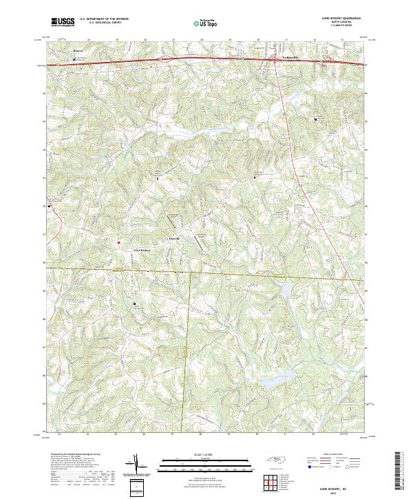 2022 Lone Hickory2022 Print · USGSYadkinville and the surrounding Piedmont countryside are shown here in the early 2020s as a landscape of established rural communities. Researchers can locate several family and community burial grounds like Sandy Springs Cem and Gospel Way Cem near Footville.
End of results
Showing maps 1-11 of 11
Top cities of Davie County
Frequently asked questions
- What are the different types of historical maps available for Davie County?
- What is the oldest map of Davie County?
- Where can I purchase historical maps of Davie County for my home or office?
- Where can I download high-res historical maps of Davie County?
- Are there historical topographic maps available for Davie County?
- Is there historical aerial imagery available for Davie County?
- Where are historical maps of Davie County sourced from?