Old Maps of Davie County, North Carolina for Genealogy
Trace your family roots with 84 historic maps of Davie County. These high-res maps reveal old neighborhoods, homesites, landmarks, and streets — helping you uncover where your ancestors lived and how the area evolved over time.
- Explore historic neighborhoods: Identify where your relatives may have lived in the 1800s or 1900s.
- Compare maps over time: Trace the changes in streets, buildings, and landmarks for multi-generational research.
- Perfect for genealogy & ancestry research: Used by family historians and researchers to map out lineage and migration.
These maps are an incredible resource for exploring your personal connection to Davie County's past.
Davie County, NC maps
(84)- 1891 Map of Yadkinville, 1964 Print
 1891 Yadkinville1964 Print · USGSSurry and Yadkin counties are shown here in the late nineteenth century as the river-and-rail economy began to reshape the Piedmont. Genealogists can trace family landmarks and early crossings like Kapps Mill, Poindexter Ferry, and Cross Roads Church.
 - 1893 Map of Statesville, 1934 Print
 1893 Statesville1934 Print · USGSThe North Carolina Piedmont in the late nineteenth century was a landscape of river-powered industry and rail-connected crossroads. Researchers can trace ancestral locations through dozens of named mills like Ketchies Mill and historic crossings like Cornelius Ferry or Beattie Ford.2 unique versions available
 - 1893 Map of Yadkinville, 1944 Print
 1893 Yadkinville1944 Print · USGSNorthwest North Carolina at the close of the nineteenth century was a landscape of river-dependent commerce and mountain ridges. Researchers can trace the early industrial footprint of Kapps Mill, locate remote river crossings like Douglass Ford, and follow the progress of the Cape Fear and Yadkin Valley Railroad.
 - 1950 Map of Churchland, 1973 Print
 1950 Churchland1973 Print · USGSThe banks of the Yadkin River at the Davidson and Davie county lines are captured here at mid-century. Researchers can trace rural schoolhouse locations and family landmarks like Union Chapel Sch, Grubb Cem, and the village of Churchland.3 unique versions available
 - 1951 Map of Churchland
 1951 Churchland1951 Print · USGSNorth Carolina's central river valleys are detailed here in the early 1950s, showing the rural communities along the Yadkin River. Researchers can locate family landmarks like the Grubb Cemetery and schools such as St Johns Sch and Union Chapel Sch.
 - 1953 Map of Charlotte, 1968 Print
 1953 Charlotte1968 Print · USGSThe North Carolina Piedmont and South Carolina borderlands are shown in detail during a period of significant growth and reservoir development. Trace the rail corridors of the Southern Railway or find family roots in towns like China Grove, Misenheimer, and Lincolnton.3 unique versions available
 - 1953 Map of Winston-Salem, 1974 Print
 1953 Winston-Salem1974 Print · USGSThe North Carolina Piedmont and Virginia highlands meet in the mid-1950s, a landscape defined by the tobacco and textile hubs of the Blue Ridge foothills. Researchers can trace the rail-and-river geography connecting Winston-Salem to mountain towns like Mount Airy and Galax.2 unique versions available
 - 1954 Map of Charlotte
 1954 Charlotte1954 Print · USGSThe North Carolina Piedmont in the mid-1950s shows a region of rapid growth and industrial expansion centered around Charlotte. Trace the era's infrastructure through the Southern railroad lines and locate significant landmarks like the Charlotte Naval Ammunition Depot and Lake Norman.2 unique versions available
 - 1955 Map of Winston-Salem
 1955 Winston-Salem1955 Print · USGSThe Central Blue Ridge and Piedmont transition are captured here in the mid-fifties, from the industrial hub of Winston-Salem to the high peaks of Southwest Virginia. Genealogists can trace family landmarks like Richmond Hill Ch, Siloam Ch, and the old rail stops along the Southern Railway.
 - 1960 Map of Charlotte
 1960 Charlotte1960 Print · USGSMid-century North Carolina and South Carolina meet in this 1960 survey of the Piedmont's industrial and textile heartland. Trace the growth of Charlotte alongside historic landmarks like Kings Mountain National Military Park and the Charlotte Naval Ammunition Depot.2 unique versions available
 - 1962 Map of Winston-Salem
 1962 Winston-Salem1962 Print · USGSThe North Carolina Piedmont meets the Virginia highlands in the early sixties, showing the rail corridors and mountain gaps of the southern Appalachians. Researchers can trace the Blue Ridge Parkway or locate family sites near Winston-Salem, Mount Airy, and Hanging Rock Mountain.
 - 1962 Map of Charlotte
 1962 Charlotte1962 Print · USGSThe North Carolina Piedmont in the early sixties showcases a landscape transformed by massive reservoirs and industrial growth. Researchers can trace the development of Lake Norman, locate the Charlotte Naval Ammunition Depot, or find family landmarks like Wesley Chapel and Brown & Norcott Mills.
 - 1962 Map of Salisbury, 1964 Print
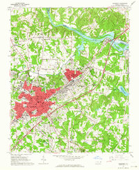 1962 Salisbury1964 Print · USGSSalisbury and its rail corridors are shown here in the early sixties, as the city expanded around its historic colleges and industrial hubs. Researchers can trace family roots through numerous sites like National Cem, Catawba College, and the old crossroads at Trading Ford.3 unique versions available
 - 1966 Map of Farmington, 1967 Print
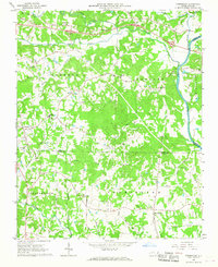 1966 Farmington1967 Print · USGSYadkin and Davie Counties are shown in the mid-1960s as the rural landscape centered on the Yadkin River began to modernize. Genealogists and local historians can trace family-named landmarks and old routes like the Old Stage Road, Huntsville, and the Sportsmans Park Drag Strip.2 unique versions available
 - 1966 Map of Lone Hickory, 1967 Print
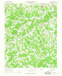 1966 Lone Hickory1967 Print · USGSYadkin and Iredell Counties appear here in the mid-1960s, showing a rural landscape of creek-side farms and historic church communities. Researchers can trace local genealogy through sites like Martins Store, Sandy Springs Ch, and Footville.
 - 1968 Map of Clemmons, 1970 Print
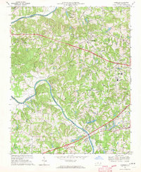 1968 Clemmons1970 Print · USGSForsyth County experiences a period of steady growth during the late sixties as the area between Lewisville and Clemmons develops. Researchers can trace family landmarks and local institutions from Tanglewood Park to rural congregations like Shiloh Ch and Union Hill Ch.3 unique versions available
 - 1969 Map of Welcome, 1972 Print
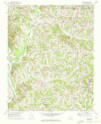 1969 Welcome1972 Print · USGSThe Piedmont countryside of North Carolina appears here in the late sixties, showing the rural communities of Davidson County before modern expansion. Genealogists and local historians can trace family roots through numerous landmarks like Eureka Mills, Good Hope Ch, and the Winston-Salem Southbound railroad line.2 unique versions available
 - 1969 Map of Cooleemee, 1972 Print
 1969 Cooleemee1972 Print · USGSThe river-and-rail landscape of the North Carolina Piedmont is captured here in the late sixties. Genealogists can trace family landmarks like Woodleaf, Jerusalem, and numerous country churches including Liberty Ch and Concord Ch.2 unique versions available
 - 1969 Map of Cool Springs, 1972 Print
 1969 Cool Springs1972 Print · USGSThe rural borderlands of Rowan, Iredell, and Davie counties are captured here in the late sixties as the landscape remained defined by small crossroads and river bends. Genealogists can trace family footprints near Moores Chapel, New Jerusalem Ch, and the settlement of Cool Springs.2 unique versions available
 - 1969 Map of Advance, 1972 Print
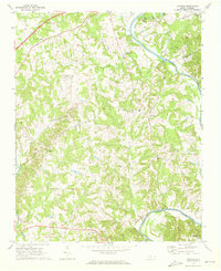 1969 Advance1972 Print · USGSThe Yadkin River valley near the turn of the 1970s shows a landscape of rural crossroads and riverfront recreation. Genealogists and local historians can trace family locations near Fork Church, Mocks Ch, and the old community of Yadkin College.2 unique versions available
 - 1969 Map of Mocksville, 1972 Print
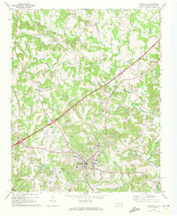 1969 Mocksville1972 Print · USGSDavie County settlement and industry are on full display during the late sixties as the town of Mocksville expands along the SOUTHERN rail line. Researchers can trace family history through numerous landmarks like Rose Cem, Union Chapel, and Stanleys Store.3 unique versions available
 - 1969 Map of Calahaln, 1972 Print
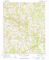 1969 Calahaln1972 Print · USGSThe rural Piedmont of Davie and Iredell counties appears here in the late sixties as a landscape of established crossroads and country churches. Researchers can locate small family-named landmarks like Ijames Crossroads or congregations at Rock Spring Ch and Piney Grove Ch.2 unique versions available
 - 1977 Map of Clemmons, 1979 Print
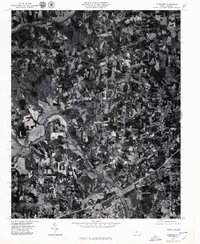 1977 Clemmons1979 Print · USGSThe northern Piedmont and the winding Yadkin River appear in detailed aerial photography from the late seventies. Researchers can trace property lines and the early footprints of settlements like Lewisville, Grapewood, and Hillsdale.
 - 1977 Map of Churchland, 1979 Print
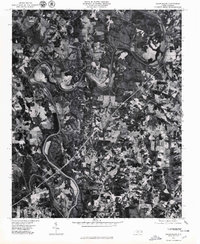 1977 Churchland1979 Print · USGSThe Yadkin River valley in the late seventies is captured here in sharp photographic detail, showing the rural landscape around the Horseshoe bend. Researchers can trace land use and homesteads near the old communities of Churchland, Petersville, and Tyro.
 - 1977 Map of Salisbury, 1980 Print
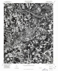 1977 Salisbury1980 Print · USGSSalisbury and its surrounding Rowan County communities are captured in this mid-seventies aerial survey as the region's suburban footprint began to expand. Genealogists and local historians can trace specific properties and landmarks near Ellis Crossroads, Franklin, and the banks of the Yadkin River.
Showing maps 1-25 of 84
Top cities of Davie County
Frequently asked questions
- What are the different types of historical maps available for Davie County?
- What is the oldest map of Davie County?
- Where can I purchase historical maps of Davie County for my home or office?
- Where can I download high-res historical maps of Davie County?
- Are there historical topographic maps available for Davie County?
- Is there historical aerial imagery available for Davie County?
- Where are historical maps of Davie County sourced from?