2020s Maps of Wallace, North Carolina
Explore 4 historic maps of Wallace from the 2020s. These maps offer a rare glimpse into what life looked like during the 2020s — showing old roads, neighborhoods, homes, and landmarks that have changed or disappeared over time.
Whether you're researching your family's past, planning a metal detecting trip, or studying how Wallace's landscape evolved across the 2020s, these high-resolution maps are a powerful tool for exploring the history of this region.
- Focus on a specific era: All maps on this page are from the 2020s, giving you a focused view of this time period.
- See what’s changed: Compare century-old streets, trails, and buildings to today's modern landscape using overlays and satellite layers.
- Research with precision: Use these maps for genealogy, historical research, land use analysis, or educational projects.
- View, download, or print: Maps are fully viewable online in high resolution, and can be downloaded or printed for your own records.
Start exploring Wallace's history through authentic maps from the 2020s. This is your window into the past.
Wallace, NC maps
(4)- 2022 Map of Charity, 2022 Print
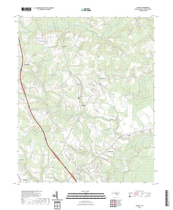 2022 Charity2022 Print · USGSDuplin County is shown in the early 2020s as a landscape of riverine wetlands and established small towns. Researchers can trace family roots at Clay Hill Cem and explore the rural road networks surrounding Charity, Greenevers, and Cartersville.
 - 2022 Map of Wallace West, 2022 Print
 2022 Wallace West2022 Print · USGSThe coastal plain of Pender and Duplin Counties appears here in the early 2020s, showing a landscape of rural crossroads and intricate stream networks. Genealogists can locate family burial sites like Gurganus Cem and White Cem or trace the lands near Penderlea.
 - 2022 Map of Wallace East, 2022 Print
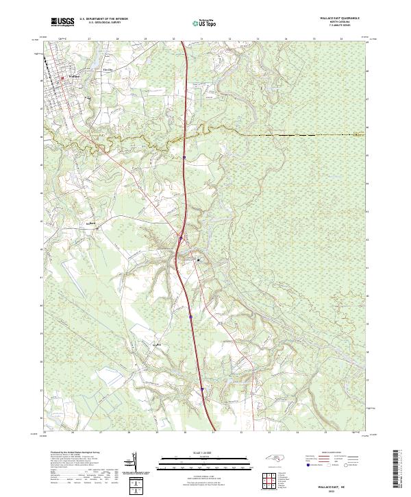 2022 Wallace East2022 Print · USGSCoastal plain communities and wetlands define this Pender County landscape in the early 2020s. Genealogists and local historians can trace family roots through the streets of Wallace, explore the vicinity of Boney Mill Pond, or locate the rural crossroads of Tin City and Watha.
 - 2022 Map of Rose Hill, 2022 Print
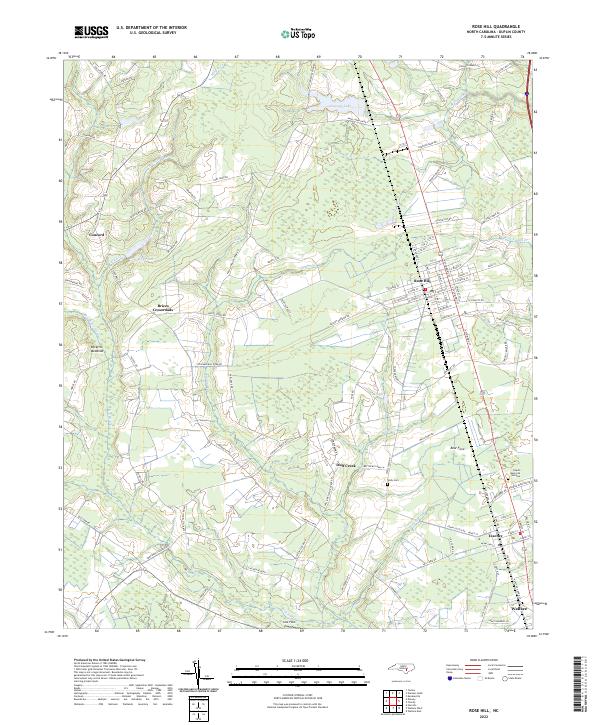 2022 Rose Hill2022 Print · USGSDuplin County's rural landscapes and small towns are captured here in the early twenty-first century. Local historians can trace old homesteads and family names near Wells Cem, Brices Crossroads, and along the banks of Fussell Mill Br.
End of results
Showing maps 1-4 of 4
Top cities near Wallace
- Burgaw historical maps
- Rose Hill historical maps
- Beulaville historical maps
- Magnolia historical maps
- Kenansville historical maps
- Greenevers historical maps
See more
Top neighborhoods of Wallace
Frequently asked questions
- What are the different types of historical maps available for Wallace?
- What is the oldest map of Wallace?
- Where can I purchase historical maps of Wallace for my home or office?
- Where can I download high-res historical maps of Wallace?
- Are there historical topographic maps available for Wallace?
- Is there historical aerial imagery available for Wallace?
- Where are historical maps of Wallace sourced from?