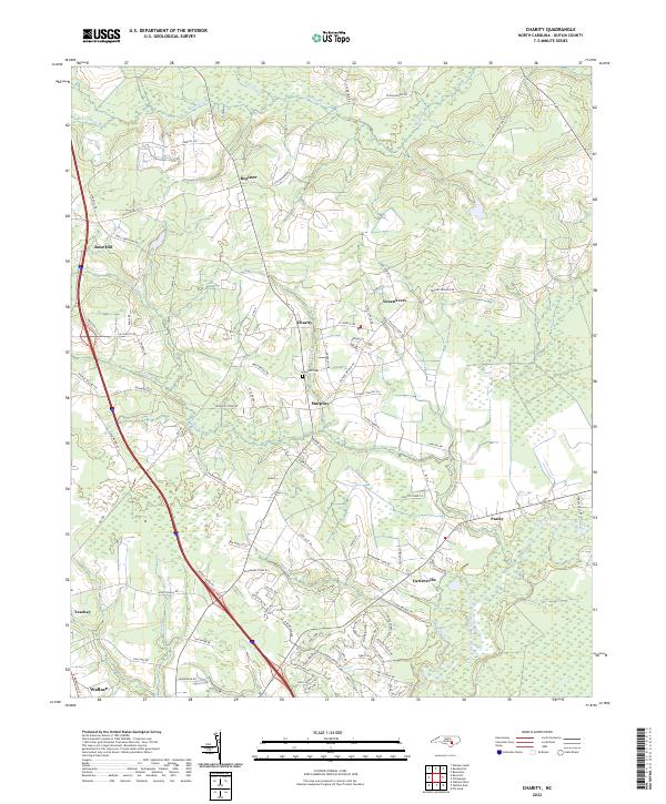
2022 Map of Charity
USGS Topo · Published 2022About this map
The Northeast Cape Fear River meanders through the southeastern portion of this Duplin County landscape, defining a network of wetlands and creeks including Island Cr and Oakie Br. Modern transit corridors run parallel to older settlement patterns, with the primary highway corridor connecting Rose Hill, Teachey, and Wallace in the west. This agricultural and residential region is punctuated by small named communities like Charity and Greenevers. Local history and genealogy are anchored by landmarks such as the Clay Hill Cem near Murphey. The map reveals a transition from these established town centers to the more distributed rural landscape of Register and Pasley, where winding roads like Stockinghead RD follow the contours of the low-lying coastal plain.
Find a feature on this map
91 named features on this map. Tap any name to fly to it.
Don’t see what you’re looking for? This feature index may not catch every label — zoom into the map to look around manually.
Map Details
Editions of this 2022 Charity Map
This is the sole edition of this map. No revisions or reprints were ever made.
Other maps of this area

1942 · Burgaw
USGS Topo · 1:62,500

1943 · Kenansville
USGS Topo · 1:62,500

1948 · Kenansville
USGS Topo · 1:62,500

1953 · Florence
USGS Topo · 1:250,000

1953 · Beaufort
USGS Topo · 1:250,000

1954 · Florence
USGS Topo · 1:250,000

1954 · Beaufort
USGS Topo · 1:250,000

1955 · Atkinson
USGS Topo · 1:62,500

1962 · Rose Hill
USGS Topo · 1:62,500

1972 · Beaufort
USGS Topo · 1:250,000