1900s (20th Century) Maps of Walkertown, North Carolina
Explore 11 historic maps of Walkertown from the 1900s (20th Century). These maps offer a rare glimpse into what life looked like during the 1900s — showing old roads, neighborhoods, homes, and landmarks that have changed or disappeared over time.
Whether you're researching your family's past, planning a metal detecting trip, or studying how Walkertown's landscape evolved across the 1900s, these high-resolution maps are a powerful tool for exploring the history of this region.
- Focus on a specific era: All maps on this page are from the 1900s, giving you a focused view of this time period.
- See what’s changed: Compare century-old streets, trails, and buildings to today's modern landscape using overlays and satellite layers.
- Research with precision: Use these maps for genealogy, historical research, land use analysis, or educational projects.
- View, download, or print: Maps are fully viewable online in high resolution, and can be downloaded or printed for your own records.
Start exploring Walkertown's history through authentic maps from the 1900s. This is your window into the past.
Walkertown, NC maps
(11)- 1950 Map of Winston-Salem East, 1965 Print
 1950 Winston-Salem East1965 Print · USGSMid-century Winston-Salem is captured here during its post-war growth, showing the city's eastern neighborhoods and surrounding rural crossroads. Genealogists and historians can trace institutional roots at State Teachers College and find family-named churches like New Friendship Church.5 unique versions available
 - 1951 Map of Winston-Salem East
 1951 Winston-Salem East1951 Print · USGSMid-century Forsyth County shows the expansion of Winston-Salem toward Kernersville during a period of significant institutional and industrial growth. Researchers can locate local landmarks like Salem College, trace the Southern rail lines, and find rural centers such as Waughtown and Friedland Ch.
 - 1951 Map of Walkertown, 1953 Print
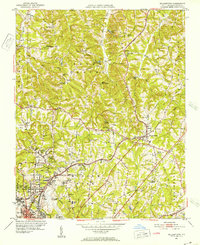 1951 Walkertown1953 Print · USGSForsyth County at mid-century shows the expanding footprint of Winston-Salem meeting the rural homesteads of Middle Fork. Genealogists can trace family names through landmarks like the Memorial Industrial Sch, Odd Fellows Cemetery, and Ogburn Sta.5 unique versions available
 - 1953 Map of Winston-Salem, 1974 Print
 1953 Winston-Salem1974 Print · USGSThe North Carolina Piedmont and Virginia highlands meet in the mid-1950s, a landscape defined by the tobacco and textile hubs of the Blue Ridge foothills. Researchers can trace the rail-and-river geography connecting Winston-Salem to mountain towns like Mount Airy and Galax.2 unique versions available
 - 1955 Map of Winston-Salem
 1955 Winston-Salem1955 Print · USGSThe Central Blue Ridge and Piedmont transition are captured here in the mid-fifties, from the industrial hub of Winston-Salem to the high peaks of Southwest Virginia. Genealogists can trace family landmarks like Richmond Hill Ch, Siloam Ch, and the old rail stops along the Southern Railway.
 - 1962 Map of Winston-Salem
 1962 Winston-Salem1962 Print · USGSThe North Carolina Piedmont meets the Virginia highlands in the early sixties, showing the rail corridors and mountain gaps of the southern Appalachians. Researchers can trace the Blue Ridge Parkway or locate family sites near Winston-Salem, Mount Airy, and Hanging Rock Mountain.
 - 1977 Map of Walkertown, 1979 Print
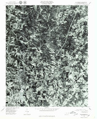 1977 Walkertown1979 Print · USGSForsyth County is shown in transition during the late seventies as the suburban reach of Winston-Salem meets the rural Piedmont. Genealogists and local researchers can trace the growth of Walkertown and the woodlots near Belews Creek.
 - 1977 Map of Winston-Salem East, 1979 Print
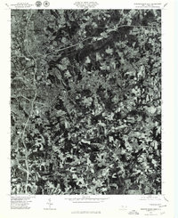 1977 Winston-Salem East1979 Print · USGSWinston-Salem and its eastern suburbs are captured in high-altitude detail during the late seventies, showing the city's modern expansion. Trace the growth of local neighborhoods like Sunnyside and Rosemont or the wooded shores of Salem Lake.
 - 1984 Map of Winston-Salem, 1985 Print
 1984 Winston-Salem1985 Print · USGSThe North Carolina Piedmont in the mid-1980s shows the growth of Winston-Salem and the busy rail corridors of the Southern Railway. Genealogists and local historians can trace family-named lands and rural communities from Yadkinville to Mount Airy.2 unique versions available
 - 1997 Map of Walkertown, 2000 Print
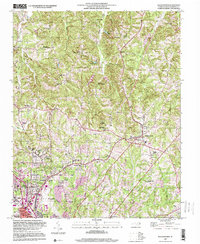 1997 Walkertown2000 Print · USGSThe outskirts of Winston-Salem and the community of Walkertown are captured here in the late twentieth century. Researchers can trace the legacy of rural schools and family burial grounds like Banner Cem or locate the historic Bethlehem Ch.
 - 1997 Map of Winston-Salem East, 2001 Print
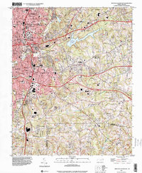 1997 Winston-Salem East2001 Print · USGSWinston-Salem and its eastern suburbs are shown here in the late nineties as urban growth begins to push toward the Davidson County line. Genealogists and historians can trace neighborhood landmarks like Salem College, Odd Fellows Cem, and the historic industrial footprint of Waughtown.
End of results
Showing maps 1-11 of 11
Top cities near Walkertown
- Greensboro historical maps
- Winston-Salem historical maps
- High Point historical maps
- Thomasville historical maps
- Kernersville historical maps
- Clemmons historical maps
See more
Top neighborhoods of Walkertown
Frequently asked questions
- What are the different types of historical maps available for Walkertown?
- What is the oldest map of Walkertown?
- Where can I purchase historical maps of Walkertown for my home or office?
- Where can I download high-res historical maps of Walkertown?
- Are there historical topographic maps available for Walkertown?
- Is there historical aerial imagery available for Walkertown?
- Where are historical maps of Walkertown sourced from?