Old Maps of Franklin County, North Carolina for Hiking & Exploration
Hike through history with 119 historic maps of Franklin County. Explore old trails, ghost towns, and forgotten backroads — perfect for outdoor adventurers and local explorers.
- Rediscover forgotten places: Map out old mining camps, roads, and footpaths that no longer exist on modern maps.
- Layer with modern tools: Combine with LiDAR or satellite views to plan hikes through historical terrain.
- Made for exploration: Popular among hikers, overlanders, and local history lovers.
Use these maps to find adventure and explore the hidden past of Franklin County.
Franklin County, NC maps
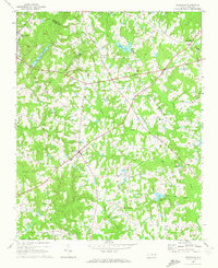
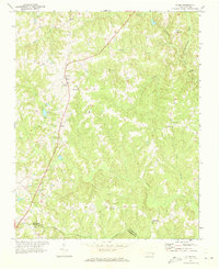
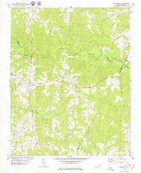
(119)- 1902 Map of Spring Hope, 1965 Print
 1902 Spring Hope1965 Print · USGSNash and Franklin Counties are seen here at the turn of the century as a landscape of river-bend settlements and railroad progress. Researchers can trace ancestral roots through family-named landmarks like Lamm Crossroads, Lee Chapel, and Pine Ridge Schoolhouse.
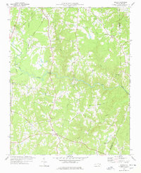
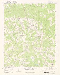
 - 1904 Map of Springhope, 1942 Print
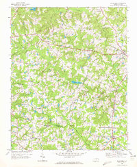
 1904 Springhope1942 Print · USGSNash County at the turn of the century shows a rural landscape connected by the Atlantic Coast Line R. R. and the winding Tar River. Researchers can trace ancestral locations at Lamm Crossroads, Whiteoak Church, and the Pine Ridge Schoolhouse.
 - 1943 Map of Creedmoor, 1957 Print
 1943 Creedmoor1957 Print · USGSGranville and Wake counties are shown here during the transformative years of the early 1940s. Researchers can locate dozens of specific rural landmarks, from the sprawling Camp Butner Military Reservation to local centers like Creedmoor and Mt Energy.2 unique versions available
 - 1944 Map of Creedmoor
 1944 Creedmoor1944 Print · USGSGranville County during the Second World War shows the massive footprint of Camp Butner alongside traditional rail towns. Genealogists can trace family roots through numerous country landmarks like Lattice Ch, Mt Vernon Cem, and Providence Sch.
 - 1953 Map of Raleigh, 1965 Print
 1953 Raleigh1965 Print · USGSCentral North Carolina in the early sixties shows a landscape of growing towns and military hubs before the full expansion of the interstate system. Genealogists can trace family footprints across the Piedmont through Wake Forest, Siler City, and the large Fort Bragg Military Reservation.4 unique versions available
 - 1953 Map of Greensboro, 1981 Print
 1953 Greensboro1981 Print · USGSThe Piedmont borderlands of North Carolina and Virginia show a landscape defined by new reservoirs and old rail lines. Trace family roots and the changing river geography through Elon College, the John H Kerr Reservoir, and South Boston.
 - 1954 Map of Greensboro
 1954 Greensboro1954 Print · USGSThe Piedmont borderlands of North Carolina and Virginia come alive in this mid-fifties study of a region defined by its rivers and rails. Researchers can trace the growing Buggs Island Lake or follow the paths of the Southern Ry and Seaboard Air Line RR through towns like Oxford and Reidsville.
 - 1954 Map of Raleigh
 1954 Raleigh1954 Print · USGSThe North Carolina Piedmont and Sandhills are captured in the mid-fifties during a period of steady regional growth. Genealogists and historians can trace the development of towns like Siler City or locate landmarks such as Falls of Neuse and Camp Mackall.
 - 1962 Map of Greensboro
 1962 Greensboro1962 Print · USGSThe Piedmont region along the Virginia and North Carolina border comes alive in the early 1960s, showing a landscape defined by industry and new reservoirs. Trace the path of the Virginian RR or explore the early development of Greensboro and Durham.
 - 1966 Map of Greensboro
 1966 Greensboro1966 Print · USGSThe North Carolina and Virginia Piedmont thrives during the mid-sixties, showcasing a landscape of textile hubs and expanding river reservoirs. Researchers can trace the rail corridors of the Southern Railway, find local landmarks like Elon College, or locate the extensive Camp Butner Military Reservation.
 - 1967 Map of Rolesville, 1972 Print
 1967 Rolesville1972 Print · USGSWake County and Franklin County are captured in the late sixties as traditional agricultural crossroads begin to meet modern utility. Genealogists and local historians can trace family roots through Rolesville Cem or locate old community centers like Fowlers Crossroads and Harris Crossroads.3 unique versions available
 - 1968 Map of Bunn West, 1972 Print
 1968 Bunn West1972 Print · USGSThe Franklin and Wake county line in the late sixties reveals a landscape of small farming communities and country crossroads. Genealogists can trace family names through landmarks like Union Gospel Tabernacle or the rural settlements of Pearces and New Hope.2 unique versions available
 - 1968 Map of Zebulon, 1972 Print
 1968 Zebulon1972 Print · USGSThe eastern edges of Wake County meet Franklin and Nash in the late sixties, where small-town industry revolves around the rail lines. Local historians can trace family ties at St. Mathews Church or explore the origins of Lizard Lick and Wakefield.3 unique versions available
 - 1970 Map of Vicksboro, 1973 Print
 1970 Vicksboro1973 Print · USGSVance County in the early seventies was a land of small crossroads communities and family-named creek branches. Researchers can trace the legacy of rural life through landmarks like Weldons Mill, the Seaboard Coast Line rail route, and local churches such as Hughes Grove Ch.
 - 1971 Map of Afton, 1973 Print
 1971 Afton1973 Print · USGSThe rural communities of Warren County come into focus in the early 1970s, organized around country roads and woodland creeks. Genealogists can trace family roots through numerous sites like Warren Academy, Sulphur Springs Ch, and the settlement at Elberon.
 - 1977 Map of Wilton, 1978 Print
 1977 Wilton1978 Print · USGSGranville County in the late seventies is a landscape of rural crossroads and river bottomlands. Researchers can trace family history through a high density of local landmarks including Hawkins Chapel, Synama Grove Ch, and the Seaboard Coast Line railroad.
 - 1978 Map of Middlesex
 1978 Middlesex1978 Print · USGSCoastal plain farmland and tobacco-country crossroads define this corner of Nash County in the late 1970s. Trace family roots and local history through numerous country churches like St Bethel Church and community centers like Social Plains or Middlesex.
 - 1978 Map of Bunn East
 1978 Bunn East1978 Print · USGSEastern Franklin and western Nash counties are captured here in the late seventies, showing a landscape defined by the Tar River. Genealogists and historians can locate rural communities like Seven Paths, Daddysville, and Pine Ridge, alongside numerous country churches and cemeteries.
 - 1978 Map of Franklinton
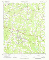
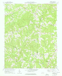
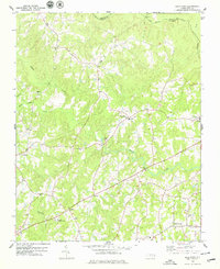
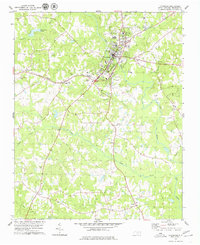
 1978 Franklinton1978 Print · USGSFranklin County in the late seventies reveals a landscape shaped by the rail corridor connecting Franklinton and Youngsville. Researchers can trace rural lineages through numerous country churches like Oak Level Ch and family landmarks at Mitchiners Crossroads.2 unique versions available
 - 1978 Map of Grissom
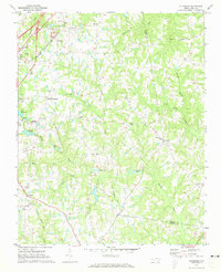
 1978 Grissom1978 Print · USGSThe intersection of Granville, Wake, and Franklin counties comes into focus in the late 1970s, showing a rural landscape defined by creek-side settlements. Genealogists can trace family roots through numerous small churches and cemeteries like Kinchen Chapel, Marys Chapel, and Purnell.2 unique versions available
 - 1978 Map of Gold Sand, 1979 Print
 1978 Gold Sand1979 Print · USGSFranklin and Warren County rural life in the late seventies is centered on crossroads like Gold Sand and Alert. Trace family sites near Mountain Grove Ch, the Gold Sand Sch, and the winding banks of Sandy Creek.2 unique versions available
 - 1978 Map of Louisburg, 1979 Print
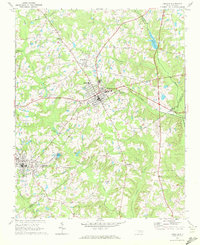
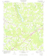
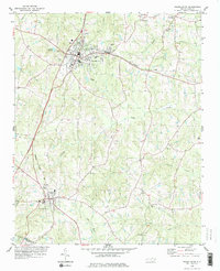
 1978 Louisburg1979 Print · USGSLouisburg in the late seventies serves as a focal point for Franklin County education and rail transport. Researchers can trace the grounds of Louisburg College, locate rural landmarks like Shady Grove Ch, or follow the Seaboard Coast Line through Katesville.2 unique versions available
 - 1978 Map of Centerville, 1979 Print
 1978 Centerville1979 Print · USGSThe Franklin and Warren County borderlands appear here in the late seventies as a landscape of winding creeks and rural crossroads. Local historians can trace the foundations of these communities through landmarks like Fork Chapel, Wester Ch, and the settlement of Wood.
 - 1979 Map of Castalia
 1979 Castalia1979 Print · USGSThe Franklin and Nash county line in the 1970s shows a landscape of established rural crossroads and small communities. Genealogists can trace family landmarks and burial sites near Castalia, Cedar Rock Ch, and the settlement at Corinth.2 unique versions available
 - 1979 Map of Kittrell
 1979 Kittrell1979 Print · USGSVance and Franklin counties appear here in the late seventies as the rural landscape centered on the Seaboard Coast Line corridor. Genealogists can locate family landmarks like St Marys Ch, Kittrell Junior College, and the small settlement of Bobbitt.
Showing maps 1-25 of 119
Top cities of Franklin County
- Louisburg historical maps
- Youngsville historical maps
- Franklinton historical maps
- Bunn historical maps
- Centerville historical maps
Frequently asked questions
- What are the different types of historical maps available for Franklin County?
- What is the oldest map of Franklin County?
- Where can I purchase historical maps of Franklin County for my home or office?
- Where can I download high-res historical maps of Franklin County?
- Are there historical topographic maps available for Franklin County?
- Is there historical aerial imagery available for Franklin County?
- Where are historical maps of Franklin County sourced from?