Old Maps of Gastonia, North Carolina for Genealogy
Trace your family roots with 63 historic maps of Gastonia. These high-res maps reveal old neighborhoods, homesites, landmarks, and streets — helping you uncover where your ancestors lived and how the area evolved over time.
- Explore historic neighborhoods: Identify where your relatives may have lived in the 1800s or 1900s.
- Compare maps over time: Trace the changes in streets, buildings, and landmarks for multi-generational research.
- Perfect for genealogy & ancestry research: Used by family historians and researchers to map out lineage and migration.
These maps are an incredible resource for exploring your personal connection to Gastonia's past.
Gastonia, NC maps
(63)- 1906 Map of Kings Mountain, 1970 Print
 1906 Kings Mountain1970 Print · USGSThe North and South Carolina borderlands come alive in this early century survey of the Kings Mountain vicinity. Genealogists can locate family landmarks including Lincoln Academy, Bordens Ferry, and Pleasant Hill Church.
 - 1908 Map of Kings Mountain
 1908 Kings Mountain1908 Print · USGSThe Carolina borderlands come alive in the first decade of the 1900s, centered on the landmark Kings Mountain Battleground and its namesake ridge. Genealogists can trace family roots through numerous rural churches and schools, including Ramah Church, Beersheba Church, and the Lincoln Academy.6 unique versions available
 - 1909 Map of Lincolnton, 1968 Print
 1909 Lincolnton1968 Print · USGSNorth Carolina's Piedmont region during the first decade of the twentieth century shows a landscape transitioning between agrarian roots and new rail-driven industry. Genealogists can trace family connections to rural landmarks like Bess Chapel, Double Chimney School, and the community of Laboratory.
 - 1911 Map of Lincolnton, 1944 Print
 1911 Lincolnton1944 Print · USGSLincoln and Gaston Counties at the peak of the rail era show a landscape of growing textile hubs and rural crossroads. Genealogists can trace family footprints through sites like Double Chimney School, Snapp Cem, and the industry at Beam Mill.
 - 1914 Map of Gastonia
 1914 Gastonia1914 Print · USGSGaston and Lincoln counties are captured here just before the First World War, when the textile industry and rail lines shaped every community. Researchers can locate long-standing landmarks like Loray Mills, Belmont Abby, and the old County House near Dallas.2 unique versions available
 - 1916 Map of Gastonia
 1916 Gastonia1916 Print · USGSGaston and Lincoln counties are captured here just as the textile industry was transforming the Piedmont landscape. Trace the rail-and-river economy through landmarks like the Loray Mill, the Rehoboth Furnace, and the early village of McAdenville.2 unique versions available
 - 1947 Map of Clover, 1956 Print
 1947 Clover1956 Print · USGSThe Carolina Piedmont at the dawn of the postwar era shows a landscape of textile mills and rural farmsteads along the rising waters of the Catawba. Local historians can trace the foundations of the region through landmarks like the State Textile Sch, Boogertown, and the Buster Boyd Bridge.2 unique versions available
 - 1949 Map of Clover
 1949 Clover1949 Print · USGSThe Carolinas' borderlands come alive in the late 1940s as the textile and rail economy centers around Lake Wylie. Researchers can trace old family roots at China Grove Ch, locate the vanished Shiny Eye Sch, or follow the Southern Ry through Belmont and Clover.
 - 1953 Map of Charlotte, 1968 Print
 1953 Charlotte1968 Print · USGSThe North Carolina Piedmont and South Carolina borderlands are shown in detail during a period of significant growth and reservoir development. Trace the rail corridors of the Southern Railway or find family roots in towns like China Grove, Misenheimer, and Lincolnton.3 unique versions available
 - 1954 Map of Charlotte
 1954 Charlotte1954 Print · USGSThe North Carolina Piedmont in the mid-1950s shows a region of rapid growth and industrial expansion centered around Charlotte. Trace the era's infrastructure through the Southern railroad lines and locate significant landmarks like the Charlotte Naval Ammunition Depot and Lake Norman.2 unique versions available
 - 1960 Map of Charlotte
 1960 Charlotte1960 Print · USGSMid-century North Carolina and South Carolina meet in this 1960 survey of the Piedmont's industrial and textile heartland. Trace the growth of Charlotte alongside historic landmarks like Kings Mountain National Military Park and the Charlotte Naval Ammunition Depot.2 unique versions available
 - 1962 Map of Charlotte
 1962 Charlotte1962 Print · USGSThe North Carolina Piedmont in the early sixties showcases a landscape transformed by massive reservoirs and industrial growth. Researchers can trace the development of Lake Norman, locate the Charlotte Naval Ammunition Depot, or find family landmarks like Wesley Chapel and Brown & Norcott Mills.
 - 1970 Map of Mount Holly, 1972 Print
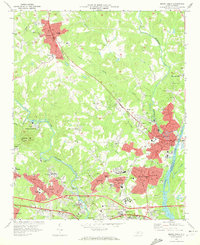 1970 Mount Holly1972 Print · USGSGaston County’s textile and rail corridor thrives in the early seventies, centered on the Catawba River and the bustling hub of Mount Holly. Genealogists can trace family landmarks like Hillcrest Cem and Belmont Abbey College or follow the path of the Seaboard Coast Line.
 - 1970 Map of Gastonia North, 1972 Print
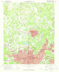 1970 Gastonia North1972 Print · USGSGaston County enters a period of significant suburban growth in the early seventies, centered on the expansion of Gastonia and Dallas. Researchers can trace local genealogy at Hollywood Cem or locate vanished landmarks like the Ashley High Sch and the original Gaston Memorial Hospital.
 - 1971 Map of Kings Mountain, 1973 Print
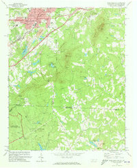 1971 Kings Mountain1973 Print · USGSThe foothills of the Carolinas come into focus during the early seventies as the industrial growth of Kings Mountain meets the preserved heights of the state and military parks. Researchers can trace the legacy of rural congregations and local landmarks like Pisgah Cem, Camp Rotary, and The Pinnacle.
 - 1973 Map of Gastonia South, 1975 Print
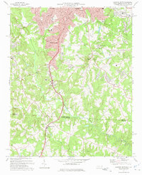 1973 Gastonia South1975 Print · USGSThe North Carolina and South Carolina borderlands south of Gastonia appear here in the early seventies, capturing the city's suburban reach and industrial growth. Researchers can trace family sites like Firestone Mem Cem or locate the Gastonia Airport and Bowling Green along the SOUTHERN rail line.
 - 1973 Map of Bessemer City, 1976 Print
 1973 Bessemer City1976 Print · USGSGaston and Cleveland counties come into sharp focus in the early seventies as industrial centers and rural crossroads meet along the rail lines. Genealogists can locate family landmarks like Patterson Grove Ch, while researchers can trace the footprint of local industry at the Mines and Tailings Ponds.
 - 1973 Map of Belmont, 1976 Print
 1973 Belmont1976 Print · USGSThe industrial corridor of Gaston County comes to life in the early seventies, showing the textile centers and river life at the South Carolina border. Trace family roots at Bethesda Ch or Smith Cem, and locate landmarks like Sacred Heart College.
 - 1976 Map of Kings Mountain, 1978 Print
 1976 Kings Mountain1978 Print · USGSKings Mountain and the surrounding Piedmont landscape are captured in mid-1970s aerial detail, showing the era's mining and forest clearings. Trace early residential footprints near Mountain View or study the industrial sites near Kings Mountain and Lake York.
 - 1976 Map of Belmont, 1978 Print
 1976 Belmont1978 Print · USGSGaston County enters the late seventies with its textile towns expanding toward the water. Trace the shoreline of Lake Wylie and identify early suburban growth patterns near Belmont, Cramerton, and Elmore Crossroads.
 - 1976 Map of Bessemer City, 1978 Print
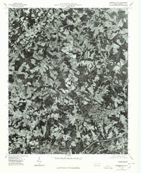 1976 Bessemer City1978 Print · USGSGaston County enters the mid-seventies with a landscape defined by industrial growth and traditional farming. Researchers can trace the literal footprint of the era's textile and mining operations near Bessemer City, Kings Mountain, and Tryon.
 - 1986 Map of Gastonia
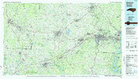 1986 Gastonia1986 Print · USGSThe Carolina Piedmont in the mid-eighties shows a landscape shaped by Revolutionary War history and the textile industry. Trace the footprints of early battles at Kings Mountain National Military Park and locate depots along the Southern Railway in Shelby and Gastonia.
 - 1991 Map of Gastonia
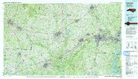 1991 Gastonia1991 Print · USGSThe Piedmont region along the North Carolina and South Carolina border shows a bustling industrial and transit corridor in the early nineties. Researchers can trace the sprawling footprints of Gastonia and Shelby or explore the grounds of Kings Mountain National Military Park and Lake Wylie.
 - 1993 Map of Mount Holly, 1996 Print
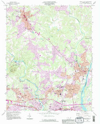 1993 Mount Holly1996 Print · USGSGaston County communities thrived along the river forks during the mid-nineties as suburban growth met long-standing textile and academic centers. Researchers can trace family roots at Mauney Cem, explore the campus of Belmont Abbey College, or locate the mills and works of McAdenville.
 - 1993 Map of Bessemer City, 1996 Print
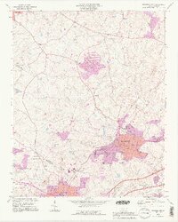 1993 Bessemer City1996 Print · USGSGaston and Cleveland counties are captured in the early nineties, showcasing the industrial growth of Bessemer City and its surrounding rural communities. Genealogists can trace family roots through numerous country churches like Mt Pisgah Ch and Hephzibah Ch or locate the Rhynes Airfield and local mines.2 unique versions available
Showing maps 1-25 of 63
Top cities near Gastonia
- Charlotte historical maps
- Rock Hill historical maps
- Fort Mill historical maps
- Mount Holly historical maps
- Tega Cay historical maps
- Tega Cay historical maps
See more
Top neighborhoods of Gastonia
- Gardner Wood historical maps
- Wesley Park historical maps
- Love Park historical maps
- Oakland Park historical maps
- Gardner Park historical maps
- Jenkins Heights historical maps
See more
Frequently asked questions
- What are the different types of historical maps available for Gastonia?
- What is the oldest map of Gastonia?
- Where can I purchase historical maps of Gastonia for my home or office?
- Where can I download high-res historical maps of Gastonia?
- Are there historical topographic maps available for Gastonia?
- Is there historical aerial imagery available for Gastonia?
- Where are historical maps of Gastonia sourced from?